pouget yves

 Visorando Member
 Premium user
 - Location: Mornant (69440)
- Gender: man
Sign up:
Published route(s)
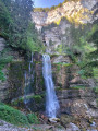
 Around the Cirque de Saint-Même
 8.20 mi
 +3,970 ft
 -3,983 ft
 7h 15
7h 15
 Difficult
 Departure from Saint-Pierre-d'Entremont (Savoie) (Savoie)
From the Cirque de Saint-Même and its waterfalls, across the Hauts de Chartreuse plateaus via 3 Pas to the Croix de l’Alpe (1,821 m).Stunning views.
⚠️ This route is partly unmarked, unmaintained and presents significant risks. Hikers undertake this route at their own risk. Please follow the official marked trails.
Le Pinet then La Croix de l'Alpe
 8.70 mi
+3,360 ft
-3,360 ft
6h 55
Difficult
Departure from Entremont-le-Vieux (Savoie)
8.70 mi
+3,360 ft
-3,360 ft
6h 55
Difficult
Departure from Entremont-le-Vieux (Savoie)
From the small hamlet of La Plagne, summit of Le Pinet (1,867m), beautiful view to the west, then summit of La Croix de l'Alpe (1,821m) via the Chalets de l'Alpe.
Around the Couzon Dam
12.85 mi
+2,175 ft
-2,172 ft
7h 50
Difficult
Departure from Châteauneuf (Loire) (Loire)
Walk in the Pilat, 6 km from Rive de Gier, around the beautiful Lake Barrage du Couzon.
Around and in the Combe d'Allier
 12.74 mi
+1,129 ft
-1,152 ft
6h 50
12.74 mi
+1,129 ft
-1,152 ft
6h 50
 Moderate
Departure from Saint-Andéol-le-Château (Rhône)
Moderate
Departure from Saint-Andéol-le-Château (Rhône)
A long, bucolic walk on the plateau of Saint-Andéol-le-Château and Saint-Jean-de-Toulas, interspersed with valleys and streams. Long but easy with little elevation gain.
The Molière and Sornin plateaus
14.06 mi
+3,337 ft
-3,323 ft
9h 20
Difficult
Departure from Engins (Isère)
A walk between two limestone plateaus in the Northern Vercors, passing close to the Gouffre Berger and the sharp limestone pavement.
Can be done on snowshoes in winter.
Le Moucherotte via Saint-Nizier
 7.64 mi
+3,179 ft
-3,150 ft
6h 15
Moderate
Departure from Saint-Nizier-du-Moucherotte (Isère)
7.64 mi
+3,179 ft
-3,150 ft
6h 15
Moderate
Departure from Saint-Nizier-du-Moucherotte (Isère)
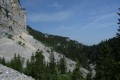
Climbing the Moucherotte via the east face from Saint-Nizier is a wild and little-known route. The return via the large ski jump (on foot, fortunately) is also unusual.
Yellow and green markings, as well as white/red.
Around the Bozançon
 8.55 mi
+1,220 ft
-1,194 ft
5h 00
Moderate
Departure from Saint-Maurice-sur-Dargoire (Rhône)
8.55 mi
+1,220 ft
-1,194 ft
5h 00
Moderate
Departure from Saint-Maurice-sur-Dargoire (Rhône)
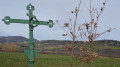
Walk around the Bozançon valley (and even the Bozançon rivers) with remains of Roman aqueducts, water mills, old railway tracks and old gold mines.
At Les Piles, you can continue up the Bozançon to the viaduct and return to Jurieux via the old railway line (an extra 2 hours).
Pic Saint-Michel circular from Les Blancs
 6.96 mi
+2,835 ft
-2,812 ft
5h 40
Moderate
Departure from Lans-en-Vercors (Isère)
6.96 mi
+2,835 ft
-2,812 ft
5h 40
Moderate
Departure from Lans-en-Vercors (Isère)
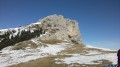
The hike starts at the hamlet of Les Blancs near Lans and takes us to Pic St Michel via the Chemin des Anciens and the Col de l'Arc. The return journey is via Les Allières and the Pierre Berchue viewpoint.
Ridges of the Northern Vercors
 12.42 mi
+4,449 ft
-4,419 ft
9h 35
Difficult
Departure from Montaud (Isère) (Isère)
12.42 mi
+4,449 ft
-4,419 ft
9h 35
Difficult
Departure from Montaud (Isère) (Isère)
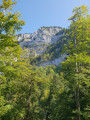
A walk along the ridges of the Northern Vercors starting from Montaud, above Voreppe. Little immediate elevation gain but a bit more on the ridges. Unobstructed views all the way.
Lac du Lauzon and Col de Charnier
 5.92 mi
+3,114 ft
-3,114 ft
5h 25
Difficult
Departure from Lus-la-Croix-Haute (Drôme)
5.92 mi
+3,114 ft
-3,114 ft
5h 25
Difficult
Departure from Lus-la-Croix-Haute (Drôme)
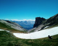
Beautiful wild hike in the Jarjatte valley to Lac de Lauzon and the Col de Charnier for views to the south. Return via the Col des Aurias.
Around Mornant
 10.82 mi
+1,519 ft
-1,532 ft
6h 20
Moderate
Departure from Mornant (Rhône)
10.82 mi
+1,519 ft
-1,532 ft
6h 20
Moderate
Departure from Mornant (Rhône)
Walk in the Mornant countryside after visiting the medieval centre.
Grand Tour of Mornant
14.54 mi
+1,713 ft
-1,693 ft
8h 10
Moderate
Departure from Mornant (Rhône)
A long walk with little elevation gain around Mornant, with the option to visit the old village.
La Grande Moucherolle
 10.96 mi
+4,180 ft
-4,186 ft
8h 40
Difficult
Departure from Villard-de-Lans (Isère)
10.96 mi
+4,180 ft
-4,186 ft
8h 40
Difficult
Departure from Villard-de-Lans (Isère)
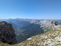
A challenging hike with the ascent of the second highest peak in the Vercors, the Grande Moucherolle (2,284 m).
Walk in the Arinthod forest
 7.73 mi
+1,145 ft
-1,158 ft
4h 35
Moderate
Departure from Arinthod (Jura)
7.73 mi
+1,145 ft
-1,158 ft
4h 35
Moderate
Departure from Arinthod (Jura)
Walk in the forest above the beautiful village of Arinthod, which you can also visit after your hike.
From La Roussillière to Les Bozançons
 6.25 mi
+988 ft
-955 ft
3h 45
Moderate
Departure from Saint-Maurice-sur-Dargoire (Rhône)
6.25 mi
+988 ft
-955 ft
3h 45
Moderate
Departure from Saint-Maurice-sur-Dargoire (Rhône)
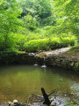
A wild walk, often along the Bozançon, with the option to visit special sites (Roman aqueduct).
Between Echalas and Longes J 2
13.49 mi
+2,201 ft
-2,221 ft
8h 05
Difficult
Departure from Échalas (Rhône)
A long walk through the countryside of the lower Pilat region, with little elevation gain but stream crossings (fords) which may be difficult depending on the season and water level.
 On the plateaus and the summit of Pierre-sur-Haute
11.62 mi
+1,129 ft
-1,129 ft
7 hrs
Difficult
Departure from Valcivières (Puy-de-Dôme)
A long and extensive snowshoe walk (on foot or on cross-country skis) across the vast plateaus and valleys to the west of Pierre-sur-Haute, followed by an ascent to the summit to take in the view.
From the lower Beaujolais to the upper ridges
 11.07 mi
+1,952 ft
-1,942 ft
6h 45
Moderate
Departure from Saint-Étienne-la-Varenne (Rhône)
11.07 mi
+1,952 ft
-1,942 ft
6h 45
Moderate
Departure from Saint-Étienne-la-Varenne (Rhône)
Walk among the vineyards of the lower Beaujolais, the forests and the ridges above.
Paths and trails marked in yellow with signs.
From the Col du Béal to Pierre sur Haute
10.32 mi
+1,696 ft
-1,696 ft
6 hrs
Difficult
Departure from Saint-Pierre-la-Bourlhonne (Puy-de-Dôme)
On snowshoes or on foot, from the Col du Béal to the summit of Pierre-sur-Haute through the forest. Return via the ridges, still on theGR®3or a variant thereof.
Corrençon-en-Vercors - Le Pas Ernadant
 8.57 mi
+2,211 ft
-2,211 ft
5 hrs
Moderate
Departure from Corrençon-en-Vercors (Isère)
8.57 mi
+2,211 ft
-2,211 ft
5 hrs
Moderate
Departure from Corrençon-en-Vercors (Isère)
Leaving Corrençon, you will reach the Crête des Rochers de la Balme via theGR® trail at the start, then via a steeper climb to the summit.
Croix des Boutières and knolls
11.58 mi
+1,709 ft
-1,709 ft
7 hrs
Difficult
Departure from Borée (Ardèche)
A long hike across the plateaus, south of Les Estables, amongst the knolls and near Mont Gerbier de Jonc.
Le Gros Martel
 7.58 mi
+2,175 ft
-2,149 ft
5 hrs
Moderate
Departure from Méaudre (Isère)
7.58 mi
+2,175 ft
-2,149 ft
5 hrs
Moderate
Departure from Méaudre (Isère)
Long snowshoe hike starting from the village of Méaudre. Shorter and easier starting from the Refuge des Narces.
The route is generally marked "snowshoes" all along. You may have to search a little sometimes.
Ridges and plateau of La Molière via Croix Perrin
 10.99 mi
+2,073 ft
-2,064 ft
7 hrs
Moderate
Departure from Lans-en-Vercors (Isère)
10.99 mi
+2,073 ft
-2,064 ft
7 hrs
Moderate
Departure from Lans-en-Vercors (Isère)
Long snowshoe hike (or walk) on the eastern ridge of the northern Vercors overlooking the Molière plateau and return via the plateau (or in the opposite direction if the north wind is blowing on the plateau).
6 hours on foot; 7 hours on snowshoes.
Plateau de la Molière via Les Merciers
 7.13 mi
+2,037 ft
-2,041 ft
6 hrs
Moderate
Departure from Engins (Isère)
7.13 mi
+2,037 ft
-2,041 ft
6 hrs
Moderate
Departure from Engins (Isère)
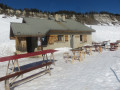
We will climb up to the La Molières plateau, which we will cross to reach the ridge and return via the ridge, with several beautiful viewpoints.
Around Sainte-Catherine de Riverie
13.50 mi
+2,300 ft
-2,303 ft
8h 15
Moderate
Departure from Sainte-Catherine (Rhône) (Rhône)
A great day’s walk in the deep countryside of the Monts du Lyonnais.
Tour des Sucettes de Bornes
 8.72 mi
+3,031 ft
-3,038 ft
6h 40
Moderate
Departure from Glandage (Drôme)
8.72 mi
+3,031 ft
-3,038 ft
6h 40
Moderate
Departure from Glandage (Drôme)
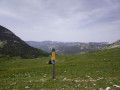
A beautiful hike around the Bellemotte mountain, first through the forest and then along a ridge offering spectacular views. The descent passes by the Sucettes de Bornes, an interesting geological curiosity.
Between Trèves and Échalas
 6.78 mi
+1,165 ft
-1,161 ft
4h 10
Moderate
Departure from Dargoire (Loire)
6.78 mi
+1,165 ft
-1,161 ft
4h 10
Moderate
Departure from Dargoire (Loire)
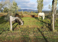
Walk between the two villages of Bas-Pilat, crossing several streams and valleys that descend to the Gier.
The Bruyant Gorges and the Pas de la Bergère
 9.27 mi
+2,989 ft
-2,986 ft
6h 50
Difficult
Departure from Lans-en-Vercors (Isère)
9.27 mi
+2,989 ft
-2,986 ft
6h 50
Difficult
Departure from Lans-en-Vercors (Isère)
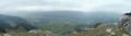
Bucolic walk along the Bruyant, at the bottom of the gorges, before reaching the Moucherotte ridges via the Pas de la Bergère, which can be difficult in wet weather.
Do this in this direction as the descent via the Pas de la Bergère can be difficult or even dangerous after rain.
300 m below the Cabane des Ramées (south), a path on the left in a meadow (cairn) leads to the Trou St Michel, a cave that emerges from the cliff (incorrectly located on the map)
Walk in the forest above Saint-Régis-du-Coin
 11.68 mi
+1,250 ft
-1,224 ft
6h 30
Moderate
Departure from La Versanne (Loire)
11.68 mi
+1,250 ft
-1,224 ft
6h 30
Moderate
Departure from La Versanne (Loire)
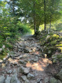
A long, pleasant walk in summer through beautiful forests between the Col de la République and Saint-Régis-du-Coin. Can also be done in winter with snowshoes or even cross-country skis.
Family walk around Lajoux in the Jura
 7.95 mi
+1,060 ft
-1,037 ft
4h 35
Moderate
Departure from Lajoux (Jura)
7.95 mi
+1,060 ft
-1,037 ft
4h 35
Moderate
Departure from Lajoux (Jura)
There is little elevation gain and lots of forest for this walk, which is recommended in summer on the Jura plateau.
Between forests and high stubble fields in the Forez region.
 10.90 mi
+1,398 ft
-1,378 ft
6 hrs
Moderate
Departure from Valcivières (Puy-de-Dôme)
10.90 mi
+1,398 ft
-1,378 ft
6 hrs
Moderate
Departure from Valcivières (Puy-de-Dôme)
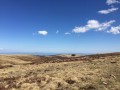
Day hike with little elevation gain in the Monts du Forez and the wild Hautes Chaumes.
It is advisable to climb to the summit of Montiallier for the view.
This can be done in winter with snowshoes and even cross-country skis.
Great spot for snowkiting at the Col des Supeyres.
The Givors valleys and the Echalas plateau (long version)
11.51 mi
+1,775 ft
-1,755 ft
6h 50
Moderate
Departure from Givors (Rhône)
A walk between Givors and Echalas, mostly through woods and along wild valleys. Although close to the town, this walk remains very natural before reaching the plateau.
The Combes de Givors
7.46 mi
+978 ft
-978 ft
4h 15
Moderate
Departure from Givors (Rhône)
Hike in the valleys between Givors and Echalas, in unspoilt countryside just a stone's throw from a large town.
On the plateaus above Sainte-Catherine-sur-Riverie
 13.16 mi
+2,011 ft
-2,011 ft
7h 50
Difficult
Departure from Sainte-Catherine (Rhône) (Rhône)
13.16 mi
+2,011 ft
-2,011 ft
7h 50
Difficult
Departure from Sainte-Catherine (Rhône) (Rhône)
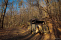
Long hike starting from Sainte-Catherine, which passes by the summit of the Monts du Lyonnais, the Crêt Malherbe at 946m.
The Crêtes de Vars via the Val d'Escreins
 6.94 mi
+2,822 ft
-2,841 ft
5h 40
Moderate
Departure from Vars (Hautes-Alpes)
6.94 mi
+2,822 ft
-2,841 ft
5h 40
Moderate
Departure from Vars (Hautes-Alpes)
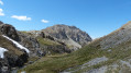
A beautiful classic hike that starts from Val d'Escreins (nature reserve) and climbs up to the ridges overlooking the Vars Valley, then descends further down via another pass.
Carsac greenway, the Dordogne and the Montfort site
 8.52 mi
+367 ft
-381 ft
4h 15
Moderate
Departure from Carsac-Aillac (Dordogne)
8.52 mi
+367 ft
-381 ft
4h 15
Moderate
Departure from Carsac-Aillac (Dordogne)
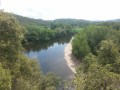
Walk first along a greenway (cycle and footpath) and return along the Dordogne and Château de Montfort before returning via the greenway.
La Moucherotte de Lans
 7.23 mi
+1,985 ft
-1,985 ft
5 hrs
Moderate
Departure from Lans-en-Vercors (Isère)
7.23 mi
+1,985 ft
-1,985 ft
5 hrs
Moderate
Departure from Lans-en-Vercors (Isère)
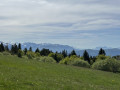
An easy loop starting from the Lans-en-Vercors snow stadium to reach the summit of Moucherotte (on snowshoes or on foot).
Caution: do not descend via the Combe de Saint-Nizier if visibility is poor. Stay on the path.
Between Annonay and Burdignes
 13.40 mi
+2,244 ft
-2,241 ft
8h 05
Difficult
Departure from Villevocance (Ardèche)
13.40 mi
+2,244 ft
-2,241 ft
8h 05
Difficult
Departure from Villevocance (Ardèche)
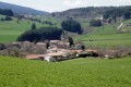
Climb and ramble along the ridges above Annonay. Beautiful view of the Alps and Pilat.
Ceillac and its hamlets via the Cols de Bramousse and du Fromage
11.20 mi
+3,419 ft
-3,419 ft
8h 10
Difficult
Departure from Ceillac (Hautes-Alpes)
A lovely walk on well-marked trails, long but not too difficult. There are several scenic viewpoints and the return route passes through pretty hamlets.
A circular route to Le Cugulet and the Pic d’Escreins from Guillestre
11.68 mi
+5,551 ft
-5,554 ft
10h 10
Difficult
Departure from Guillestre (Hautes-Alpes)
A long and challenging hike starting from Guillestre and returning via the Val d’Escreins, with magnificent views and a wild, unspoilt atmosphere.
Tour of the Pic des Toillies
 8.22 mi
+3,169 ft
-3,166 ft
6h 30
Difficult
Departure from Saint-Véran (Hautes-Alpes)
8.22 mi
+3,169 ft
-3,166 ft
6h 30
Difficult
Departure from Saint-Véran (Hautes-Alpes)
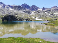
Starting from the Chapelle des Clausis, we will circle a remarkable peak, passing through three mountain passes and making a short detour into Italy. Numerous lakes and the beautiful Refuge de la Blanche.
In the Gier Valley
 3.64 mi
+692 ft
-679 ft
2h 15
3.64 mi
+692 ft
-679 ft
2h 15
 Easy
Departure from Saint-Romain-en-Gier (Rhône)
Easy
Departure from Saint-Romain-en-Gier (Rhône)
The walk is often through woodland between Saint-Romain-en-Gier and Échalas, north of Pilat (Gier valley).
Tour of the Val de Charsac
 11.34 mi
+1,814 ft
-1,821 ft
6h 50
Difficult
Departure from Mirabel-et-Blacons (Drôme)
11.34 mi
+1,814 ft
-1,821 ft
6h 50
Difficult
Departure from Mirabel-et-Blacons (Drôme)
A long walk with beautiful views, with no difficulty other than the length, on trails and paths through fairly sparse pine forests.
Circular route from Le Ponteil via the Col de Tramouillon
9.24 mi
+3,481 ft
-3,478 ft
7h 15
Moderate
Departure from Champcella (Hautes-Alpes)
A long walk around the Bois du Bouchet on two different slopes with a 360° view at the beautiful Col de Tramouillon.
Circuit of the Fressinières cliffs
 7.00 mi
+2,759 ft
-2,756 ft
5h 35
Difficult
Departure from Freissinières (Hautes-Alpes)
7.00 mi
+2,759 ft
-2,756 ft
5h 35
Difficult
Departure from Freissinières (Hautes-Alpes)
A walk around the cliffs overlooking the village of Fressinières, winding through rocky terrain and a beautiful forest higher up.
Please note! Following the major fire in 2026, the paths may have been altered or some may be closed.
Grand Tour of the Pointe de la Saume
9.76 mi
+4,528 ft
-4,531 ft
8h 25
Difficult
Departure from Ceillac (Hautes-Alpes)
A long and rugged mountain hike, alternating between woodland and grassy slopes, made challenging by its length and the steep descent at the Pas du Curé. Perhaps easier in the opposite direction?
Around Petit Buëch via the Sentier des Bans trail
 6.85 mi
+2,162 ft
-2,162 ft
5h 00
Difficult
Departure from Rabou (Hautes-Alpes)
6.85 mi
+2,162 ft
-2,162 ft
5h 00
Difficult
Departure from Rabou (Hautes-Alpes)
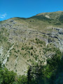
After taking the famous Sentier des Bans balcony path, we will cross the Petit Buech to return via a small balcony path on the other side before reaching Rabou via a small Roman bridge.
There are a few tricky sections on the balconies, especially on the way back. This is where the difficulty lies. Not suitable for those who are afraid of heights.
A circular walk to the Tête de Paneyron and Lac de l’Étoile from the Col de Vars
 11.16 mi
+3,189 ft
-3,196 ft
7h 55
Difficult
Departure from Saint-Paul-sur-Ubaye (Alpes-de-Haute-Provence)
11.16 mi
+3,189 ft
-3,196 ft
7h 55
Difficult
Departure from Saint-Paul-sur-Ubaye (Alpes-de-Haute-Provence)
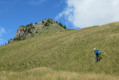
A circular route featuring a steep climb to the summit overlooking the Col de Vars and, further on, the small Lac de l’Étoile. Return via the ridges of La Selle to the Cabane du Vallon before reaching the Refuge Napoléon and the Col de Vars.
The Guions - Champaussel - Pra Reboul circular loop
 6.72 mi
+2,297 ft
-2,300 ft
5h 05
Moderate
Departure from Saint-Crépin (Hautes-Alpes)
6.72 mi
+2,297 ft
-2,300 ft
5h 05
Moderate
Departure from Saint-Crépin (Hautes-Alpes)
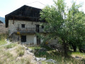
Complements the existing routes on the Guions and Champaussel, but this time in a circular route, returning to Saint-Crépin along the old canal. A fairly easy walk in a magnificent setting with views of the valley.