Country:

 City:
City:


Park above and to the east of Guillestre. From the D902, before leaving Guillestre towards the Gorges du Guil, take Rue de Chazal and park at the junction of Rue du Pied Du Bois and Chemin de Combe Sauve (the last road).
(S/E) Take the path leading uphill opposite Rue de Chazal, signposted “Mont Cugulet”.
(1) After the canal, turn left onto the yellow-marked path which climbs through the forest, alternating between forest tracks and steep trails. It crosses the track several times (which can be difficult at times).
(2) At Grand Pré (water tank), continue along this yellow-marked trail, which crosses the forest track several times, until you reach the ridge.
(3) Head north along the path that climbs through the forest to the summit of Combe Chauve (cross and lovely view).
(4) Take the ridge path (or go via the summit of Cugulet) which joins the Crête de Cugulet, which you then follow.
(5) Turn right onto the path towards Val d’Escreins (marked orange-red).
(6) At the junction with the path to the Cabane de Cugulet, continue downwards, following the same markings. Cross a few sections with cables and ladders without any major difficulty.
(7) At the junction, turn right towards Guillestre, following a path running along the mountainside.
(8) Reach the bottom of the Val d’Escrins and the path (near some ruins), which you should follow westwards.
(9) At Pont de Vars, continue along the right bank on a path that follows the river until you reach a track.
(10) Follow this track down to Guillestre.
(11) Before the marble works, take the yellow-marked path on the right (signposted) which climbs 50 metres before descending onto the track, which turns into a road and leads directly back to the car park (S/E).

 Visorando Member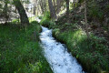
 Easy
Easy 
 Moderate