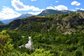
Around the village of Risoul

A short walk, lasting no more than 3 hours, which does not take into account the recent flooding in the village of Risoul.

Details

61256627
Creation:
Last update:
Last review:
  • Walking
    Activity: Walking
  • ↔
    Distance: 4.02 mi
  • ◔
    Average duration: 2h 55 
  • ▲
    Difficulty: Moderate

  • ⚐
    Back to start: Yes
  • ↗
    Ascent: + 1,270 ft
  • ↘
    Descent: - 1,253 ft

  • ▲
    Highest point: 4,928 ft
  • ▼
    Lowest point: 3,707 ft

Description of the walk

From Risoul, park near the bridge over the Torrent du Palps, on the Barbeinq road. The start is at the bridge that was washed away, and the path is immediately 10 metres from the scree.

(S/E) Just before the bridge on the Route de Barbeinq, head up to the left then take the path on the left 10 metres further up, which winds its way up and leads to a small plateau (recent works).

(1) Pass the two houses and continue along a path, then a track that climbs up to a forest road (GR®).

(2) Turn right onto the track, which climbs quite steeply to rejoin the road further up (you can also follow the GRP®).

(3) Turn right onto a small track which joins the forest road further on, and continue to the hamlet of Brunissard.

(4) On the plateau, follow this path to the left as far as the place known as Les Quatre Chemins.

(5) Head back down to the right along a Risoul hiking/mountain-biking track to reach the hamlet of Barbeing.

(6) Take the tarmac road on the right to return to the starting point after the bridge (S/E).

Waypoints

  1. S/E : mi 0 - alt. 3,724 ft - Bridge
  2. 1 : mi 0.19 - alt. 3,783 ft - Two houses
  3. 2 : mi 0.47 - alt. 3,904 ft - GRP forest track on the right
  4. 3 : mi 0.87 - alt. 4,301 ft - Narrow path
  5. 4 : mi 1.5 - alt. 4,656 ft - Brunissard hamlet
  6. 5 : mi 2.1 - alt. 4,928 ft - Mountain bike trail to the right
  7. 6 : mi 3.27 - alt. 3,734 ft - Barbeing
  8. S/E : mi 4.02 - alt. 3,737 ft - Bridge

Notes

Water points at the various farms.

Worth a visit

Risoul ski resort.

Always be cautious and plan ahead when you're outdoors. Visorando and the author of this route cannot be held responsible for any accidents occurring on this route.

The GR® and PR® markings are the intellectual property of the Fédération Française de Randonnée Pédestre.

Other walks in the area

For more walks, use our search engine .

The GPS track and description are the property of this route's author. Please do not copy them without permission.