Around the Merdanel

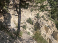
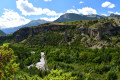
A long hike around the Merdanel torrent with its ‘demoiselles coiffées’ (rock formations), high-altitude forests and vast mountain pastures, returning via a beautiful marked path – not always shown on the map – before fording the torrent.

Warning! This walk should not be undertaken after a period of heavy rain (thunderstorms): crossing the Merdanel may prove difficult.

Details

n°1198894
Creation:
Last update:
Last review:
  • Walking
    Activity: Walking
  • ↔
    Distance: 9.57 mi
  • ◔
    Average duration: 7h 45 
  • ▲
    Difficulty: Difficult

  • ⚐
    Back to start: Yes
  • ↗
    Ascent: + 3,868 ft
  • ↘
    Descent: - 3,894 ft

  • ▲
    Highest point: 6,844 ft
  • ▼
    Lowest point: 3,645 ft

Description of the walk

Park above the Serre des Hodouls at the end of the track (barrier).

(S/E) At the barrier, head down the track to find the stream, which you’ll follow along the left bank.

(1) Look out for the marked path (in places) which you’ll follow for an hour, cutting across several tracks to reach the Cabane du Bois Durat.

(2) Leave the return path on your left and continue on to the hut.

(3) Above the hut, take theGR® 541 (marked in white and red), which crosses a stream, climbs through the forest and emerges into the mountain pastures

(4) Leave theGR® as you emerge from the forest at a hairpin bend and head west across the mountain pastures, descending until you reach the clearly visible path leading up to the Cabane Sainte-Marie.

(5) Follow this path downwards to reach a wider track above Moussière.

(6) Follow this path downhill, keeping an eye out for the cairns which allow you to cut across some of the numerous hairpin bends.

(7) Leave this path at a bend at point 1440 to descend directly to Le Villard and its Chapelle Saint-Michel.

(8) Continue left onto the upper path which leads to Les Chapins.

(9) On leaving the hamlet, carry on straight ahead on level ground, then take the path that climbs into the forest.

(10) At the first hairpin bend, carry on straight ahead along a path that climbs and eventually becomes a footpath.

(11) Turn right onto the yellow-marked balcony path, which will descend further on to the Merdanel stream.

(12) Cross the stream and look out for the cairn opposite, which marks the start of the path leading back up the opposite side.

(2) Turn right onto the original path, which descends alongside the stream and leads back down to the bottom.

(1) All that remains is to follow the path back up to the car park (S/E).

Waypoints

  1. S/E : mi 0 - alt. 3,691 ft - Barrier on the path
  2. 1 : mi 0.13 - alt. 3,645 ft - Start of the trail
  3. 2 : mi 1.33 - alt. 4,692 ft - Crossroads at the end of the circular loop
  4. 3 : mi 1.73 - alt. 5,144 ft - Cabane du Bois Durat
  5. 4 : mi 3.45 - alt. 6,844 ft - Exit from the forest
  6. 5 : mi 3.72 - alt. 6,470 ft - Sainte-Marie Path
  7. 6 : mi 4.3 - alt. 6,125 ft - Moussière
  8. 7 : mi 6.22 - alt. 4,721 ft - Abandoning the path
  9. 8 : mi 6.47 - alt. 4,482 ft - Le Villard
  10. 9 : mi 6.9 - alt. 4,472 ft - Les Chapins
  11. 10 : mi 7.31 - alt. 4,669 ft - Winding path
  12. 11 : mi 7.57 - alt. 4,856 ft - Balcony trail
  13. 12 : mi 8.12 - alt. 4,692 ft - Merdanel torrent
  14. S/E : mi 9.57 - alt. 3,688 ft - Barrier on the path

Notes

Several mountain streams. Shelter at the Cabane Durat and in the hamlets.
Good walking boots and walking poles recommended.

Worth a visit

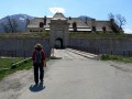
The Fort Vauban at Mont Dauphin.
The Queyras is not far away.

Always be cautious and plan ahead when you're outdoors. Visorando and the author of this route cannot be held responsible for any accidents occurring on this route.

The GR® and PR® markings are the intellectual property of the Fédération Française de Randonnée Pédestre.

Reviews and comments

5 / 5
Based on 1 review

Reliability of the description
5 / 5
Ease of following the route
5 / 5
Route interest
5 / 5
CHENILLE
CHENILLE

Overall rating : 5 / 5

Date of your route : Mar 27, 2022
Reliability of the description : ★★★★★ Very good
Ease of following the route : ★★★★★ Very good
Route interest : ★★★★★ Very good
Very busy route : No

A lovely spring walk to do in dry weather.
You can park at the entrance to the village when approaching from Embrun, at the start of the circular walk.

Machine-translated

Other walks in the area

For more walks, use our search engine .

The GPS track and description are the property of this route's author. Please do not copy them without permission.