The Crète du Riou Vert via the Aiguillettes

A circular loop that is largely off the marked trail, allowing you to get away from the crowds and explore wild areas. Best done in this direction as it climbs quite steeply in places.
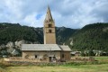
You can also park at Sainte-Cécile Church and join the GR®.

Details

25097094
Creation:
Last update:
Last review:
  • Walking
    Activity: Walking
  • ↔
    Distance: 4.33 mi
  • ◔
    Average duration: 3h 55 
  • ▲
    Difficulty: Difficult

  • ⚐
    Back to start: Yes
  • ↗
    Ascent: + 2,224 ft
  • ↘
    Descent: - 2,201 ft

  • ▲
    Highest point: 7,805 ft
  • ▼
    Lowest point: 5,627 ft

Description of the walk

Park at the top of the Queyras district above Ceillac.

(S/E) Take the Sentier des Aiguillettes, marked in yellow, leaving the via ferrata paths on your left.

(1) Just before a large valley, at a large cairn, head up to the left along a track that stays on a ridge with regular cairns; it can be quite steep. You’ll come out onto a meadow and a trough that joins a path.

(2) Take this to the left before heading up to the right across the slope, towards the ridge (a few faintly visible tracks).

(3) Reach a small pass and turn right to reach a small summit.
From the pass, it is possible to reach the Bramousse valley and the remarkable larch tree.

(4) From the summit, head back down the same route to rejoin the lower path through a meadow and a valley.

(2) Turn left and follow the path to the Col de Bramousse.

(5) Keep turning right along theGR®58to descend to Ceillac at the Haut Queyras car park (S/E).

Waypoints

  1. S/E : mi 0 - alt. 5,633 ft - Haut de Queyras
  2. 1 : mi 0.74 - alt. 6,759 ft - Cairn on the left
  3. 2 : mi 1.15 - alt. 7,431 ft - Junction of the circular loop
  4. 3 : mi 1.39 - alt. 7,710 ft - Small pass
  5. 4 : mi 1.54 - alt. 7,799 ft - Summit
  6. 5 : mi 2.81 - alt. 7,372 ft - Col de Bramousse
  7. S/E : mi 4.33 - alt. 5,630 ft - Haut de Queyras

Notes

No water. Walking poles recommended; a GPS is useful but not essential

Route plotted using my GPS and Visorando.

Always be cautious and plan ahead when you're outdoors. Visorando and the author of this route cannot be held responsible for any accidents occurring on this route.

The GR® and PR® markings are the intellectual property of the Fédération Française de Randonnée Pédestre.

Reviews and comments

4.5 / 5
Based on 2 reviews

Reliability of the description
4.5 / 5
Ease of following the route
4 / 5
Route interest
5 / 5
Nat1827
Nat1827

Overall rating : 4.7 / 5

Date of your route : Jun 30, 2026
Reliability of the description : ★★★★★ Very good
Ease of following the route : ★★★★☆ Good
Route interest : ★★★★★ Very good
Very busy route : No

Thank you for sharing this walk; it was a lovely discovery, even though the off-trail ascent isn’t very easy to follow – you really need to stick to the GPS track and stay on the ridge. Unfortunately, the cairn at point 1 has disappeared, as have almost all the others. There are only two or three left, just to let you know you’re on the right track. Reaching the summit is well worth the effort; the setting is wild and magnificent, with a stunning panoramic view. The way back is easier to follow.

Machine-translated

pouget yves
pouget yves

The large cairn at point (1) and those at point (2) have completely disappeared, even though they were there before I drew this map. Why and for what reason? The other cairns must have suffered the same fate...

Machine-translated

roro68
roro68

Overall rating : 4.3 / 5

Date of your route : Aug 18, 2024
Reliability of the description : ★★★★☆ Good
Ease of following the route : ★★★★☆ Good
Route interest : ★★★★★ Very good
Very busy route : No

With my two teenagers, aged 12 and 14, this was a superb hike that requires strong legs to get started.
The route requires the paid app!! This helps you find the signposts, which are otherwise missing, and the path really does disappear once you start climbing through the branches and leaves on the steep, rugged ascent. That’s the only thing you need to watch out for. At the top, we also struggled to find the route as we wanted to take a shortcut, not wanting to push on to point 4 with a storm rumbling in the distance. But the walk really is magnificent. Some lovely little marmots towards the end surprised us by playing hide-and-seek with us. And what made it even more blissful was that, apart from right at the very end, we didn’t come across a single soul!

Machine-translated

Other walks in the area

For more walks, use our search engine .

The GPS track and description are the property of this route's author. Please do not copy them without permission.