The Tête de Vautisse circular loop

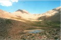
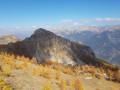
Another version of the ascent of the Tête de Vautisse, this time in a circular format, to enjoy different experiences and views.

Details

n°61472549
Creation:
Last update:
Last review:
  • Walking
    Activity: Walking
  • ↔
    Distance: 6.89 mi
  • ◔
    Average duration: 5h 35 
  • ▲
    Difficulty: Difficult

  • ⚐
    Back to start: Yes
  • ↗
    Ascent: + 2,740 ft
  • ↘
    Descent: - 2,720 ft

  • ▲
    Highest point: 10,315 ft
  • ▼
    Lowest point: 7,838 ft

Description of the walk

Head up the sheep track to the Cabane de l’Alpe, where you can park easily. The journey from Mikéou is long but manageable in a standard car.

(S/E) Take the path leading from the sheepfold for a long traverse westwards to a large cairn in the Vallon de la Selle.

(1) Cross this valley to the right, following the cairns, then begin the ascent. Cross the Torrent de Feyssoles, then continue up a steep, sustained climb to reach the summit of the Tête de Vautisse.

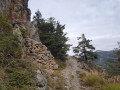
(2) Begin the descent, turning right at the junction marked by a yellow post. Continue on to reach the junction you passed on the way up.

(1) Retrace your steps along the route you took on the way up to return to the Cabane de l’Alpe car park (S/E).

Waypoints

  1. S/E : mi 0 - alt. 7,848 ft - Cabane de l'Alp
  2. 1 : mi 2.43 - alt. 8,986 ft - Junction of the circular loop – Cairn
  3. 2 : mi 3.43 - alt. 10,315 ft - Tête de Vautisse
  4. S/E : mi 6.89 - alt. 7,848 ft - Cabane de l'Alp

Notes

Water at the sheepfold.

Reviews and comments

4.7 / 5
Based on 1 review

Reliability of the description
5 / 5
Ease of following the route
4 / 5
Route interest
5 / 5
ollagnier
ollagnier
• Edited:

Overall rating : 4.7 / 5

Date of your route : Aug 26, 2025
Reliability of the description : ★★★★★ Very good
Ease of following the route : ★★★★☆ Good
Route interest : ★★★★★ Very good
Very busy route : Yes

Very beautiful hike, vultures, 10 people during the day

Machine-translated

Other walks in the area

For more walks, use our search engine .

The GPS track and description are the property of this route's author. Please do not copy them without permission.