Ceillac and its hamlets via the Cols de Bramousse and du Fromage

A lovely walk on well-marked trails, long but not too difficult. There are several scenic viewpoints and the return route passes through pretty hamlets.

Details

279531
Creation:
Last update:
Last review:
  • Walking
    Activity: Walking
  • ↔
    Distance: 11.20 mi
  • ◔
    Average duration: 8h 10 
  • ▲
    Difficulty: Difficult

  • ⚐
    Back to start: Yes
  • ↗
    Ascent: + 3,419 ft
  • ↘
    Descent: - 3,419 ft

  • ▲
    Highest point: 8,406 ft
  • ▼
    Lowest point: 5,410 ft

Description of the walk

Park at the top of Ceillac in the car park near the fire station.

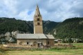
(S/E) Head west along the road to Sainte-Cécile Church.

(1) Head north on theGR®58, marked in red and white. Follow a series of good hairpin bends through the forest to reach the plateau where the concrete blocks supporting the former Bramousse ski area are located.

(2) Continue on theGR®58to climb up to the Col de Bramousse.

(3) Take the ridge path towards Col Fromage, leaving theGR®58here. Before reaching the pass, climb to the summit at the Poste Optique hut.

(4) Begin the descent, taking the winding path rather than the direct route to Col Fromage. Reach this pass.

(5) Head east along the balcony path and reach a crossroads.

(6) Turn right onto the almost level path, cross the Ravin de Rabinoux and join theGR®58further down, which leads to the Col des Estronques.

(7) Follow theGR® to the right downhill and, via a few hairpin bends, reach the path leading to the ruins of Le Touret (signpost).

(8) Follow the signposted path to the left, which passes close to the ruins, overlooking the hamlet of Les Chalmettes, then climb slightly to reach a track on the drovers' road at Chaleu.

(9) Head right downhill to reach the track between the hamlets of Les Chalmettes and Le Serre.

(10) Stay on the track to the right to reach the hamlet of Les Chalmettes.

(11) Continue straight on to rejoin theGR®58.

(12) Follow it, passing through the hamlets of Rabinoux, Tioure and Villard in turn. At Villard, join theGR®5coming down from Col Fromage; stay on this path, following the red and white markings, to reach the entrance to the village of Ceillac.

(13) Follow theGR® to the left, which descends onto a small road leading back to the car park at the start (S/E).

Waypoints

  1. S/E : mi 0 - alt. 5,479 ft - Fire brigade
  2. 1 : mi 0.47 - alt. 5,443 ft - Church
  3. 2 : mi 1.68 - alt. 6,598 ft - GR junction
  4. 3 : mi 2.36 - alt. 7,372 ft - Col de Bramousse
  5. 4 : mi 3.91 - alt. 8,402 ft - Optical station
  6. 5 : mi 5.02 - alt. 7,556 ft - Col Fromage
  7. 6 : mi 5.49 - alt. 7,539 ft - Crossroads on the balcony path
  8. 7 : mi 6.3 - alt. 7,228 ft - GR 58 junction
  9. 8 : mi 6.83 - alt. 6,614 ft - Towards the ruins
  10. 9 : mi 7.81 - alt. 6,880 ft - Path below
  11. 10 : mi 8.27 - alt. 6,545 ft - Path to the west
  12. 11 : mi 8.6 - alt. 6,368 ft - Les Chalmettes
  13. 12 : mi 8.98 - alt. 6,434 ft - GR 58 junction
  14. 13 : mi 10.95 - alt. 5,587 ft - GR towards the road
  15. S/E : mi 11.2 - alt. 5,479 ft - Car park

Notes

Shelter at the old signal station and in the various hamlets where water can be found.

Worth a visit

The village of Ceillac.
The Queyras region as a whole and Château-Queyras.

Always be cautious and plan ahead when you're outdoors. Visorando and the author of this route cannot be held responsible for any accidents occurring on this route.

The GR® and PR® markings are the intellectual property of the Fédération Française de Randonnée Pédestre.

Reviews and comments

4.9 / 5
Based on 4 reviews

Reliability of the description
5 / 5
Ease of following the route
5 / 5
Route interest
4.8 / 5
daniel_bouche
daniel_bouche

Overall rating : 5 / 5

Date of your route : Aug 21, 2023
Reliability of the description : ★★★★★ Very good
Ease of following the route : ★★★★★ Very good
Route interest : ★★★★★ Very good
Very busy route : No

Stunning views, particularly at the Col Fromage. The walk is fairly easy and not too busy. It’s easy to follow, although, after a moment’s inattention, I found myself at the blockhouse (an interesting detour, incidentally...). It’s possible to shorten the route by heading straight down to Ceillac via the GR, but we preferred to stick to the original route.

Machine-translated

michelbes
michelbes

Overall rating : 4.7 / 5

Date of your route : Jul 04, 2022
Reliability of the description : ★★★★★ Very good
Ease of following the route : ★★★★★ Very good
Route interest : ★★★★☆ Good
Very busy route : No

I completed most of this hike without passing through the hamlets (between points 6 and 12), instead linking the Col de Fromage directly to Ceillac via the GR5, in about seven hours including stops at the Col de Bramousse and the optical station. The ridge walk between the two passes is spectacular and exposed, though this doesn’t seem to faze the mountain bikers!

Machine-translated

manuuher
manuuher

Overall rating : 5 / 5

Date of your route : Aug 13, 2021
Reliability of the description : ★★★★★ Very good
Ease of following the route : ★★★★★ Very good
Route interest : ★★★★★ Very good
Very busy route : Yes

A very scenic hike, especially between the Col du Fromage and Bramousse. A route along ridges and ridgelines offering breathtaking views. Admittedly, it’s a bit dizzying at times, but it’s well worth the detour...
We ‘short-cut’ the section through the hamlets by heading straight up from Le Villard to the Col du Fromage along the GR (we did the circular route in the opposite direction, as the start point is easier to find when setting off from Ceillac towards Le Villard).
Similarly, for the descent from the Col de Bramousse, we followed the GR.
We covered 800m of elevation gain and around 12 km.

Machine-translated

M Grisel
M Grisel

Overall rating : 5 / 5

Date of your route : Jul 20, 2021
Reliability of the description : ★★★★★ Very good
Ease of following the route : ★★★★★ Very good
Route interest : ★★★★★ Very good
Very busy route : Yes

A lovely route starting from Ceillac, with a steep but well-marked climb through the forest. The section crossing from the Col de Bramousse to the Col Fromage may be tricky for those prone to vertigo; it’s a shame that mountain bikes use the path leading down to the Col Fromage, as I feel sharing the trail is dangerous.

Machine-translated

Other walks in the area

For more walks, use our search engine .

The GPS track and description are the property of this route's author. Please do not copy them without permission.