Circular route between the two valleys of Ceillac

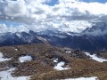
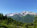
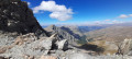
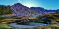
We’ll make our way from the Cristillan valley to the Mélezet valley via the Beaubarnon, Albert and Clausis passes, before returning to the starting point of this long circular route through varied landscapes.
To avoid the 3 km of tarmac on the return journey to the bridge, you can try hitchhiking from the Bois Noir car park.

Details

40814649
Creation:
Last update:
Last review:
  • Walking
    Activity: Walking
  • ↔
    Distance: 10.09 mi
  • ◔
    Duration according to the author: 7 hrs 
  • ▲
    Difficulty: Very difficult

  • ⚐
    Back to start: Yes
  • ↗
    Ascent: + 4,413 ft
  • ↘
    Descent: - 4,416 ft

  • ▲
    Highest point: 9,541 ft
  • ▼
    Lowest point: 6,165 ft

Description of the walk

Park near the bridge over the Cristillan at or below Les Chalmettes.

(S/E) Cross the bridge and start climbing through the forest, following the path. At thefirst junction, leave the signposted path towards Les Chalmettes on your left. Continue along the path on the right, climbing via wide switchbacks to reach the clearing at the Ravin de Beaubarnon.

(1) Walk up this meadow, keeping to the left, and look out for a cairn further on, just before the rocks.

(2) Head straight up to the left onto a path that goes round these rocks and continues up a fairly steep climb along a narrow track, heading towards a large, menhir-shaped rock. You’ll reach a flat area and then the Col de Beaubarnon.

(3) Follow the path downwards until you can see the Col Albert path.

(4) Take this path to the left and reach the foot of the pass. Here, take a wide hairpin bend to reach the Col Albert.

(5) Carefully follow the ridge to the left to reach the highest point of the walk at the Tête de Rissaace or the Longet.

(6) Begin the descent, taking care, to reach the Col de Clausis.

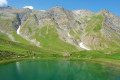
(7) Turn left and follow the yellow-marked path across the large Clausis valley to reach Lac de Clausis.

(8) Continue the descent, entering the forest to quickly reach the Étable des Génisses, also known as the Cabane de la Lavine.

(9) Take the wide track and continue down the gentle slope, crossing the Cristillan at the ford. A few hundred metres further on, you’ll reach the Claux car park.

(10) Join the road here and follow the Cristillan stream to the Chalmettes car park (S/E)

Waypoints

  1. S/E : mi 0 - alt. 6,175 ft - Chalmettes car park. Cross the - Cristillan (cours d'eau) - Affluent du Guil
  2. 1 : mi 1.41 - alt. 7,408 ft - Beaubardon Valley
  3. 2 : mi 1.82 - alt. 7,792 ft - Cairn
  4. 3 : mi 2.32 - alt. 8,556 ft - Col de Beaubarnon (2608m)
  5. 4 : mi 3.37 - alt. 7,877 ft - Col Albert Trail
  6. 5 : mi 4.62 - alt. 9,291 ft - Col Albert
  7. 6 : mi 4.93 - alt. 9,541 ft - Tête de Rissace
  8. 7 : mi 5.64 - alt. 9,055 ft - Col de Clausis
  9. 8 : mi 6.7 - alt. 8,018 ft - Lac de Clausis
  10. 9 : mi 7.51 - alt. 7,044 ft - Lavine Hut
  11. 10 : mi 8.57 - alt. 6,660 ft - Claux car park
  12. S/E : mi 10.09 - alt. 6,175 ft - Chalmettes car park

Notes

The paths aren’t always signposted, but the tracks are visible.
Walking poles are essential, in my view.
No water apart from the streams

Worth a visit

Between (10) and Ceillac: numerous unusual cairns have been placed along this route and are well worth a closer look.

Reviews and comments

5 / 5
Based on 1 review

Reliability of the description
5 / 5
Ease of following the route
5 / 5
Route interest
5 / 5
JL'H
JL'H

Overall rating : 5 / 5

Date of your route : Sep 10, 2024
Reliability of the description : ★★★★★ Very good
Ease of following the route : ★★★★★ Very good
Route interest : ★★★★★ Very good
Very busy route : No

A lovely route that takes you over three neighbouring mountain passes, each very different from the others. I discovered the very wild Beaubarnon valley, which is home to a sizeable herd of chamois. A lovely hike!

Machine-translated

Other walks in the area

For more walks, use our search engine .

The GPS track and description are the property of this route's author. Please do not copy them without permission.