A circular walk to the Tête de Paneyron and Lac de l’Étoile from the Col de Vars

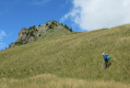
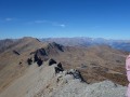
A circular route featuring a steep climb to the summit overlooking the Col de Vars and, further on, the small Lac de l’Étoile. Return via the ridges of La Selle to the Cabane du Vallon before reaching the Refuge Napoléon and the Col de Vars.

Details

764318
Creation:
Last update:
Last review:
  • Walking
    Activity: Walking
  • ↔
    Distance: 11.16 mi
  • ◔
    Average duration: 7h 55 
  • ▲
    Difficulty: Difficult

  • ⚐
    Back to start: Yes
  • ↗
    Ascent: + 3,189 ft
  • ↘
    Descent: - 3,196 ft

  • ▲
    Highest point: 9,121 ft
  • ▼
    Lowest point: 6,519 ft

Photos

Description of the walk

Start from the Col de Vars car park.

(S/E) Walk down 100 m on the south-facing side to find the path on the left which leads up to the sheepfold.

(1) Before reaching it, take the signposted path (sign) on the right, which climbs up some occasionally steep slopes to the pass.

(2) Make a round trip to the summit before heading east along the ridge towards the lake.

(3) Begin a steep descent of around 120 m along the sheep fences, then climb steeply up the opposite side and follow a series of ups and downs to reach Lac de l’Étoile.

(4) Turn back for 200 m, then veer right to reach the Crête de Selle. Follow it to the left for a long while before finding a path at the Col de Selle.

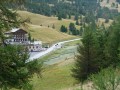
::5: Head down to the left towards the Vallon hut, which is visible below.

(6) Join the path which turns left and descends towards the valley.

(7) Turn left.

(8) Just before thefirst hairpin bend, turn left onto a balcony path that leads to the Cabane des Prises.

(9) Head down to the Refuge Napoléon.

(10) Cross the road to find the path leading up from the ski resort to the Col de Vars, 2 km away, and arrive at the car park (S/E).

Waypoints

  1. S/E : mi 0 - alt. 6,916 ft - Car park at the - Col de Vars
  2. 1 : mi 0.69 - alt. 7,077 ft - Marked path on the right
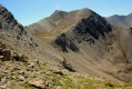
  3. 2 : mi 2.64 - alt. 9,078 ft - Col de Paneyron. Towards the - Tête de Paneyron
  4. 3 : mi 2.92 - alt. 8,967 ft - Steep descent
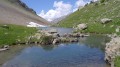
  5. 4 : mi 4.03 - alt. 9,065 ft - Lac de l'étoile
  6. 5 : mi 6.16 - alt. 7,710 ft - Col de Selle
  7. 6 : mi 6.6 - alt. 7,552 ft - Vallon hut
  8. 7 : mi 7.89 - alt. 7,267 ft - Hairpin bend
  9. 8 : mi 8.24 - alt. 7,198 ft - Path (cairn)
  10. 9 : mi 8.67 - alt. 7,110 ft - Cabane des Prises
  11. 10 : mi 9.84 - alt. 6,522 ft - Napoléon Refuge
  12. S/E : mi 11.16 - alt. 6,916 ft - Car park at the - Col de Vars

Notes

The landscape is quite arid. There is little water apart from at the sheepfolds.
Good footwear and walking poles are strongly recommended.

(10) You can also take the shuttle bus that runs from Vars up to the Col.

Worth a visit

Vars ski resort.

Reviews and comments

4.8 / 5
Based on 2 reviews

Reliability of the description
5 / 5
Ease of following the route
4.5 / 5
Route interest
5 / 5
divinum
divinum

Overall rating : 4.5 / 5

Date of your route : Aug 13, 2026
Reliability of the description : Not used / Not applicable
Ease of following the route : ★★★★☆ Good
Route interest : ★★★★★ Very good
Very busy route : No

A really lovely walk, quite a ‘challenging’ one. As the route often follows the ridge, the views are sweeping and panoramic. I can confirm that you need to take plenty of water on sunny days (there are no springs or streams along the route).
We couldn’t find the path between points 8 and 9 (I didn’t have the route description on my phone): by mistake, at point 8 we took a path with trampled grass, but it soon disappeared. So we ended up doing the section from 8 to 9 ‘off-trail’. If you can’t find this path, I’d recommend sticking to the wide track leading to the Napoléon refuge (point 10), even though it’s in full sun.
I recommend this hike.

Machine-translated

User 1601936

Overall rating : 5 / 5

Date of your route : Jul 31, 2025
Reliability of the description : ★★★★★ Very good
Ease of following the route : ★★★★★ Very good
Route interest : ★★★★★ Very good
Very busy route : No

Very beautiful route, green and varied.
It feels like you're flying over the valley all day long.
The ridges are wide and grassy (no vertigo for me!).
Thank you for this wonderful suggestion.

Machine-translated

Other walks in the area

For more walks, use our search engine .

The GPS track and description are the property of this route's author. Please do not copy them without permission.