


PierreMLS

 Visorando Member
 Premium user
 - Location: Betton (35830)
- Gender: man
Sign up:
Published route(s)
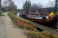
 Route de la Planchette via La Fricaussière
 5.62 mi
 +190 ft
 -171 ft
 2h 45
2h 45
 Easy
Easy
 Departure from Betton (Ille-et-Vilaine)
The towpath of the Ille and Rance Canal, the lock, the footpath and the river – nature greets you from the very first few metres. The many sunken paths along the route give this easy walk its special charm.
Very colourful in spring and autumn in the sunshine. Shade from the plane trees in summer. However, it can be damp during rainy winters.
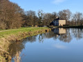
The Rigole de Boulet and La Motte aux Anglais, starting from La Plousière
 6.00 mi
+33 ft
-33 ft
2h 45
Easy
Departure from Guipel (Ille-et-Vilaine)
6.00 mi
+33 ft
-33 ft
2h 45
Easy
Departure from Guipel (Ille-et-Vilaine)
A short walk along the Rigole de Boulet, which feeds the upper section of the Ille and Rance Canal. Set amongst trees and following wide paths, this walk is magnificent in the colours of spring and autumn and well-shaded in summer. You’ll forget about tarmac roads the whole way.
You can extend the walk along the banks of the canal (at the Ville Morin lock) or along the Rigole de Boulet to the hamlet of Le Mée.
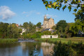
The short Pluvignon loop starting from Betton
 3.98 mi
+62 ft
-66 ft
1h 55
Easy
Departure from Betton (Ille-et-Vilaine)
3.98 mi
+62 ft
-66 ft
1h 55
Easy
Departure from Betton (Ille-et-Vilaine)
This short walk allows you to enjoy the Ille and Rance Canal and the countryside in the south-east of the town, starting from the centre of Betton.
The charm of the Pluvignon stream, shaded by a double row of ancient oak trees, makes you fancy a picnic. After the village of La Forme, the return route via the Vau Robion footpath takes us back to the canal.
The Grand Tour of Pluvignon
 9.48 mi
+151 ft
-151 ft
4h 30
Easy
Departure from Betton (Ille-et-Vilaine)
9.48 mi
+151 ft
-151 ft
4h 30
Easy
Departure from Betton (Ille-et-Vilaine)
This walk allows you to enjoy the tranquillity of the Ille and Rance Canal, as well as discover the charm of the countryside south-east of Betton.
You’ll come across the Haut Chalet Lock, the Pluvignon Stream and the Bois de Champaufour. The route passes close to dairy farms and, after a few footpaths through Betton, rejoins the canal.
Largely shaded, this varied walk is particularly colourful in spring and autumn. Some sections remain damp in winter.
Le Moulin de la Charbonnière
 7.53 mi
+62 ft
-62 ft
3h 30
7.53 mi
+62 ft
-62 ft
3h 30
 Moderate
Departure from Betton (Ille-et-Vilaine)
Moderate
Departure from Betton (Ille-et-Vilaine)
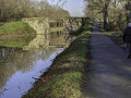
This hike is an opportunity to discover the charm of the countryside south of Betton, with a return trip along the towpath of the Ille and Rance Canal. More than half of the route is dedicated to cyclists and hikers. The rest of the route consists of dead-end roads with little traffic.
You will discover the Haut Chalet lock, the hamlets of Vau Robion and Les Lices, and the Moulin de la Charbonnière site with its wash house. Colourful, cool and peaceful.
Can also be done by motorbike.
The hillsides of the Ille in Chevaigné
 3.03 mi
+115 ft
-115 ft
1h 30
Easy
Departure from Chevaigné (Ille-et-Vilaine)
3.03 mi
+115 ft
-115 ft
1h 30
Easy
Departure from Chevaigné (Ille-et-Vilaine)
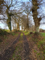
This walk has a charm that lies in the many sunken paths it takes along the slopes of the Ille, west of Chevaigné.
Sometimes lined with hundred-year-old oak trees, you can enjoy the peace and quiet, the colours and nature. Sometimes with a wide view over the Ille valley, it allows you to discover the Ille and Rance canal below, the meadows and hamlets.
Very colourful in spring and autumn, shaded in summer, passable in winter: a walk for all weathers!
The hillsides of the Ille around Chevaigné via Le Breil
 4.81 mi
+135 ft
-121 ft
2h 20
Easy
Departure from Chevaigné (Ille-et-Vilaine)
4.81 mi
+135 ft
-121 ft
2h 20
Easy
Departure from Chevaigné (Ille-et-Vilaine)
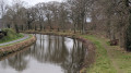
This hike takes us from the Ille and Rance Canal to the plateau north of Chevaigné via the eastern slopes of the Ille. It allows us to discover the charm of the locks, the sunken paths and the countryside with its hamlets.
It is very varied and colourful in spring and autumn.
This hike can be extended to include the "Les coteaux de l'Ille à Chevaigné" hike, with which it shares the same starting/finishing point.
Rennes Forest - The Grand Route de la Caleuvre
 9.36 mi
+217 ft
-184 ft
4h 30
Moderate
Departure from Betton (Ille-et-Vilaine)
9.36 mi
+217 ft
-184 ft
4h 30
Moderate
Departure from Betton (Ille-et-Vilaine)
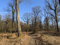
The Rennes Forest, starting from the Ille and Rance Canal. After approaching via the towpath, then through the countryside along sunken paths, we enter the great forest via the slopes of the Caleuvre. The trail avoids the main forest avenues to allow us to enjoy the tall, centuries-old oaks, the banks of the Caleuvre, and the tranquillity of the forest.
Magnificent photos to be taken in spring and autumn. Shaded in summer, very accessible in winter, the forest surprises us with its light.
The Saint-Raoul Fountain in Saint-Sulpice-la-Forêt
 4.15 mi
+59 ft
-59 ft
2h 00
Easy
Departure from Liffré (Ille-et-Vilaine)
4.15 mi
+59 ft
-59 ft
2h 00
Easy
Departure from Liffré (Ille-et-Vilaine)
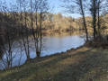
One of the most beautiful walks in the Rennes State Forest: centuries-old oaks, tranquil paths, streams, light and shade. Suitable for everyone and in all seasons.
Trees of the forest, you know my soul!...You know, the stone where a beetle scurries,A humble drop of water fallen from flower to flower,A cloud, a bird, occupy me for a whole day.Contemplation fills my heart with love.Victor Hugo.
From Chemin Joseph Gentil to La Caleuvre in the Forest of Rennes
 8.96 mi
+266 ft
-276 ft
4h 20
Moderate
Departure from Betton (Ille-et-Vilaine)
8.96 mi
+266 ft
-276 ft
4h 20
Moderate
Departure from Betton (Ille-et-Vilaine)
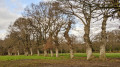
This path takes us through the meadows of the Thorigné dairy farms to the Rennes National Forest. There, the scenery changes: oak and pine forests, around the Caleuvre, recreate for us the fantastical world of elves.
Very colourful in spring and autumn. Nature just a stone’s throw from the city.
The first section follows the Chemin Joseph Gentil, established in memory of this resistance fighter from Betton.
Boulet Watercourse – La Motte aux Anglais Route
 6.94 mi
+85 ft
-98 ft
3h 15
Moderate
Departure from Dingé (Ille-et-Vilaine)
6.94 mi
+85 ft
-98 ft
3h 15
Moderate
Departure from Dingé (Ille-et-Vilaine)
The Boulet Canal stretches for 17 km and connects Boulet Pond to the Île and Rance Canal, which it once fed.
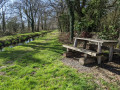
This walk allows you to explore the area south of Dingé. The path follows the banks in the shade of two-hundred-year-old beech trees. It takes you past a few small engineering structures built as part of the watercourse.
It takes us to the Motte aux Anglais burial mound (11th century).
A very open walk in all seasons and shaded in summer.
8 km alternative route: see Information
North of the Maffrais ponds in the Rennes Forest
 3.87 mi
+79 ft
-79 ft
1h 50
Easy
Departure from Liffré (Ille-et-Vilaine)
3.87 mi
+79 ft
-79 ft
1h 50
Easy
Departure from Liffré (Ille-et-Vilaine)
If you enjoyed the route from La Fontaine Saint-Raoul to Saint-Sulpice-la-Forêt, you’ll like this one too. It’s essentially the same route, but this time to the north of the ponds.
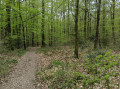
The path winds its way through alternating beech and pine forests, sometimes meandering through the heart of the woodland, sometimes following the wide avenues.
Shade and light for everyone, all year round.
The Landehuan Canal in Dingé
 5.38 mi
+141 ft
-141 ft
2h 35
Easy
Departure from Dingé (Ille-et-Vilaine)
5.38 mi
+141 ft
-141 ft
2h 35
Easy
Departure from Dingé (Ille-et-Vilaine)
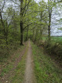
The Rigole de Boulet stretches for 17 km and links Étang de Boulet to the Ille and Rance Canal, which it once fed.
The Landéhuan Channel is a secondary channel that fed the Boulet Channel. The route follows the channel for 2 km, beneath 200-year-old beech trees.
It also passes through the hamlets of La Bouderie and Les Hauts Rochers, where you can see traditional local architecture: granite walls, arched doorways, well-tended gardens…
Pointe du Diben via Saint-Samson and Tromelin
 7.65 mi
+397 ft
-387 ft
3h 50
Moderate
Departure from Plougasnou (Finistère)
7.65 mi
+397 ft
-387 ft
3h 50
Moderate
Departure from Plougasnou (Finistère)
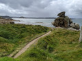
Pointe du Diben: a classic section ofthe GR®34coastal path, offering gradual views of Morlaix Bay and its many islands and peninsulas.
Magnificent views stretching as far as Île de Batz and Roscoff, with landscapes that change completely depending on the tide, the colour of the sky and the light.
Beautiful residences on the return route along fields and sunken lanes.
The balconies of Minihic-sur-Rance
 7.12 mi
+423 ft
-453 ft
3h 40
Moderate
Departure from Le Minihic-sur-Rance (Ille-et-Vilaine)
7.12 mi
+423 ft
-453 ft
3h 40
Moderate
Departure from Le Minihic-sur-Rance (Ille-et-Vilaine)
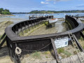
One of the classic walks in the Rance Basin. The path overlooks the Rance and offers numerous colourful views of the water, the riverbanks and river life. An opportunity to walk alongside the Minihic shipyards. A return via the sunken paths and the shaded valley of Saint-Buc takes us back to the Sainte-Anne Chapel, dating from 1631.
Very breezy and shaded in summer, very bright and open in early spring. High tide, low tide: you never see the same landscape.
The Giants' Walk in the Bazouges Basin
 3.49 mi
+13 ft
-13 ft
1h 35
Easy
Departure from Hédé (Ille-et-Vilaine)
3.49 mi
+13 ft
-13 ft
1h 35
Easy
Departure from Hédé (Ille-et-Vilaine)
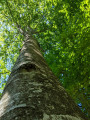
This short walk through the woods and along the water's edge will impress you. You will encounter giants: beech trees, oaks and a few chestnut trees over 25 to 30 metres tall. Some are grouped together, so in summer you find yourself under a cathedral of greenery.The Bazouges Basin, its wildlife, the reeds and the houses on its banks will naturally bring out your cameras. Full of freshness, this short hike is a pleasant little break on hot days from June to October.
Faycelles – Espagnac
 11.77 mi
+492 ft
-958 ft
5h 50
Moderate
Departure from Faycelles (Lot)
11.77 mi
+492 ft
-958 ft
5h 50
Moderate
Departure from Faycelles (Lot)
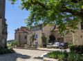
From the top of the Faycelles plateau, between the Lot and the Célé rivers, the route leads to the starting point ofthe GR®®651for thefirst descent into the Célé valley.Medieval villages such as Faycelles, Corn and Espagnac, ancient stone castles, churches, chapels and priories: you’re definitely on a route of the Way of St James. The most beautiful one, they say.The route is very shaded and benefits from the coolness of the Célé valley.
Les Granges - Bouziès
 8.77 mi
+1,430 ft
-1,457 ft
5h 15
Moderate
Departure from Orniac (Lot)
8.77 mi
+1,430 ft
-1,457 ft
5h 15
Moderate
Departure from Orniac (Lot)
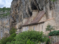
Une 4e étape qui, du Plateau des Causses, nous fait descendre les méandres du Célé. D'abord à Cabrerets où le village tout en longueur, à l'étroit entre falaise et rivière, nous emmène jusqu'au château en surplomb. Ensuite elle nous laisse au pied de la falaise à Bouziès, impressionnante par son à pic de presque 150 m.
Cette petite randonnée laisse largement la possibilité d'un retour dans le temps de 29000 années, par une visite au site préhistorique de Pech Merle sur le circuit.
Espagnac – Marcilhac-sur-Célé
 9.80 mi
+1,929 ft
-1,936 ft
6h 10
Moderate
Departure from Espagnac-Sainte-Eulalie (Lot)
9.80 mi
+1,929 ft
-1,936 ft
6h 10
Moderate
Departure from Espagnac-Sainte-Eulalie (Lot)
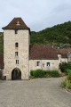
Thissecond stage on theGR®651takes you through places with ancient stone buildings: the Priory of Espagnac, the Château des Anglais in Saint-Sulpice, troglodyte houses and the caselles of Marcilhac. It also offers magnificent views of the Célé valley from the balcony-like path on the plateau.
This stage also allows you to explore the causse and its network of low stone walls, evidence of the region’s once-thriving agricultural past.
The Buguélès foreshore
 6.77 mi
+210 ft
-203 ft
3h 20
Moderate
Departure from Plougrescant (Côtes-d'Armor)
6.77 mi
+210 ft
-203 ft
3h 20
Moderate
Departure from Plougrescant (Côtes-d'Armor)
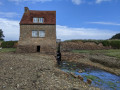
The Buguéles foreshore is a labyrinth covering more than 2,000 hectares, submerged at high tide but accessible at low tide. A maze of rocks, centred around six main islands – some of which are inhabited – criss-crossed by more or less defined paths.A real treat for exploring, for the views, and for taking photos.The circular walk returns via sunken paths beneath the trees.At high tide: do not venture onto the foreshore.
Bouziès - Saint-Cirq-Lapopie - Bouziès
 6.22 mi
+738 ft
-745 ft
3h 30
Moderate
Departure from Bouziès (Lot)
6.22 mi
+738 ft
-745 ft
3h 30
Moderate
Departure from Bouziès (Lot)
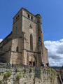
Perched on a cliff overlooking a bend in the Lot river, Saint-Cirq-Lapopie is an exceptional village that has preserved its medieval architecture.
This deliberately shortened stage allows you to take a long tour of the monuments, narrow streets and shops of Saint-Cirq-Lapopie after walking along the towpath on the banks of the Lot.
The short detour beyond the village to the Cirque de Vènes viewpoint is well worth the effort.
The Célé Valley in 7 stages
 66.32 mi
+7,972 ft
-8,547 ft
7 days
Moderate
Departure from Faycelles (Lot)
66.32 mi
+7,972 ft
-8,547 ft
7 days
Moderate
Departure from Faycelles (Lot)
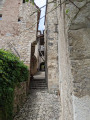
The Célé Valley is one of several routes on the Way of St James. Some say it is one of the most beautiful.
From Faycelles, near Figeac, to Cahors, via Espagnac, Saint-Cirq-Lapopie and Vers, this 7-stage hike takes its time around the villages of the Célé and then the Lot. It’s the perfect way to appreciate the monuments, landscapes and people of this very welcoming region.Don’t hesitate: it’s beautiful, friendly and welcoming.Return to the starting point by SNCF bus.
Boulet Canal – From the Estate to Pas de l’Ille via Les Landelles
 4.87 mi
+23 ft
-23 ft
2h 15
Easy
Departure from Dingé (Ille-et-Vilaine)
4.87 mi
+23 ft
-23 ft
2h 15
Easy
Departure from Dingé (Ille-et-Vilaine)
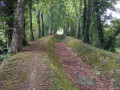
This walk follows the banks of the Rigole de Boulet to the east of Dingé. The well-maintained path runs alongside the meandering watercourse, passing wooden or iron sheet piling, and crosses several 19th-century engineering structures: siphons, aqueducts, drinking troughs…
You walk beneath a canopy of beech trees. The colours change from spring to autumn. It’s cool in summer.
Street Art in Rennes: a short route to find out more
 2.08 mi
+46 ft
-46 ft
1h 00
Easy
Departure from Rennes (Ille-et-Vilaine)
2.08 mi
+46 ft
-46 ft
1h 00
Easy
Departure from Rennes (Ille-et-Vilaine)
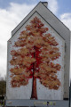
Discover the variety of street art in Rennes: this short, very pleasant route to the north of Rennes’ historic centre takes you past around fifty works.Ranging from simple tags and lettering to graffiti and murals, including mosaics, drawings and various signatures, this short, colourful stroll allows you to appreciate all the facets of this modern art form. A mix of now-famous Rennes-based artists such as War! and graffiti artists from other regions gives a good sense of the scene’s vibrancy.
The route takes you along little-known paths and alleyways in Old Rennes. You’ll skirt small parks and pass through gates to end up at Place Sainte-Anne, one of the city’s liveliest squares.Photographers, treat yourselves – you won’t regret it. And choose your time of day for the best light.
The Tour de Saint-Lunaire in Blue and Green, via Pointe du Décollé
 5.27 mi
+151 ft
-138 ft
2h 35
Easy
Departure from Saint-Lunaire (Ille-et-Vilaine)
5.27 mi
+151 ft
-138 ft
2h 35
Easy
Departure from Saint-Lunaire (Ille-et-Vilaine)
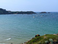
A superb hike, half by the sea and blue, half in the countryside and green. It is best to start at low tide or when the tide is going out.
This is an opportunity to cross the Grande Plage de Saint-Lunaire, which is largely exposed at low tide, then climb up to Pointe du Décollé and admire the entire Côte d'Émeraude, from Cap Fréhel to Saint-Malo and Cézembre. Why not stop for a picnic? On the sea side, you can also discover the magnificent Longchamp Beach, which is immense at low tide and much smaller at high tide.
This is also an opportunity to explore the south of Saint-Lunaire, where the countryside is just as beautiful, with its sunken lanes, gardens and old Breton houses.
The walk ends at the Vallée de l'Amitié, where you can stroll along the Crévelin river for almost a kilometre in the shade of oak trees.
Plouër-sur-Rance in shades of green and blue
 8.63 mi
+653 ft
-656 ft
4h 30
Easy
Departure from Plouër-sur-Rance (Côtes-d'Armor)
8.63 mi
+653 ft
-656 ft
4h 30
Easy
Departure from Plouër-sur-Rance (Côtes-d'Armor)
A lovely walk along the banks of the Rance and through the beautiful Bois de Rochel forest. This walk combines various routes suggested by Plouër-sur-Rance Town Hall.
It begins as a blue trail along the banks of the Rance, where the landscapes and views change with every tide. After passing through hamlets with traditional stone houses, it continues as a green trail through the forest, where beech and chestnut trees over 25 metres tall never fail to impress and where sunken paths await the walker.
Take care in winter, as some sections may be damp. But in summer, don’t hesitate – with its open, airy and shaded route, it offers a chance to enjoy a pleasant coolness in the heart of nature.
Route de Porz Poulhan sur la côte Bigouden
 4.12 mi
+266 ft
-253 ft
2h 10
Easy
Departure from Plouhinec (Finistère)
4.12 mi
+266 ft
-253 ft
2h 10
Easy
Departure from Plouhinec (Finistère)
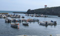
The beautiful paths of this short route take us through the countryside of Porz Poulhan in the Plozévet area of the Bigouden region, passing through two lush, shady valleys. Along the way, you’ll come across restored mills and wash houses,The walk ends with a view of the blue sea along the shore, allowing you to enjoy the sea from above.
Porz Poulhan route on the Cap Sizun side
 3.19 mi
+174 ft
-171 ft
1h 35
Easy
Departure from Plouhinec (Finistère)
3.19 mi
+174 ft
-171 ft
1h 35
Easy
Departure from Plouhinec (Finistère)
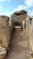
This short route takes you on a tour of the Cap Sizun side of the Porz Poulhan site. The first section, all blue, runs along the coast and is complemented by a return route, all green, through the woods and the Tréouzien valley.
Blue Route: explore the prehistoric site of Menez Drégan and the covered walkways.
Green Route: the wash houses, the Tréouzien mill and Saint-They Chapel.
Route from Beg An Fry to Moulin de la Rive in Guimaëc
 9.79 mi
+404 ft
-446 ft
4h 50
Moderate
Departure from Locquirec (Finistère)
9.79 mi
+404 ft
-446 ft
4h 50
Moderate
Departure from Locquirec (Finistère)
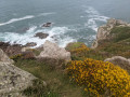
This route follows the Sentier des DouaniersGR®®34coastal path for a third of the way and takes us along country lanes for the rest. Blue highlights: the sea cliffs, the headland and hillside of Beg an Fry, the sweeping views over the beaches. Green highlights: the tree-lined paths, the restored mill at Trobodec, the Chapelle de Christ and its fountains, the springs... A fine showcase of Northern Brittany.
The Tarn: source of a great river at the Col de Finiels
 11.27 mi
+837 ft
-823 ft
5h 55
11.27 mi
+837 ft
-823 ft
5h 55
 Difficult
Departure from Le Pont-de-Montvert (Lozère)
Difficult
Departure from Le Pont-de-Montvert (Lozère)
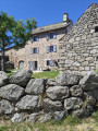
This hike, starting from the Col de Finiels in the heart of Mont Lozère, takes us along the ridge of Mont Lozère, where the magnificent views allow us to look out over the Cévennes National Park. We then witness the very source of a great river, from the very first stream known as ‘Le Tarn’, right up to the first stone bridge spanning it. The route passes through Mas Camargues, a farming village in the Causses des Cévennes, which may date back to the Knights Hospitaller of Saint John of Jerusalem. Returning via the ancient Roman road ensures we have completed a magnificent journey that brings together nature, history and geography.
The peaks of Mont Lozère at the Col de Finiels
 8.92 mi
+942 ft
-945 ft
4h 55
Moderate
Departure from Mas-d'Orcières (Lozère)
8.92 mi
+942 ft
-945 ft
4h 55
Moderate
Departure from Mas-d'Orcières (Lozère)
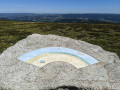
First and foremost, this is the Cévennes panorama walk starting from Mont Lozère. Indeed, the walk follows the ridges of Mont Lozère for over 5 km and offers magnificent 360° views, the most remarkable of which is from the Sommet de Finiels, complete with its three orientation tables.It is also the walk taking in the main peaks that make up the granite dome of Mont Lozère. This is because it takes in six of the mountain’s highest peaks, passing by cairns and historic boundary crosses or Maltese crosses along the way.