Country:
 City:
City:


The starting point is located at the new cemetery in the commune of Saint-Grégoire, known as the “Cimetière du Champ Renard”. To get there, follow the CD29, which links Montgermont to Thorigné, bypassing Saint-Grégoire to the north. The CD 29 crosses the road linking Saint-Grégoire to Betton at the Betton roundabout. At this roundabout, head towards Betton Centre. 50 m after the roundabout, take the small road leading uphill on the left. Follow the sign for “Cimetière du Champ Renard”.
There is a car park 200 metres further up on the left, by the cemetery.
The La Belle Visée route is organised and maintained by Saint-Grégoire. Blue signposts.
(S/E) On leaving the car park, take the road on the left heading due west (be careful not to follow the direction indicated on the sign). At the next junction, carry on straight ahead, following the sign for “Le Petit Noë”.
At Le Petit Noë, pass the farm buildings on the right and go round them by turning right. About a hundred metres further on, at the crossroads, turn left heading due west. You’ll soon reach the D82 between Saint-Grégoire and Melesse.
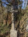
(1) Cross the departmental road with care and continue straight ahead towards the south-west. Pass through the hamlet of La Planchette. At the crossroads 100 metres further on, note the beautiful cross at the crossroads on the right. Turn right towards the west. Follow the sign for “Le Brosse”.
After about 100 m, a path branches off to the left, heading due west between two hedges. Take this path and continue to the La Fouinardière crossroads, ignoring any side paths. Caution: this area is wet in winter.
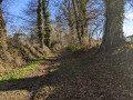
(2) At the La Fouinardière crossroads, turn right and head north-east. At the Stop sign after La Guiponnière, cross the road and take the path opposite, signposted “La Gravelais”. The road becomes a sunken lane.
Carry on straight ahead north-east until you reach the end at La Belle Écuelle. Then turn right to join the D82 near the restaurant “La Belle Écuelle”.
(3) Cross the D82 with great care to join the cycle path which starts opposite, slightly lower down. Follow the cycle path for 200 m due north to reach the road leading to the MFR (training centre). Pass the MFR; shortly afterwards, you’ll come to a junction. Carry on straight ahead, pass through the hamlet of La Belle Écuelle and take the right-hand bend. You’ll arrive at the hamlet of Le Buisson Josse.
(4) Just before the first house in this hamlet, a sunken track branches off to the left. Take this track and follow it to where it ends at the tarmac road (D91). (Please note: the track is very wet in places during winter).
(5) At the junction with the D91, turn left and carefully walk up the D91 for about 150 metres. At the T-junction, turn right, following the sign for ‘Le Ceriseret’. Continue due south until you reach the next junction at Le Ceriseret, near a mast. Then turn right and return to the starting point (S/E).

 Association / Club / Walk leader

 Visorando Member
 Moderate