Country:
 City:
City:


To reach the starting point, head from the village of Locquirec towards Guimaëc (D64). Just after Moulin de la Rive beach, turn right onto the D64A coastal road and follow it for about 2.5 km until you reach the junction for Poul Rodou beach. Park at the junction in the car park on the left, opposite Le Caplan bar.
GR®® signposts along the coastal section. More discreet yellow signposts elsewhere
(S/E) As you leave the car park, facing the sea, take the road on the right heading east towards Locquirec. After about 150 m, take the customs officers’ path which veers to the left and runs along the hillside. Follow the cliff-top path until you rejoin the road. Follow it to the junction with the D64 at Moulin de la Rive Beach.
(1) At the junction, just before the Stop sign, turn sharply right onto the wide, carriageable track before the stream (signposted ‘Sentier de la Péninsule’), heading south-west. Follow the track, which climbs slightly, until you reach a road on the right leading to the hamlet of Rozampoul.
(2) In the hamlet, at the first house on the left, turn onto the path that heads left between the fields. After about 300 m, you’ll reach a T-junction of paths, just after a row of oak trees. Then turn right, between two embankments, onto the path that climbs north-west. You’ll rejoin the road at Hent Glaz.
(3) First turn left then right for 50 m along the road, heading west towards Révélour (signposted ‘Rue Revelour’). After 400 m, you’ll reach a T-junction.
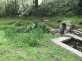
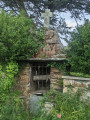
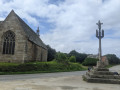
(4) First turn right then left for 20 metres and follow the tarmac road, which soon leads to a house. Go round it on the right and head due west along a path towards the hamlet of Christ. You’ll reach the tarmac road again after 500 m; turn right to quickly reach a T-junction at Lazarzalou. Turn left and head towards the Christ Chapel (picnic table, wayside cross, fountain and wash house).
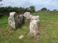
(5) Leave the chapel by heading north up the road, keeping the wayside cross on your right. Walk for about 120 m and, at the crossroads, turn left, heading due west, onto the track signposted ‘Gwele Sant Yann’ (St John’s Bed). After 50 m, pass the remains of the covered passageway (dolmen) on your right. Rejoin the road at Runtannic
(6) Turn right onto the road heading due north and pass the ‘Kreiz ar Wrach’ sign. 50 metres after the sign, a farm track branches off at a 45° angle to the left (landmarks: a telephone pole, a small wind turbine 100 metres away). Take this track, which leads through the woodland, heading north-west. As you emerge from the copse, just before the first field, you’ll come to the start of a farm track on the right.
(7) Follow this track along the edge of the woodland, heading due north (the field remains on your left, the copse on your right). Further on, the track bends left towards the west and crosses another copse (in the woodland, go round the wetland area on the left along the embankment).
(8) After leaving the woods, at the clearly marked Y-junction, take the path on the right towards Pen Ar Prat and rejoin the road.
(9) Turn right and follow the road carefully, heading east, for about 800 m until, after the first junction, you come to a sign for Prajou on the right-hand side.
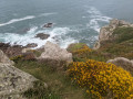
(10) Take the road on the left signposted ‘Beg an Fry’. Further on, this gives way to a track leading to a car park. Cross the car park and continue straight ahead to join theGR®®34, the Sentier des Douaniers, at the summit of Pointe de Beg an Fry (Coté 80 on the IGN map).
(11) Take the path on the right, which descends quite steeply. Further down, the path turns southwards. It joins another car park at Vilin Izella Beach.
(12) A detour to the Trobodec Mill (restored) is recommended. Simply walk 150 metres westwards along the road.
(13) At the mill, take a moment to admire the beautiful waterwheel. Return to the car park.
(12) The return journey follows theGR®®34coastal path; it is very easy to follow (ignore any paths branching off to the right). At Poul Rodou Beach, you’ll find your car park (S/E).

 Visorando Member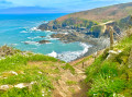
 Difficult
 Easy
Easy