Boulet Watercourse – La Motte aux Anglais Route

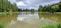
The Boulet Canal stretches for 17 km and connects Boulet Pond to the Île and Rance Canal, which it once fed.

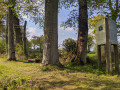
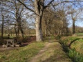
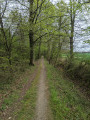
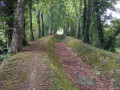
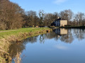
This walk allows you to explore the area south of Dingé. The path follows the banks in the shade of two-hundred-year-old beech trees. It takes you past a few small engineering structures built as part of the watercourse.
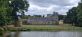
It takes us to the Motte aux Anglais burial mound (11th century).
A very open walk in all seasons and shaded in summer.

8 km alternative route: see Information

Details

7091658
Creation:
Last update:
Last review:
  • Walking
    Activity: Walking
  • ↔
    Distance: 6.94 mi
  • ◔
    Average duration: 3h 15 
  • ▲
    Difficulty: Moderate

  • ⚐
    Back to start: Yes
  • ↗
    Ascent: + 85 ft
  • ↘
    Descent: - 98 ft

  • ▲
    Highest point: 279 ft
  • ▼
    Lowest point: 200 ft
  • ⚐ Country: France
  • ⚐ City: Dingé (35440)
  • ⚑
    Start/End: N 48.356307° / W 1.71356°
  • ❏
    IGN map(s): Ref. 1217SB
  • Hour-by-hour weather

Photos

Description of the walk

The starting point of the route is in the village of Dingé, on the D83 road, near the cemetery. Parking is available at Place de la Rigole opposite the cemetery.

Yellow signposting along the entire route.

(S/E) Take the track to the right of the cemetery which heads south and continue until you reach the junction with the Boulet Canal.

(1) At the junction with the watercourse, cross the footbridge and follow the bank of the watercourse to the left. Further on, the watercourse runs alongside the D83. Note the restored wash house at Le Bignon. The watercourse then crosses the D83 to reach a signpost near the first houses of the hamlet of Le Domaine.

(2) At the hamlet signpost, turn right. Walk through the hamlet to rejoin the D83. Turn left and walk for 150 m to reach the Carrefour de Pontrucher.

(3) At this junction, the route continues along the road to the right. Leave the road at the hamlet of La Falutais, where the path branches off to the right towards the west.
(In winter, bypass the wetlands in this section via the surrounding fields).
Further on, the path crosses a road and shortly afterwards rejoins the stream downstream.

(4) At the junction with the watercourse, turn left and follow it along the bank towards the south. Just before the hamlet of La Motte aux Anglais, the channel crosses a tarmac road and, 200 m further on, reaches a small wooden footbridge allowing you to cross it (signpost). 50 m downstream from this footbridge, there is an information board providing details about the site of La Motte aux Anglais.

(5) At the footbridge, turn right and walk through the hamlet of La Motte aux Anglais. After the last house, at the signpost, ignore the path leading down to the south (Grand Chemin de Moines) and turn right towards the west. Follow the sunken lane until you come to a pond. Then turn right to head north towards the Herbage farm, where you’ll rejoin the road.

After the farm, the road bends to the left; at this point, take the path on the right which, after two bends – first turn right then left – heads northwards up to the hamlet of La Croix.

(6) In the hamlet, carry on straight ahead, keeping the houses on your right. Further on, the path joins the D82 county road at the Carrefour de la Mare Durand.

(7) Cross the D82 carefully at this junction, then continue straight ahead for 100 metres before turning right; immediately afterwards, turn left onto a track suitable for vehicles heading west. Further on, at the T-junction (marker 72), turn right towards the north. After 500 m, you’ll come to a secondary watercourse lined with beech trees (signpost).

(8) At the junction with the secondary watercourse, turn right and follow the bank. The path rejoins the main watercourse, which it runs alongside on the left. At the Pont aux Pierres, carefully cross the D82 again and continue along the bank of the watercourse to the footbridge.

(1) Then turn left to return to the starting point (S/E).

Waypoints

  1. S/E : mi 0 - alt. 279 ft - Dingé Cemetery – Place de la Rigole
  2. 1 : mi 0.4 - alt. 217 ft - First junction with the Boulet Watercourse – Footbridge
  3. 2 : mi 1.6 - alt. 217 ft - The hamlet of the estate – Leaving the watercourse
  4. 3 : mi 1.87 - alt. 200 ft - Pontrucher crossroads
  5. 4 : mi 2.61 - alt. 217 ft - 2nd junction with the - La Rigole de Boulet
  6. 5 : mi 3.52 - alt. 213 ft - The hamlet of La Motte aux Anglais – Leaving the watercourse
  7. 6 : mi 4.93 - alt. 220 ft - The hamlet of La Croix
  8. 7 : mi 5.2 - alt. 230 ft - La Mare Durand crossroads – Stop
  9. 8 : mi 5.76 - alt. 220 ft - Junction with the secondary watercourse
  10. S/E : mi 6.94 - alt. 279 ft - Dingé Cemetery – Place de la Rigole

Notes

Route designed by the DINGÉ PATRIMOINE association (website) – Guided tours of the Boulet watercourse can be arranged.

Picnic tables: Near the Bignon wash house, at the second junction with the watercourse (4), and at the junction with the secondary watercourse (8).

Paths and trails: 10 km; roads: 1.2 km.

Alternative route:
It is possible to shorten the route by 3 km by heading directly to the hamlet of La Croix at point (6) from point (4).
At the junction with the canal at (4), do not take the canal on the left heading south, but continue straight ahead, still along the bank of the canal, heading west. After 500 m in a straight line, at Le Mée, a bridge allows you to cross the canal to the left: cross the bridge and continue along the road. Turn left at the next crossroads to join the (6). Then turn right and follow the directions.

Other walks along the Rigole:
- Downstream towards the Ille and Rance Canal: The Rigole de Boulet and La Motte aux Anglais, starting from La Plousière (Visorando)
- North-east of Dingé: The Landehuan watercourse to Dingé (Visorando)
- South of Dingé: The Rigole Route (Visorando)
- West of Dingé: the Boulet watercourse – the Beaumarchais circuit (Visorando)
- Upstream from Boulet Pond: Boulet Pond and the Boulet Channel (Visorando)

Worth a visit

Dingé: Saint-Symphorien Church (History)

Dingé: The Templars’ Cross (located at the entrance to the village of Dingé, at ‘La Poterie’ on the road to
Tinténiac) (Description)

The Ille and Rance Canal links Rennes to Dinan. The starting point for this walk is at the highest point of the canal (the leat). Numerous locks (notably near Hédé) add to the charm of walks along the towpaths.

When the canal was in operation, the Rigole de Boulet supplied water to the canal from the Étang du Boulet (in the commune of Feins). The channel is now partially dry. Its total length is 17 km between its mouth and the Étang de Boulet. A footpath runs alongside it from start to finish.

Reviews and comments

4.3 / 5
Based on 2 reviews

Reliability of the description
4.5 / 5
Ease of following the route
4.5 / 5
Route interest
4 / 5
bretilien35132
bretilien35132
• Edited:

Overall rating : 4.7 / 5

Date of your route : Apr 02, 2023
Reliability of the description : ★★★★★ Very good
Ease of following the route : ★★★★★ Very good
Route interest : ★★★★☆ Good
Very busy route : No

A very easy route.
Set off around 10 am – a bit chilly and grey
Very pretty along the waterways. However, there were a few flooded sections
Worth doing again on a sunny day.

Machine-translated

Apsis
Apsis

Overall rating : 4 / 5

Date of your route : Feb 19, 2023
Reliability of the description : ★★★★☆ Good
Ease of following the route : ★★★★☆ Good
Route interest : ★★★★☆ Good
Very busy route : No

Please note that before you reach point 5 at La Motte-au-Anglais, the footbridge for crossing the ditch no longer exists.

A section of the route was flooded in February, but you can get round it by going through a field. It’s an easy route; I only came across other people towards the end, as I was heading towards the Rigole du Boulet.

Machine-translated

Other walks in the area

For more walks, use our search engine .

The GPS track and description are the property of this route's author. Please do not copy them without permission.