Bouzies – Vers

For this stage, we leave the Célé behind to follow the Lot valley.
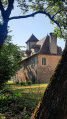
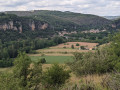
The path winds its way through the shade of the oak forests south of the Lot. As expected, numerous crosses, wayside shrines and old houses line this route to Santiago de Compostela.
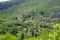
At the confluence of the Vers and the Lot: Vers. It’s a very pretty village where it’s lovely to rest and have a bite to eat for a while.

This walk is part of a multi-day hike: The Célé Valley in 7 stages

Details

n°10930708
Creation:
Last update:
Last review:
  • Walking
    Activity: Walking
  • ↔
    Distance: 10.78 mi
  • ◔
    Average duration: 6h 15 
  • ▲
    Difficulty: Moderate

  • ⚐
    Back to start: No
  • ↗
    Ascent: + 1,476 ft
  • ↘
    Descent: - 1,486 ft

  • ▲
    Highest point: 1,161 ft
  • ▼
    Lowest point: 400 ft
  • ⚐ Country: France
  • ⚐ City: Bouziès (46330)
  • ⚑
    Start: N 44.484892° / E 1.641978°
  • ⚑
    End: N 44.485332° / E 1.552012°
  • ❏
    IGN map(s): Ref. 2138OT, 2139E, 2139O
  • Hour-by-hour weather

Photos

Description of the walk

The starting point for this stage is in the centre of the village of Bouziès, on the D662 road which runs alongside the River Lot upstream from Cahors.

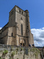
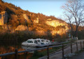
(S) Set off from the left bank of the Lot at the bridge or the church in Bouziès. Follow the signfor GR®36Pasturat, and take the road that runs alongside the Lot towards the west, cross the old railway line and continue to a Y-junction marked by a cross.

(1) Turn right; further down, cross the railway line again. Reach a bend to the left of the road, before the old railway line. Head down to the right at a hut. Follow the path along the banks of the Lot until you come to a road on the left, where you can see a railway bridge 20 metres away.

(2) Turn left, go under the bridge and follow the path which winds its way up onto the plateau through the forest in wide hairpin bends. Head south, then, once on the plateau, south-east. Join the road at the large crossroads at Lusclade, marked by a cross, picnic tables and a caselle.

(3) Turn right, keeping parallel to the D8 road. You’ll reach a junction at the side of the road.

(4) Take the path on the right – this is still theGR® marked in red and white – and head down into the oak forest. Stay on this path, ignoring all the turnings to the right and left. You’ll reach the D10 road.

(5) Walk along the road for a few metres, then leave it on your right and take the path leading off to the left; pass under a bridge to reach the left bank of the Lot.

Follow the banks of the Lot as far as the bridge leading to Saint Gery. Leave the bridge behind and continue on to the entrance to Pasturat at the foot of the cliff. Head for the crossroads by the church.

(6) At the church, turn right, then further on at No. 109, turn left and head uphill through the houses. Join the winding road and follow it uphill until you reach the crossroads marked by a cross on the right.

(7) Turn right onto the road, continue along the path that follows it and climb steadily through the oak forest to the south-east. Reach the plateau and begin a descent back to the road.
Follow it to the right, climb, and go round a sharp bend to the left.

(8) After the bend, head off to the right towards the north-west, climbing gently through the forest. Further on, follow the ridge line above the River Lot. Pass the Pech de Béars and its mast, then descend to reach the village of Béars.

(9) Cross the village, go round a hillock on its left to reach the large bridge over the Lot. Cross the bridge and head towards Vers (E).

Waypoints

  1. S : mi 0 - alt. 446 ft - Bridge at Bouziès - Lot (rivière)
  2. 1 : mi 1.1 - alt. 515 ft - Fork in the road with a cross
  3. 2 : mi 2.34 - alt. 423 ft - The path starts at the bridge under the railway line
  4. 3 : mi 4.05 - alt. 1,138 ft - Lusclade crossroads, cross
  5. 4 : mi 4.67 - alt. 1,138 ft - Start of the forest track on the right
  6. 5 : mi 6.06 - alt. 518 ft - Junction with the D10 road
  7. 6 : mi 7.19 - alt. 538 ft - Crossroads by the church in Pasturat
  8. 7 : mi 7.62 - alt. 797 ft - Y-junction with a cross
  9. 8 : mi 8.5 - alt. 965 ft - Start of a path on the right (signposted)
  10. 9 : mi 10.16 - alt. 505 ft - Béars
  11. E : mi 10.78 - alt. 436 ft - Bridge at Vers over the - Vers (rivière) - Affluent du Lot

Notes

Route recorded in June 2021.
Vers: Daily SNCF train service to Figeac (stopping at Faycelles) and Cahors.

Accommodation: Bouziès, Vers, Saint-Gery.
Provisions: Bouziès, Vers, Saint-Gery.
Camping: Vers, Saint-Gery near the bridge over the Lot.

Next stage: Vers – Cahors (Visorando)

Worth a visit

Vers: Narrow old streets, church.

Always be cautious and plan ahead when you're outdoors. Visorando and the author of this route cannot be held responsible for any accidents occurring on this route.

The GR® and PR® markings are the intellectual property of the Fédération Française de Randonnée Pédestre.

Reviews and comments

5 / 5
Based on 1 review

Reliability of the description
5 / 5
Ease of following the route
5 / 5
Route interest
5 / 5
Schubetzer
Schubetzer

Overall rating : 5 / 5

Date of your route : Jun 15, 2026
Reliability of the description : ★★★★★ Very good
Ease of following the route : ★★★★★ Very good
Route interest : ★★★★★ Very good
Very busy route : No

A wonderful hike, with a climb and descent that really get your heart rate up!
The scenery is stunning… We’re on a variant of the Camino de Santiago, so there are people around regularly

Machine-translated

PierreMLS
PierreMLS

Hello. I’m replying more than 15 months after the walk itself, so my memories are a bit hazy.
However, I clearly recall that this walk didn’t present any particular difficulties. Only two climbs (after points 2 and 6), each about 150 metres, might perhaps slow you down a bit. To cover 18 km at 3 km/h, allow six hours or a little more.
I no longer have the Guide de Compostelle, but you should check carefully whether it recommends the same route, and whether the start and finish points are indeed at Bouzies and Vers.
Enjoy your walk.

Machine-translated

COMPO2017
COMPO2017

Hello. Could you please confirm the duration of this walk, as the guidebooks on the Camino de Santiago state that it takes considerably less time?

Machine-translated

Other walks in the area

For more walks, use our search engine .

The GPS track and description are the property of this route's author. Please do not copy them without permission.