
Vers – Cahors

This final stage of the route takes us back to Cahors after a pleasant walk along the left bank of the Lot.
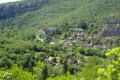
The walk passes through a vast oak forest before finishing by following the plain on the left bank of the Lot, in the shade of the trees, with its many horticultural plots.

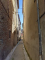
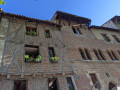
Cahors, with its old town, cathedral, cobbled medieval streets and colourful shops, is the perfect place to spend a few hours and step back a few centuries in time.

This walk is part of a multi-day hike: The Célé Valley in 7 stages

Details

n°10956451
Creation:
Last update:
Last review:
  • Walking
    Activity: Walking
  • ↔
    Distance: 10.42 mi
  • ◔
    Average duration: 5h 20 
  • ▲
    Difficulty: Moderate

  • ⚐
    Back to start: No
  • ↗
    Ascent: + 620 ft
  • ↘
    Descent: - 666 ft

  • ▲
    Highest point: 961 ft
  • ▼
    Lowest point: 371 ft
  • ⚐ Country: France
  • ⚐ City: Vers (46090)
  • ⚑
    Start: N 44.485397° / E 1.552033°
  • ⚑
    End: N 44.447529° / E 1.443768°
  • ❏
    IGN map(s): Ref. 2138OT, 2139O
  • Hour-by-hour weather

Photos

Description of the walk

The starting point is in Vers, a village on the right bank of the River Lot, 20 km upstream from Cahors on the D662. Set off from the bridge spanning the River Vers in Vers.
Red and white GR® markings along the entire route, except for a section where you leave the D49.

(S) Head south on the road to Cahors and turn left onto the bridge spanning the Lot. Cross the bridge and, on the left bank, turn right onto the road towards Bears. Pass Bears and, on the way out, take the road that climbs to the left towards the horticultural greenhouses.
The road becomes a track; continue uphill through the oak forest to the south-west.
Further on, you’ll come to a crossroads of footpaths.

(1) Carry on straight ahead, ignoring the turn-off to the left, and follow the sign for Cahors. Join the D49 and turn left onto it. Head slightly uphill; leave the signposted route here and, after a short climb along a well-graveled track, rejoin the GR®36.

(2) Join the GR® on the right, signposted ‘Impasse Combel Fourcat’. Continue along a track. At the next junction, take the path on the left which descends westwards. Continue the steady descent to Mas De Barte. In the hamlet, at the main junction, turn right downhill and continue along a very steep, winding path to reach the banks of the Lot.

(3) Take the grassy path on the left, following the banks of the Lot due west, leaving the farmland on your left. (See also: Practical Information below). Pass under the A20 motorway viaduct and head north-west, still following the banks of the Lot. This entire section is mostly in the shade. You’ll reach the junction leading to the hamlet of Les Bégoux.

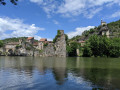
(4) Continue straight on along the banks of the Lot, taking theGR®®36alternative route, which is also signposted in red and white. You’ll arrive opposite the castle in the village of Laroque-des-Arcs, perched on the opposite bank of the Lot. The path turns south-west. Pass a lock. At the end of the path, you’ll reach the Terre Rouge neighbourhood.

(5) Turn left, then immediately right just before the old railway line, and follow the south-facing streets, running alongside the old railway line, until you reach the junction with Rue des Jacobins (D167).
Turn left and cross the River Lot via the Pont de Cabessut to reach Place Champollion and the cathedral, on the left on the right bank (E).

Waypoints

  1. S : mi 0 - alt. 436 ft - Bridge over the - Vers (rivière) - Affluent du Lot
  2. 1 : mi 1.14 - alt. 728 ft - Trail junction, Signpost: Cahors
  3. 2 : mi 2.63 - alt. 955 ft - Junction at Impasse Combel Fourcat
  4. 3 : mi 4.5 - alt. 394 ft - Junction with the bank of the - Lot (rivière)
  5. 4 : mi 6.45 - alt. 387 ft - Junction with the GR36 variant
  6. 5 : mi 8.91 - alt. 407 ft - Junction of the road with the old railway line
  7. E : mi 10.42 - alt. 400 ft - Place Champollion – Cahors

Notes

Route recorded in June 2021.
Cahors and surrounding area: free buses (download the free app).
Daily SNCF train service to Figeac, stopping at Faycelles.

Notes from May 2025
It has been noted that the path running alongside the River Lot after the point (3) is not being maintained (2025). A new alternative will be available after 18 June 2025, using the recently opened greenway. (See the website). This greenway (for pedestrians and cyclists) follows the former route of the Arcambal–Cahors railway line. It is signposted from the former Arcambal Primary School and extends for 7.5 km to Cabessut station, arriving in Cahors. To reach the starting point, leave the banks of the Lot after the landmark (3) and join the path that runs alongside the old railway line. You’ll reach the school after about 500 metres. At the end point in Cabessut, continue straight on towards the east to reach the D167, which you take to the left to reach the Cabessut Bridge. GPX filehere.

Accommodation, campsites: Vers, Cahors
Refreshments: Vers, Cahors

Worth a visit

(E) Cahors: Old Town, Cathedral, Valentré Bridge.

Always be cautious and plan ahead when you're outdoors. Visorando and the author of this route cannot be held responsible for any accidents occurring on this route.

The GR® and PR® markings are the intellectual property of the Fédération Française de Randonnée Pédestre.

Reviews and comments

3.7 / 5
Based on 2 reviews

Reliability of the description
3.5 / 5
Ease of following the route
4.5 / 5
Route interest
3 / 5
Schubetzer
Schubetzer

Overall rating : 4 / 5

Date of your route : Jun 15, 2026
Reliability of the description : ★★★☆☆ Average
Ease of following the route : ★★★★★ Very good
Route interest : ★★★★☆ Good
Very busy route : No

The walk is easy and very pleasant, offering a magnificent view of the River Lot, followed by a path that runs alongside the river – very pleasant and often well shaded.
It’s not always easy to follow, unless you use the app, because there are sections that overlap with a variant of the Camino de Santiago, which is, itself, very well signposted

Machine-translated

trovit
trovit

Overall rating : 3.3 / 5

Date of your route : Sep 17, 2025
Reliability of the description : ★★★★☆ Good
Ease of following the route : ★★★★☆ Good
Route interest : ★★☆☆☆ Disappointing
Very busy route : No

It is better to take the route that runs along the banks of the Lot rather than the one that runs along the greenway. The greenway follows the route of an old railway line. It is straight, enclosed and without any views. It is boring.

Machine-translated

Other walks in the area

For more walks, use our search engine .

The GPS track and description are the property of this route's author. Please do not copy them without permission.