Country:
 City:
City:


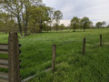
To reach the starting point from Dingé church, head towards Feins, and 150 metres further down, turn left onto the D83 towards Lanrigan. Stop after 1 km at the hairpin bend on the left going uphill, just before the Lande du Fresne. Parking is available on the right.
(S/E) From the hairpin bend, head up towards Lande du Fresne and continue along the D83 towards the hamlet of La Bouderie.
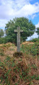
After the first houses on the right, ignore the D87 on the right at the junction towards Saint-Léger des Prés and carry on straight through the hamlet. 150 m after this junction, take the first road on the right (the junction is marked by a cross set into the wall on the left). Follow this road for 100 m to rejoin the departmental road and turn left onto it. After 80 m on the departmental road, there is a turn-off to the left, just before the last house in the hamlet.
(1) Take the road on the left. It quickly becomes a path through the woods. After 300 m, this path joins the departmental road towards Lanrigan. Cross the road and take the track on the left 10 m further on. Follow the track as it heads west into the woods. It turns north to join a road.
(2) Take this road to the right and pass through the hamlet of Les Hauts Rochers to rejoin the D83, which you should follow to the right for 200 m to reach the Rochelet crossroads (just before the ‘Épine Ronde’ sign).
(3) At the Rochelet crossroads, turn left onto the farm track. The track becomes a path that heads east then north-east along the edge of the fields until it reaches a T-junction. There, turn right to join the D87.
(4) Turn left onto the departmental road and cross the railway line at the level crossing that follows. Continue straight ahead along the road until you reach the edge of the forest. The road then crosses the Landehuan ditch via a bridge.
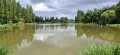
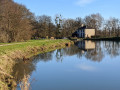
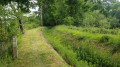
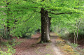
(5) After the bridge over the Landehuan ditch, turn right onto the track which quickly leads to the start of the Landehuan Ditch footpath. The atmosphere changes. Follow the path in the shade of the beech trees. Further on, to your right, you can see the Étang au Moines. Cross a road (marker 67). The path continues along the edge of the watercourse until it joins the Rigole de Boulet (picnic table).
(6) At the junction, turn right onto the bank of the Rigole de Boulet, then follow the track to the left just before the railway line to reach the level crossing. Cross the railway line and turn right towards the Landelles farm.
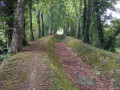
(7) At the farm, cross over the Rigole de Boulet and use the farmyard to walk alongside the watercourse on the right (the owners are happy to allow access). After the first field, the path climbs up to the left, due west, along the embankment. Head towards the houses at Hunault and continue along the road to return to the starting point (S/E).


 Visorando Member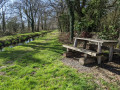
 Moderate
 Association / Club / Walk leader