Boulet Canal – From the Estate to Pas de l’Ille via Les Landelles

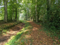
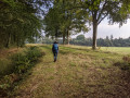
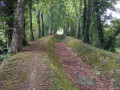
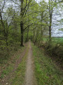
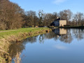
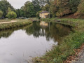
This walk follows the banks of the Rigole de Boulet to the east of Dingé. The well-maintained path runs alongside the meandering watercourse, passing wooden or iron sheet piling, and crosses several 19th-century engineering structures: siphons, aqueducts, drinking troughs…

You walk beneath a canopy of beech trees. The colours change from spring to autumn. It’s cool in summer.

Details

15732838
Creation:
Last update:
Last review:
  • Walking
    Activity: Walking
  • ↔
    Distance: 4.87 mi
  • ◔
    Average duration: 2h 15 
  • ▲
    Difficulty: Easy

  • ⚐
    Back to start: Yes
  • ↗
    Ascent: + 23 ft
  • ↘
    Descent: - 23 ft

  • ▲
    Highest point: 223 ft
  • ▼
    Lowest point: 194 ft
  • ⚐ Country: France
  • ⚐ City: Dingé (35440)
  • ⚑
    Start/End: N 48.346209° / W 1.693613°
  • ❏
    IGN map(s): Ref. 1217SB
  • Hour-by-hour weather

Photos

Description of the walk

The starting point is in the commune of Dingé, between Combourg and Rennes. From Dingé church, head down towards Montreuil-sur-Ille via the D83. After about 2 km, the road crosses the Rigole de Boulet. After a further 200 m, turn left onto the small road towards the hamlet of Le Domaine. Look for a parking area in the hamlet. Cars can drive right up to the Rigole de Boulet.

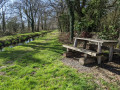
(S/E) In the hamlet of Le Domaine, continue along the road to its northern end. You will then reach the Rigole de Boulet (picnic table). At the Rigole, turn right (without crossing it) and follow the southern bank of the Rigole, heading north-east.

(1) Ignore the path branching off to the right (which will be the return route) and continue along the bank of the canal for about 3 km until you reach the Landelles farm. The canal crosses a first road, then the D20 (picnic table), then a third road before reaching the farm.

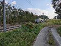
(2) At the Landelles farm, carry on to the tarmac footbridge leading to the farm. Leave the canal and turn right onto the road which runs alongside the railway line and returns to the level crossing. Turn left and cross the railway line at the level crossing.

(3) Continue for 50 m and turn left, heading north, onto the track which, further on, meets the railway line. The track crosses the watercourse. Then take the bank of the watercourse on the right and follow it. After 50 m, you’ll reach the confluence with the Rigole Secondaire de Landehuan, which comes from the left (picnic table).

(4) At the confluence, leave the Rigole de Landéhuan on your left and continue straight ahead along the Rigole de Boulet. Carry on along the bank of the ditch for about 3 km. You will cross a first road at the hamlet of La Chaussée, then a second road, before arriving at La Métairie de la Cour.

(5) Continue in a circular route to reach a third road which takes you back to Pas de l’Îlle. This junction is notable for the sign saying ‘Étang de Boulet 3.5 km’ on the right-hand bank of the watercourse.

(6) At the crossroads, turn right onto the road. After 200 metres, you’ll join the D20 after a bus stop.
Turn right and follow the D20 carefully until you reach and cross the level crossing at Pas de l’Îlle (Dingé station).

(7) After the level crossing, turn left onto the small tarmac road which starts immediately after the shed. Follow the road southwards. It joins the railway line, curves to the right and then to the left, leading to a house. Leave it on your left and continue along the path which branches off to the right, climbing slightly between the fields. (Please note: this section is less well maintained and is very often damp; do not hesitate to use the path through the field on the right). After 300 m, you will rejoin the Rigole de Boulet.

(1) Turn left to return to the starting point (S/E).

Waypoints

  1. S/E : mi 0 - alt. 217 ft - The hamlet of Domaine, - Dingé
  2. 1 : mi 0.2 - alt. 217 ft - Junction of the circular loop - La Rigole de Boulet
  3. 2 : mi 1.63 - alt. 217 ft - Landelles Farm - La Rigole de Boulet
  4. 3 : mi 1.75 - alt. 210 ft - Level crossing
  5. 4 : mi 2.09 - alt. 217 ft - Junction with the Landehuan Canal
  6. 5 : mi 2.92 - alt. 217 ft - La Dairy Farm of the Cour
  7. 6 : mi 3.78 - alt. 217 ft - Junction on the road to Le Pas de l’Ille
  8. 7 : mi 4.26 - alt. 210 ft - Pas de l’Ille level crossing - Gare de Dingé
  9. S/E : mi 4.87 - alt. 217 ft - The hamlet of Le Domaine, - Dingé

Notes

This walk passes by Dingé station (7), where trains on the Saint-Malo–Comboug–Rennes line stop. You can reach the station by train and start the walk from there, completing a circular route whilst taking care to turn right at (1).

Footpaths and trails: 6.6 km; roads: 1.3 km.

Other walks along the Rigole de Boulet:
- Downstream towards the Ille and Rance Canal: The Rigole de Boulet and La Motte aux Anglais, starting from La Plousière (Visorando)
- Starting from Dingé: The Rigole de Boulet – La Motte aux Anglais route (Visorando)
- Starting from La Bouderie: The Rigole de Landehuan to Dingé (Visorando)
- Upstream from the Étang de Boulet: The Étang and the Rigole de Boulet. (Visorando)

Worth a visit

Dingé: Saint-Symphorien Church (Historical).

Dingé: The Templars’ Cross (located at the entrance to the village of Dingé, at ‘La Poterie’ on the road to
Tinténiac) (Description).

The Ille and Rance Canal links Rennes to Dinan. The starting point for this walk is at the highest point of the canal (the leat). Numerous locks (particularly near Hédé) add to the charm of walks along the towpaths.

When the canal was in operation, the Rigole de Boulet supplied water to the canal from the Étang du Boulet (in the commune of Feins). The channel is now partially dry. Its total length is 17 km between its mouth and the Étang de Boulet. A footpath runs alongside it from end to end. This walk covers the central section of this channel.

Reviews and comments

4.7 / 5
Based on 2 reviews

Reliability of the description
5 / 5
Ease of following the route
4 / 5
Route interest
5 / 5
cricaille35
cricaille35

Overall rating : 4.7 / 5

Date of your route : Aug 30, 2023
Reliability of the description : ★★★★★ Very good
Ease of following the route : ★★★★☆ Good
Route interest : ★★★★★ Very good
Very busy route : No

A very pleasant walk, apart from the section of route 7, which is impassable on the path – you really do have to go through the field.
I chose a different starting point because I couldn’t find a convenient place to park in the hamlet without inconveniencing local residents

Machine-translated

EtienneBar
EtienneBar

Overall rating : 4.7 / 5

Date of your route : Aug 03, 2022
Reliability of the description : ★★★★★ Very good
Ease of following the route : ★★★★☆ Good
Route interest : ★★★★★ Very good
Very busy route : No

A lovely little walk – very pleasant and easy.
There’s a slight issue towards the end, between points 7 and 1, where the path isn’t very clear.
Take extra care when turning after the last buildings at Pas d’Ille.

Machine-translated

Other walks in the area

For more walks, use our search engine .

The GPS track and description are the property of this route's author. Please do not copy them without permission.