Country:

 City:
City:


The starting point is in Espagnac-Sainte-Eulalie, on the left bank of the River Célé. It can be reached via the D41 to the west of Figeac. The route begins at the entrance to the priory.
Note: the entire route follows the red and white markings of the GR®.
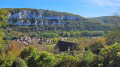
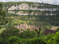
(S) Head towards the bridge over the Célé. Cross the Célé and turn right after the bridge onto the D41. After a few hundred metres, head up the road on the left. Then turn left again. The road will turn into a footpath, leading up onto the Causse plateau and skirting the Célé valley along a ridge (heading south, then west, then north-west). Magnificent views over the valley. You’ll pass the two Causse fountains in turn: thefirst for animals, thesecond for the locals. You’ll reach the houses of the hamlet of Causse.
(1) Turn left onto the road to head south again, still following the Célé valley along the ridge but this time at the foot of the cliff. Pass beneath the Château des Anglais, which offers shelter in case of rain. Further on, pass through the gate; this is a former rampart. Begin your descent here.
Further on, rejoin the road after the descent towards Brengues. Follow the signposts through the village and head west again. Climb gradually through the forest up onto the plateau.
(2) Pass the Fontaine de la Heath on your left. Join the road at a large crossroads on high ground near the Mas de Bazèle.
(3) Cross the large crossroads and rejoin the path to head south-west, following the signpost for Saint-Sulpice. Further on, after the start of a descent, rejoin the D13 departmental road, which winds down to Saint-Sulpice.
After the Bout des Costes viewpoint, walk down the road a short way, then turn left onto a path heading west towards the Château de Saint-Sulpice. You will then reach the road running along the cliff face, past the cave dwellings.
After the last houses, continue along the road which heads south-west through the heath. Further on, the road becomes a track; walk between the cultivated fields to reach a signpost indicating the Falaise de Balme.
(4) Climb more steeply northwards to reach the plateau again. Continue between the low stone walls. Return to the road after Pech-Merlu at the Pech Peyrous crossroads.
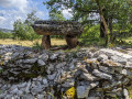
(5) Follow the tarmac road to the right until you reach the next Y-junction. Take the straight path to the left, heading south-east, through the scrub. Continue southwards between the low stone walls; a beautiful dolmen is visible after a detour to the left, but you’ll need to enter a field. To get there, look out for the signpost from the GR®. Join the road after the descent at the Grotte du Facteur.
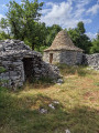
(6) Turn left and continue down the road. Turn right and continue south-east downhill between the low stone walls towards Marcilhac. A discovery route on the left takes you past a series of six caselles (one of which has been restored).
You’ll come out onto the road just above Marcilhac.
(7) Here you have two options:
- follow the winding road down to Marcilhac (E).
- turn right to take theGR® alternative route; further on, rejoin theGR® and turn right to reach the Mas de Picarel, where accommodation is available.


 Visorando Member
 Difficult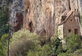
 Association / Club / Walk leader
 Easy
Easy