Country:
 City:
City:


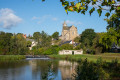
The starting point is on Place de la Cale, in the centre of Betton, opposite the town hall. Parking available. The square hosts the large Sunday market until 2 pm. If necessary, park opposite the town hall or in the nearby streets.
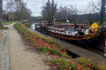
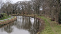
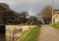
(S/E) Set off from Place de la Cale heading south, away from Betton Town Hall. Follow the towpath and walk alongside the canal on your left. Take thefirst footbridge to cross the canal.
(1) Turn right immediately, continue along the towpath heading south and keep the canal on your right. Walk past the Écluse du Haut Chalet lock and continue along the canal bank.
(2) When the canal bends to the right, take a small footbridge on the left and head away from the canal. Continue to the first junction on the tarmac road. Then turn left. Continue for 200 m along the road until you come to the start of a footpath on the right.
(3) An RTE electricity substation helps you spot the path. Take this path and follow it alongside the Training Centre until you arrive opposite the Altenov premises. Turn left to reach the D3175 after 50 metres.
(4) Cross the departmental road and follow it to the right, heading south, on the pavement, for 150 m. You will come to a junction on the left.
(5) Turn left at the junction (signposted Brebion), then cross the railway line at the level crossing. Immediately after the crossing, turn right onto the path running alongside the railway line. Continue along this path, which curves sharply to the left a little further on. Shortly after this bend, a fitness trail branches off to the left, just before the Pluvignon stream. Take this trail and, a little further on to the right, cross the Pluvignon stream (footbridge) to follow the fitness trail as it runs along its left bank.
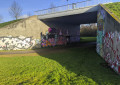
(6) The trail takes you close to the shopping area. Do not head into the shopping area, but turn right towards the bridge that takes you under the access road to the centre, which is notable for its street art. Go under the bridge and continue along the tarmac cycle path until you reach the road at the hamlet of La Lice. Continue along this road, cross over the D29 county road, and at the next junction turn left onto the D3029. Continue along this road eastwards to the car-sharing car park just before the large La Brandais roundabout.
(7) Do not enter the roundabout but follow the local road on the right which runs alongside the expressway, heading south (signposted ‘Centre Aéré D Savio’). After 400 m, pass under the expressway on the left. Turn left again at the end of the bridge (signposted ‘Cesson Sévigné’). Follow this local road, which curves to the right shortly afterwards, heading east. 200 m after this bend, a stony track branches off to the left of the road, signposted GR®39.
(8) Turn left onto the stony path and follow the GR®. Further on, cross the D29 and continue straight ahead. After about 800 m, when an embankment blocks the path’s direction, turn right to head east. A little further on, you’ll come to another fork.
(9) Turn right and stay at the edge of the woodland, continuing eastwards. When you see the Haut Portal water tower, a wide forest track appears on the left, at a junction marked by a large oak tree overlooking the crossroads.
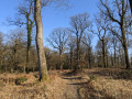
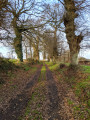
(10) Leave the GR® and take the forest track to the left. Follow this straight track northwards, lined with trees on either side. At the end of the track, go through the barrier via a chicane on the left,
Cross the road and continue northwards along a track suitable for vehicles on the right, at the Beauséjour crossroads. Pass beyond the hamlet of Beauséjour. Continue until you reach the D27 in the village of Les Maffrais (specialist hospital)
(11). Take the D27 on the left and follow it for 100 metres. At the edge of the woods, take the forest track branching off to the left, heading towards Betton in the south-west. Follow it alongside the fields and pastures until you rejoin the road at the hamlet of Champ Giron, where you turn right. Immediately afterwards, at the Stop sign, turn right onto the D27. Follow this road for 50 m.
(12) Turn left after the ‘Champ Giron’ bus stop. Continue downhill and pass under the motorway. As you come off the bridge, you’ll see the sign marking the entrance to the town of Betton.
(13) Take the dirt track branching off to the right before the ‘Betton’ signpost. Continue northwards to Champ Guérin, where you’ll come to a road leading to the centre of Betton on the left. Continue downhill, heading west. A road, then footpaths, then Rue des Marronniers will take you to the railway line.
(14) At the junction at the end of Rue des Marronniers, by the railway line, turn left. After 100 m, pass under the railway line. You will then come to a small square at the end of Rue Ernest Renan. First turn right then left along this street to reach Rue de Rennes after 100 m. Cross the road and turn left onto it for 100 m.
(15) Turn right onto Allée du Pigeon Blanc, which leads straight to the towpath of the Ille and Rance Canal. Turn left and head for the footbridge you crossed on the way there.
(1) Cross the footbridge, turn right and walk along the canal on your right-hand side to return to Place de la Cale (S/E).

 Visorando Member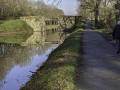
 Moderate