Les Granges - Bouziès

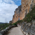
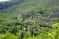
Une 4e étape qui, du Plateau des Causses, nous fait descendre les méandres du Célé. D'abord à Cabrerets où le village tout en longueur, à l'étroit entre falaise et rivière, nous emmène jusqu'au château en surplomb. Ensuite elle nous laisse au pied de la falaise à Bouziès, impressionnante par son à pic de presque 150 m.

Cette petite randonnée laisse largement la possibilité d'un retour dans le temps de 29000 années, par une visite au site préhistorique de Pech Merle sur le circuit.

This walk is part of a multi-day hike: The Célé Valley in 7 stages

Details

n°10865011
Creation:
Last update:
Last review:
  • Walking
    Activity: Walking
  • ↔
    Distance: 8.77 mi
  • ◔
    Average duration: 5h 15 
  • ▲
    Difficulty: Moderate

  • ⚐
    Back to start: No
  • ↗
    Ascent: + 1,430 ft
  • ↘
    Descent: - 1,457 ft

  • ▲
    Highest point: 1,099 ft
  • ▼
    Lowest point: 420 ft
  • ⚐ Country: France
  • ⚐
  • ⚐ City: Orniac (46330)
  • ⚑
    Start: N 44.517917° / E 1.683106°
  • ⚑
    End: N 44.484924° / E 1.642119°
  • ❏
    IGN map(s): Ref. 2138OT
  • Hour-by-hour weather

Photos

Description of the walk

The starting point is in the village of Orniac, on the right bank of the Célé, near the hamlet of Les Granges, on the D41 halfway between Sauliac and Cabrerets.

(S) From the Flèche Bleue lodge in Les Granges, rejoin the path heading north-east, which you took the previous day, to reach the junction withthe GR®®651.

(1) Turn left here towards the west and follow the red and white markings. A little further on, at the highest point, a new sign points towards Cabrerets. Begin a short descent to reach the junction with a road at the bottom of the valley.

(2) Cross the road and continue straight ahead, climbing towards Espinières. Gradually, the road turns into a track; follow this to reach the junction at Pech de Fomot.

(3) Turn left downhill to reach the junction with the balcony path.

(4) Turn left onto it and continue the descent towards Le Bout du Lieu. You will then reach the village of Cabrerets, enjoying a magnificent panoramic view of the cliffs as you descend.
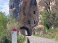
Join the D41 along the banks of the Célé at the foot of the cliffs. Beautiful houses built into the cliff face.
Pass the bridge on your left. Further on, take the narrow lane on the right and head uphill towards Cabrerets Castle, then head back towards the church.

(5) Take the road running alongside the cemetery, and continue straight ahead along the footpath. Head uphill in line with the road. Reach the Pech Merle Cave; there is a picnic table at a viewpoint halfway along the route.
At the cave site, go round the entrance and museum buildings on the right, and head up the path leading to the car parks. Continue south-west after the last car park.

(6) Turn left uphill after the last car park. Return to a vantage point overlooking the Célé valley, with a viewpoint on the left.
Note: this entire section is also part of the Discovery Trail, which explores the theme of the origin of life on Earth. You’ll reach a four-way junction.

(7) Take the path leading straight ahead between two hedges of shrubs. Walk down through an oak forest until you reach another four-way junction.

(8) Take the path on the left; this is theGR®®. After a bend to the right, enter a wide avenue of pine trees.
Further on, the descent becomes steeper. After several hairpin bends, you’ll come out onto a road. Pass a small château on your left to rejoin the D41 along the banks of the Lot.

(9) Cross the D41 with great care and head left to reach, a little further on, the old railway station, now a bistro called “Les deux vallées”. From there, you can reach the old railway line, which has been converted into a cycle path since July 2026. Head back north-west along the cycle path. Cross the bridge over the Lot. At Bouzies, take the tourist route to the right (D40) to reach your accommodation (E).

Waypoints

  1. S : mi 0 - alt. 482 ft - Lodge des Granges in Orniac
  2. 1 : mi 0.81 - alt. 827 ft - Junction with the GR651 on the Causse
  3. 2 : mi 1.54 - alt. 682 ft - Road junction towards Espinières
  4. 3 : mi 2.58 - alt. 899 ft - Road to Pech de Fomot
  5. 4 : mi 3.68 - alt. 702 ft - Junction with the balcony path along the Célé
  6. 5 : mi 4.42 - alt. 531 ft - Church of Cabrerets
  7. 6 : mi 5.16 - alt. 1,007 ft - Turn left onto a stony path
  8. 7 : mi 5.99 - alt. 1,079 ft - Crossroads
  9. 8 : mi 6.38 - alt. 863 ft - Junction of four paths. Signposted for Bouziès
  10. 9 : mi 7.94 - alt. 443 ft - Junction with the D41 at Bouziès
  11. E : mi 8.77 - alt. 446 ft - Bouziès Bridge over the - Lot (rivière)

Notes

Route recorded in June 2021.
Bouziès: Daily SNCF train service to Figeac (stopping at Faycelles) and Cahors.

Accommodation: Cabrerets, Bouziès
Provisions: Cabrerets, Bouziès
Campsite: Cabrerets.

Next stage: Bouziès – Saint-Cirq-Lapopie – Bouziès (Visorando)

Worth a visit

Cabrerets: Church and Castle
Cabrerets: Pech Merle prehistoric cave – booking essential.
Bouziès: Church, towpath towards Saint-Cirq-Lapopie

Always be cautious and plan ahead when you're outdoors. Visorando and the author of this route cannot be held responsible for any accidents occurring on this route.

The GR® and PR® markings are the intellectual property of the Fédération Française de Randonnée Pédestre.

Reviews and comments

Michel ALLEGRE
Michel ALLEGRE

PLEASE NOTE: when you reach the D41, the GR route has changed. At the junction with the D662, head towards the station (now a bistro) and go round the back of it to take the old railway line, thus avoiding the road to Bouziès.
You need to be very careful as the markings are not very visible.

Machine-translated

Other walks in the area

For more walks, use our search engine .

The GPS track and description are the property of this route's author. Please do not copy them without permission.