Country:
 City:


The route starts north of Betton on the edge of the built-up area, at the junction of the Route du Landret and the Route du Mont Saint Michel. See Practical Information.
At this point, you will find a car park (a few spaces along this road).
(S/E) Head towards the railway line, cross the level crossing and follow the road to the left. At the Fork in the road, continue to the right and, further on, pass under the motorway bridge and carry on to the left as you exit. After about 600 m on the uphill road, a path branches off to the right (45°) between two hedges of oak trees.
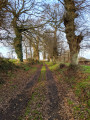
(1) Turn right onto the path. Once you rejoin the road at the hamlet of “Le Paradis”, take the road branching off to the right after the first house. The road becomes a sunken lane that bends to the left. At the next path junction, take the sunken lane to the left to rejoin the road at La Foye. Continue along the road until you reach the junction with the D97, the road to Saint-Sulpice, on the edge of the forest.
(2) At the junction in La Foye with the D97, cross carefully and continue straight ahead for about twenty metres. Enter the forest via a path branching off to the right (signpost). “From this point until you leave the forest, follow the yellow markings. (Ignore the orange markings, which sometimes interfere with the route).”
At the entrance to the forest (pine forest), the path runs parallel to the forest track which follows the edge of the forest eastwards. After about 800 metres, at an irrigation ditch between forest sections 91 and 92, the path turns 90° to the right.
(3) Take the path that descends south-south-west, following the ditch. Caution: after 100 m, do not miss a 45° diagonal path to the right (and do not follow the orange arrow pointing ‘straight ahead’). Further on, the well-marked path resumes its original direction. Continue until you reach the District Forest Road, where the landscape changes from pine forest to oak forest.
(4) On the District Forest Road, first turn left then right for 20 metres to rejoin the path that descends south-south-west. A signpost indicates the two routes for the Caleuvre route: to the left, the Grand Route heading east; to the right, the Petit Route (which we are following).
Continue to the right, following the signposts, to descend southwards until you reach a wooden footbridge over the River Caleuvre at the bottom of the valley.
(5) Cross the footbridge and head back up the valley, still heading south. Further up, a sign marks the junction where the Grand Route rejoins the Petit Route.
(6) At the junction, turn right (follow “Betton via La Petite Hublais”) and continue up the valley. A little further on, the path goes round a pool of water (in winter) on the left, before reaching the Betton Forest Road (signpost).
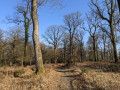
(7) At the Betton Forest Road junction, head straight ahead (signpost). Here, the high forest is sparse. The marked path turns right, but the many offshoots are all temptations to lose your way… Keep a close eye out for the yellow markers.
Initially, the path runs alongside the forest track heading north-west. After 500 m, look out for a fork to the left heading west.
(8) Turn left. Cross a stream. Although the path zigzags, it generally heads south-west, then west as it approaches the edge of the woodland. A forest track at the edge of the woodland takes you to the Carrefour de La Petite Hublais on the D97.
(9) At the La Petite Hublais junction, cross the departmental road and follow the road opposite, which descends gently past the pastures of the equestrian centres, taking you close to the expressway at the Le Fort junction.
(10) At the Le Fort junction, turn right, go under the bridge, and follow Rue de la Hamonais until it meets Chemin de la Hamonais, which joins from the right at the railway line.
Turn right onto Chemin de la Hamonais to reach the level crossing you crossed at the start, then turn left to return to the starting point (S/E).

 Visorando Member

 Moderate