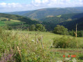
The peaks of Mont Lozère at the Col de Finiels

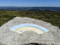
First and foremost, this is the Cévennes panorama walk starting from Mont Lozère. Indeed, the walk follows the ridges of Mont Lozère for over 5 km and offers magnificent 360° views, the most remarkable of which is from the Sommet de Finiels, complete with its three orientation tables.
It is also the walk taking in the main peaks that make up the granite dome of Mont Lozère. This is because it takes in six of the mountain’s highest peaks, passing by cairns and historic boundary crosses or Maltese crosses along the way.

Details

58957706
Creation:
Last update:
Last review:
  • Walking
    Activity: Walking
  • ↔
    Distance: 8.92 mi
  • ◔
    Average duration: 4h 55 
  • ▲
    Difficulty: Moderate

  • ⚐
    Back to start: Yes
  • ↗
    Ascent: + 942 ft
  • ↘
    Descent: - 945 ft

  • ▲
    Highest point: 5,574 ft
  • ▼
    Lowest point: 4,836 ft

Photos

Description of the walk

The starting point is at the Bleymard Mont Lozère ski resort on the D20 departmental road linking Le Bleymard (to the north) to Pont de Montvert (to the south) in the Cévennes National Park. From the Chalet du Mont Lozère at the ski resort, drive up towards the Col de Finiels for about 500 metres along the D20. Look out for the start of a track on the right, used for infrastructure maintenance. Turn right onto this track and make use of the car park there.

(S/E) From the car park, head south along the GR®70, which climbs amongst the pine trees (signposted: “Sommet de Finiels”). Very soon, you’ll reach a section of the path marked by a series of upright granite stones (pierres de montjoie – see below). Continue along the path to a small pass and a T-junction (elevation 1636).

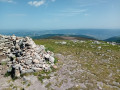
(1) At the junction, turn right heading due west (signposted “Sommet de Finiels”), onto the GR®70 which climbs along the ridge towards the summit. Pass the first hump and arrive at the Sommet de Finiels (elevation 1,699). Magnificent 360° views, marked by the three orientation boards. Splendid. Note the boundary cross (see below).

(2) Leave the GR®70, which descends southwards, and stay on the ridge heading west. The pleasant, well-marked path leads to the next summit (elevation 1,686).
This summit is also marked by a Maltese cross, near a stone shelter for animals.

(3) Continue due west towards the next summit, which is clearly visible. The route begins with a lovely descent to a small pass at the lowest point. Note the Maltese cross in the pass. After the cross, the path climbs towards a first summit, then a second: the Signal des Laubies (elevation 1,657)
The Signal des Laubies is also marked by a Maltese cross. Magnificent views. See the Practical Information section for return options.

(4) At the summit, pass the Maltese cross and continue along the line of the approach path, heading due north-west. Begin the descent and look out for the pass visible further down (weather permitting). Before reaching it, the descent turns left towards the south-west to join a forest track suitable for vehicles (Route Forestière des Crêtes) at an elevation of 1568.

(5) Turn right onto this road and join another track suitable for vehicles (T-junction with the Route des Chômeurs) at an elevation of 1,538 metres.

(6) Follow the Route des Chômeurs to the right and, after a few very wide hairpin bends on level ground, you’ll reach the car park (S/E).
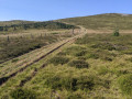
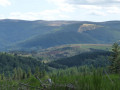
Heather-covered landscape on the northern slope of the mountain.

Waypoints

  1. S/E : mi 0 - alt. 4,843 ft - Ski resort – Maintenance track (elevation 1473)
  2. 1 : mi 1.34 - alt. 5,364 ft - Start of the path towards the Pic de Finiels
  3. 2 : mi 1.98 - alt. 5,574 ft - Finiels summit (elevation 1636)
  4. 3 : mi 2.65 - alt. 5,535 ft - Intermediate summit. (elevation 1686)
  5. 4 : mi 4 - alt. 5,436 ft - Summit of the Signal des Laubies. (elevation 1,657)
  6. 5 : mi 4.47 - alt. 5,144 ft - Junction with the Route Forestière des Crêtes
  7. 6 : mi 4.8 - alt. 5,052 ft - Junction with the Route des Chômeurs
  8. S/E : mi 8.92 - alt. 4,836 ft - Ski resort – Maintenance track (altitude 1473)

Notes

There is usually a temperature difference of between 5°C and 10°C between the summit of Mont Lozère and the adjacent valleys. Be sure to check the weather forecast for the summit before planning your hike.

There are very few shaded areas on this route, but there is always a breeze at the summits. Under no circumstances should you attempt this route in winter, or in foggy or rainy conditions.

Shortcut option at point (3). At the intermediate summit (elevation 1686), a path heads due north from the Maltese cross. It descends in a straight line through the heather to join the Route des Chomeurs, with a descent of 140 m. On the road, turn right towards (S/E).

Option for the return journey from the Signal des Laubies, point (4) at an altitude of 1,657 m. Depending on the weather and your preference, you can choose here between:
- continuing the walk by descending to point (6) and returning via the Route des Chômeurs,
- or retracing your steps in the opposite direction.
In hot weather with a southerly wind, the Route des Chômeurs can feel rather stifling, and the view is more limited. Conversely, in strong winds, it offers shelter.

Worth a visit

(2) The summit of Finiels with its three orientation boards, (4) The summit of Les Laubies,

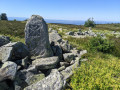
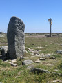
On the ridge between the summits, you come across a series of seven Maltese crosses: standing granite stones with a Maltese cross engraved on one side. These stones marked the boundaries of the Knights Hospitaller’s domain (13th to 15th centuries).

Montjoies are standing stones measuring between 1.50 m and 2 m in height, lining transhumance routes to mark the path, but also to serve as landmarks in fog or snow. You walk alongside them as you emerge from the woods after setting off, until you reach the point (1).

The boundary crosses, or Maltese crosses, are markers erected by the Knights Hospitaller to demarcate their estate

Always be cautious and plan ahead when you're outdoors. Visorando and the author of this route cannot be held responsible for any accidents occurring on this route.

The GR® and PR® markings are the intellectual property of the Fédération Française de Randonnée Pédestre.

Reviews and comments

4.2 / 5
Based on 3 reviews

Reliability of the description
4 / 5
Ease of following the route
4.3 / 5
Route interest
4.3 / 5
lui
lui

Overall rating : 3.3 / 5

Date of your route : Aug 17, 2026
Reliability of the description : ★★★☆☆ Average
Ease of following the route : ★★★★☆ Good
Route interest : ★★★☆☆ Average
Very busy route : Yes

Please note: the route back via a DFCI is long and uninteresting – find an alternative

Machine-translated

User 20084931

Overall rating : 5 / 5

Date of your route : Jun 17, 2026
Reliability of the description : ★★★★★ Very good
Ease of following the route : ★★★★★ Very good
Route interest : ★★★★★ Very good
Very busy route : No

An easy walk and a must-do for this beautiful view.

Machine-translated

7oise
7oise

Overall rating : 4.3 / 5

Date of your route : Jun 09, 2025
Reliability of the description : ★★★★☆ Good
Ease of following the route : ★★★★☆ Good
Route interest : ★★★★★ Very good
Very busy route : No

The hike is superb and easy to follow, but there is some information missing at the Laubies signpost to find the route and the Maltese cross below. It was the club's mascot, a dog, who sniffed out where to go.

Machine-translated

Other walks in the area

For more walks, use our search engine .

The GPS track and description are the property of this route's author. Please do not copy them without permission.