Route de la Planchette via La Fricaussière

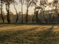
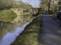
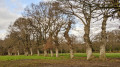
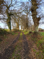
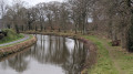
The towpath of the Ille and Rance Canal, the lock, the footpath and the river – nature greets you from the very first few metres. The many sunken paths along the route give this easy walk its special charm.

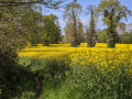
Very colourful in spring and autumn in the sunshine. Shade from the plane trees in summer. However, it can be damp during rainy winters.

Details

4255757
Creation:
Last update:
Last review:
  • Walking
    Activity: Walking
  • ↔
    Distance: 5.62 mi
  • ◔
    Average duration: 2h 45 
  • ▲
    Difficulty: Easy

  • ⚐
    Back to start: Yes
  • ↗
    Ascent: + 190 ft
  • ↘
    Descent: - 171 ft

  • ▲
    Highest point: 240 ft
  • ▼
    Lowest point: 105 ft
  • ⚐ Country: France
  • ⚐ City: Betton (35830)
  • ⚑
    Start/End: N 48.183163° / W 1.63968°
  • ❏
    IGN map(s): Ref. 1218SB
  • Hour-by-hour weather

Photos

Description of the walk

Park in the centre of Betton, in the town hall car park between the Ille and Rance Canal and the River Ille.

(S/E) Join the towpath along the canal on the right bank, then head left towards the north. Cross the footbridge over the Ille riverbed; a few metres further on, you’ll come to a path junction with a small footbridge (this will be your return route).

(1) Ignore the small footbridge on the left and continue along the canal bank. You will then pass the Brosses lock. Stay on the right bank of the canal until, after the KM 16 marker in a right-hand bend, you reach a small concrete footbridge which branches off to the left of the towpath to cross the stream.

(2) Do not take the small footbridge (shortcut – see below), but continue along the towpath which follows the bends of the canal.

One kilometre further on, at the exit of a sharp bend in the canal to the right; just before a long straight stretch begins and after kilometre marker KM 17; a path branches off to the left just after a row of three birch trees in a row along the towpath.

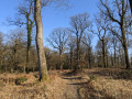
(3) Take the path on the left, which climbs steeply into a copse, before turning south after 50 metres, overlooking the canal. Follow the path as it climbs through the undergrowth. On emerging from the copse, you’ll reach a T-junction.

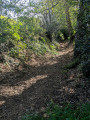
(4) At the T-junction, take the sunken path on the right, heading north-west. Climb the hillside, where the view then opens up. At the junction with the Route de Betton, continue straight on towards La Fricaussière.

In the hamlet of La Fricaussière, turn left at the stone wall, before the first house. Join the sunken path again; a little further on, it veers to the right to complete the climb up the hillside. At the top, you’ll reach a T-junction with a path running perpendicular to it.

(5) At the crossroads, turn left and head south. Follow the sunken path, which joins the road after 300 metres. Take the road on the left downhill and join the Betton–Chevaigné road.

Continue to the right towards Betton for 300m. You will then reach the start of a tarmac road which descends to the left towards Haut Finvert.

(6) Leave the road and turn right (120°) onto the dirt track which climbs slightly between two embankments. Further on, a sharp bend to the left directs the track southwards. Follow it along the ridge to the village of Champ Roussel.

(7) Turn 90° to the left onto the road to head downhill and reach La Planchette farm.

(8) At La Planchette farm, leave the road as it curves to the left. Then, just after the shed, turn right onto the path that descends between two fields and crosses the Ruisseau de Quincanpoix further down. Head back up towards Betton in a straight line. Pass the cemetery on your left.

(9) After the cemetery, head down the first street on the left, Rue du Clos Paisible, and reach the canal via the footbridge at thefirst junction you passed on the way out.

(1) Turn right and follow the same route as on the way there to return to the car park at Betton Town Hall (S/E).

Waypoints

  1. S/E : mi 0 - alt. 108 ft - Car park at Betton Town Hall - Canal d'Ille-et-Rance
  2. 1 : mi 0.14 - alt. 112 ft - Crossroads at the end of the circular loop
  3. 2 : mi 1.51 - alt. 118 ft - Small concrete footbridge on the left
  4. 3 : mi 2.15 - alt. 118 ft - Trail start to the left of the canal
  5. 4 : mi 2.29 - alt. 157 ft - T-junction of footpaths
  6. 5 : mi 3.04 - alt. 223 ft - La Fricaussière crossroads
  7. 6 : mi 3.67 - alt. 184 ft - Haut Finvert crossroads
  8. 7 : mi 4.26 - alt. 184 ft - Turn-off towards La Planchette
  9. 8 : mi 4.41 - alt. 157 ft - La Planchette Farm – Head down to the right
  10. 9 : mi 5.25 - alt. 161 ft - Rue du Clos Paisible
  11. S/E : mi 5.62 - alt. 108 ft - Car park at Betton Town Hall

Notes

Betton: all local shops. Bus. SNCF railway station (starting point 400m from the station).

Alternative route (shortcut) – At (2), at the footbridge in the hamlet of Finvert, you can reach the Haut Finvert crossroads (6) via the road. This shortens the route to approximately 7 km. Route:
- Cross the footbridge and cross the stream at (2),
- At the hamlet of Finvert, do not turn right onto the Allée de Chênes, but follow the tarmac road which turns left. Continue uphill until you reach the Betton–Chevaigné road.
- Turn right towards Chevaigné and follow the road to the crossroads at Haut Finvert (7). Turn left.
Alternative route: on the Betton–Chevaigné road. It is also possible to head directly to La Planchette farm (8).

(9) Alternative route on arrival: continue straight ahead along the road to reach Betton Church. To the left of the church, a flight of steps leads down to the River Ille, taking you back to the starting point. A complete walk around the lake opposite the town hall takes about 30 minutes.

Worth a visit

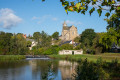
Betton: the neo-Romanesque parish church of Saint-Martin.
Betton: large market every Sunday morning, Place de la Cale, opposite the Town Hall.
Les Brosses Lock: boats pass through from June to October.

Reviews and comments

4.1 / 5
Based on 4 reviews

Reliability of the description
4.5 / 5
Ease of following the route
4 / 5
Route interest
3.8 / 5
griso35
griso35

Overall rating : 3.7 / 5

Date of your route : Mar 18, 2024
Reliability of the description : ★★★★☆ Good
Ease of following the route : ★★★★☆ Good
Route interest : ★★★☆☆ Average
Very busy route : No

Pleasant but not signposted. Follow the route description or the GPX track.
Best avoided in wet weather

Machine-translated

leterme
leterme

Overall rating : 4.3 / 5

Date of your route : Oct 17, 2023
Reliability of the description : ★★★★★ Very good
Ease of following the route : ★★★★☆ Good
Route interest : ★★★★☆ Good
Very busy route : No

An easy and pleasant walk between the canal and the wooded countryside. But be careful: there are no signposts, so you must follow the route description and map provided carefully.

Machine-translated

randonneur 35
randonneur 35

Overall rating : 4.7 / 5

Date of your route : Aug 15, 2023
Reliability of the description : ★★★★★ Very good
Ease of following the route : ★★★★★ Very good
Route interest : ★★★★☆ Good
Very busy route : No

Hello
A lovely walk, with pleasant dirt tracks; however, at point (5) at the T-junction, the path on the left is hard to see because of the vegetation – you have to walk a bit further to spot it

Machine-translated

Moizan
Moizan

Overall rating : 3.7 / 5

Date of your route : Feb 20, 2022
Reliability of the description : ★★★★☆ Good
Ease of following the route : ★★★☆☆ Average
Route interest : ★★★★☆ Good
Very busy route : Yes

Hello,

A lovely walk, but it’s a bit tricky to find your way around the northern part of the route, as there’s no map for this section between points 4 and 6.

Have a nice day

Machine-translated

Other walks in the area

For more walks, use our search engine .

The GPS track and description are the property of this route's author. Please do not copy them without permission.