


petitspas26

 Visorando Member
 Premium user
 Sign up:
Published route(s)
 Tour of the Rochers de Cresta and Auberts from Saillans
 8.84 mi
 +3,406 ft
 -3,415 ft
 7h 00
7h 00
 Difficult
 Departure from Saillans (Drôme)
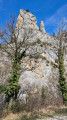
A beautiful but long hike around the Rochers de Cresta, with the added bonus, if you feel up to it, of climbing to the top of the ridges: breathtaking views of the Trois Becs massif, the Drôme valley, the Vercors, Glandasse, and even a glimpse of Grand Ferrand... But only do this in dry weather with very good footwear that grips well, as there are steep slopes and secure rocks...
The Rochers de la Sausse and the Col de la Bataille as seen from Omblèze
 6.03 mi
+2,638 ft
-2,615 ft
5h 05
Difficult
Departure from Omblèze (Drôme)
6.03 mi
+2,638 ft
-2,615 ft
5h 05
Difficult
Departure from Omblèze (Drôme)
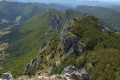
From Omblèze, a steep climb will take you to the beautiful cliffs of the Rochers de la Sausse, which you’ll follow as far as the Col de la Bataille before descending just before the Ambel plateau. The more adventurous can push on to the Tête de la Dame or set out to tackle the Roc de Toulau.
See the ‘Practical Information’ section for details on the difficulty of this route.
Tour of the Rocher de Turon from Combovin via the Pas de Fontfène
 6.19 mi
+1,821 ft
-1,821 ft
4h 25
6.19 mi
+1,821 ft
-1,821 ft
4h 25
 Moderate
Departure from Combovin (Drôme)
Moderate
Departure from Combovin (Drôme)
This hike from Combovin takes you around the Vallon de la Cursaye via balconies, ridges and viewpoints over the Vercors, the Rhône Valley and even the Mézenc on a clear day.
Tour du Taillefer from L'Escoulin
 10.76 mi
+2,641 ft
-2,648 ft
7h 15
Difficult
Departure from Eygluy-Escoulin (Drôme)
10.76 mi
+2,641 ft
-2,648 ft
7h 15
Difficult
Departure from Eygluy-Escoulin (Drôme)
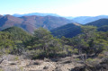
This lovely hike goes all the way around Taillefer, passing through Saint-Andéol-en-Quint, Vachères-en-Quint and the two Col de Vachères (north and south). Beautiful views of Vercors, Bec Pointu, Tête de la Dame, Montagne de Glandasse and Les 3 Becs.
Good news at the end of the route: you no longer have to wade through the Sépie river, but can cross via a very pretty footbridge!
La Servelle from Brette
 10.98 mi
+3,009 ft
-2,979 ft
7h 40
Difficult
Departure from Brette (Drôme)
10.98 mi
+3,009 ft
-2,979 ft
7h 40
Difficult
Departure from Brette (Drôme)
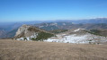
This is a long hike but without any technical difficulties apart from the relatively steep grassy slopes below the summit of La Servelle. Your efforts will be rewarded with a magnificent 360° view from Vercors to Ventoux and from Dévoluy to the Monts d'Ardèche! Return via a partial circular route passing through Champ Rabi.
Montagne de Beaufayn from Les Derbons
 8.17 mi
+2,884 ft
-2,884 ft
6h 15
Moderate
Departure from Aix-en-Diois (Drôme)
8.17 mi
+2,884 ft
-2,884 ft
6h 15
Moderate
Departure from Aix-en-Diois (Drôme)
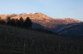
A few steep paths, a touch of orientation in the boxwoods and pines, a very short vertiginous ledge on the way back, a narrow passage between two cliffs, four small fords, an exceptional 360° view from the summit over the Vercors (as far as Veymont), the Devoluy, the southern peaks of the Drôme, Serre Chauvière, the Trois Becs, the Drôme Valley: this is the "Beaufayn" programme!
The Pas de Saint-Vincent, Pierre-Chauve and the Col de Tourniol
 9.49 mi
+2,927 ft
-2,904 ft
6h 55
Difficult
Departure from Barbières (Drôme)
9.49 mi
+2,927 ft
-2,904 ft
6h 55
Difficult
Departure from Barbières (Drôme)
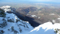
While the Pas de Saint-Vincent and Pierre-Chauve are classics in the area, the route described here is less so... You'll need strong legs to climb the 300 m ascent below the Pas, save some energy to reach the summit of Pierre-Chauve, and a good sense of direction to reach Tourniol... but what a treat for the eyes!
Tour de Chabrier from Saillans to Pas de la Bernarde
 8.64 mi
+2,612 ft
-2,612 ft
6h 15
Moderate
Departure from Saillans (Drôme)
8.64 mi
+2,612 ft
-2,612 ft
6h 15
Moderate
Departure from Saillans (Drôme)
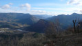
An extension of the classic Tour de Chabrier hike, this figure-of-eight hike (with the Col des Vallons at its centre) takes you to the Pas de la Bernarde (magnificent views of the Vercors, Montagne de Glandasse and Drôme Valley on the Vercheny side) and into the Fond de Chabrier. In total, the Col des Vallons will have been explored from all four cardinal points!
Bec Pointu from the Quint Valley
 8.33 mi
+3,087 ft
-3,061 ft
6h 30
Difficult
Departure from Saint-Julien-en-Quint (Drôme)
8.33 mi
+3,087 ft
-3,061 ft
6h 30
Difficult
Departure from Saint-Julien-en-Quint (Drôme)
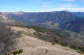
This circular hike takes you up the south-eastern slope of Bec Pointu from the Quint Valley. Although the ascent and descent are challenging, your efforts will be rewarded by the incomparable 360° view from the summit, taking in the Vercors, Glandasse, the Massif des Trois-Becs, Omblèze and, of course, the Tête de la Dame.
Les Rancs du Touet
 9.18 mi
+2,379 ft
-2,359 ft
6h 15
Moderate
Departure from Peyrus (Drôme)
9.18 mi
+2,379 ft
-2,359 ft
6h 15
Moderate
Departure from Peyrus (Drôme)
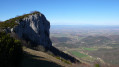
The Rancs du Touet cliffs overlook Peyrus and Châteaudouble; this hike takes you around them, climbing the famous Chemin des Moines and Pas du Touet and descending via the Route des Limouches. Beautiful views and varied paths guaranteed!
Moderator's note added on 13/09/2021: please note that there are some difficulties in finding the paths on this route: see the comments at the bottom of this page.
Taillefer from Pontaix
 12.40 mi
+2,769 ft
-2,740 ft
8h 05
Moderate
Departure from Pontaix (Drôme)
12.40 mi
+2,769 ft
-2,740 ft
8h 05
Moderate
Departure from Pontaix (Drôme)
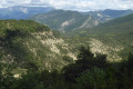
Mainly on wide tracks, this hike—which is not difficult apart from its length—takes you up to the Taillefer, offering stunning views from the Vercors to the Trois-Becs Massif with beautiful vistas over the Drôme Valley.
Le Pré de Cinq Sous via Saragaillard and Ravin des Goulets
 6.26 mi
+2,592 ft
-2,612 ft
5h 10
Moderate
Departure from Beauregard-Baret (Drôme)
6.26 mi
+2,592 ft
-2,612 ft
5h 10
Moderate
Departure from Beauregard-Baret (Drôme)
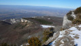
A variation on the classic hike via the Col des Marchand (which it avoids), less demanding in terms of difficulty and duration than the usual routes, this loop takes you along good paths and trails to the Pré de Cinq Sous, returning via the Ravin des Goulets and the luminous Ravin de Tête d'Homme.
The Orthodox Monastery of La Traverse
 6.79 mi
+892 ft
-922 ft
3h 55
Moderate
Departure from Montgreleix (Cantal)
6.79 mi
+892 ft
-922 ft
3h 55
Moderate
Departure from Montgreleix (Cantal)
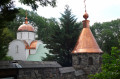
A pleasant loop around the pretty village of Montgreleix, ending at the Orthodox Monastery of the Mother of God Znaménié (open to visitors at certain times) at La Traverse. No technical difficulties and a wide variety of landscapes (pastures typical of the Cézallier region and burons, valleys and small woods, streams and waterfalls, etc.). You may even return with a Saint-Nectaire cheese in your bag...
Grand tour of La Godivelle
 9.22 mi
+1,086 ft
-1,089 ft
5h 10
Moderate
Departure from La Godivelle (Puy-de-Dôme)
9.22 mi
+1,086 ft
-1,089 ft
5h 10
Moderate
Departure from La Godivelle (Puy-de-Dôme)
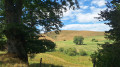
Mainly along paths and tracks, this walk around the pretty hamlet of La Godivelle takes in the characteristic landscapes of the Cézallier: pastures stretching as far as the eye can see, the gentle contours of the ‘mountains’, peat bogs, lakes and a few woods. On the way back, the route passes by Lake Saint-Alyre and the Sagnes de la Godivelle peatland reserve.
Mont Chamaroux
 6.99 mi
+1,348 ft
-1,335 ft
4h 25
Moderate
Departure from La Godivelle (Puy-de-Dôme)
6.99 mi
+1,348 ft
-1,335 ft
4h 25
Moderate
Departure from La Godivelle (Puy-de-Dôme)
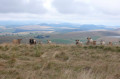
With its distinctive silhouette, Mont Chamaroux offers a magnificent viewpoint in the heart of the Cézallier; the route suggested here is a return walk through little-used pastures, where you’ll need to navigate the fences and know how to deal with the herds... No technical difficulties apart from the slightly steep final climb, and flexibility and agility are required to get over the fences.
Moderator’s note added on 19/08/2021. See the comments at the bottom of this page regarding passages through summer pastures when herds are present
Luguet signpost
 11.32 mi
+1,549 ft
-1,542 ft
6h 35
Moderate
Departure from Anzat-le-Luguet (Puy-de-Dôme)
11.32 mi
+1,549 ft
-1,542 ft
6h 35
Moderate
Departure from Anzat-le-Luguet (Puy-de-Dôme)
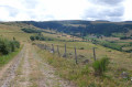
The Signal du Luguet is the highest point of the Cézallier. This hike along wide tracks, the only difficulty being the distance, takes you around the peak and up to the summit. But as for the view from the top, forget it, as it’s covered in trees! You can nevertheless enjoy the scenery by skirting the summit and taking in a 360° panorama, from the Puy de Dôme to the Monts du Cantal.
Courbières Mountain and Pradiers from Rascoupet
 11.97 mi
+1,250 ft
-1,237 ft
6h 35
Difficult
Departure from Landeyrat (Cantal)
11.97 mi
+1,250 ft
-1,237 ft
6h 35
Difficult
Departure from Landeyrat (Cantal)
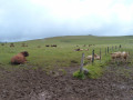
A long and magnificent hike in the little Mongolia of Cézallier. Pastures as far as the eye can see, herds of Aubrac and Salers cows, burons (stone huts)... and the Monts du Cantal on the horizon. No technical difficulty, good trails or wide paths that are always well marked, with numerous ladders to cross barriers. The route is circular except for the section between Rascoupet and before Courbières, which is a round trip.
The Croix du Vellan from Beaufort-sur-Gervanne
 10.62 mi
+2,178 ft
-2,139 ft
6h 45
Moderate
Departure from Beaufort-sur-Gervanne (Drôme)
10.62 mi
+2,178 ft
-2,139 ft
6h 45
Moderate
Departure from Beaufort-sur-Gervanne (Drôme)
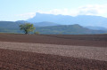
From Beaufort-sur-Gervanne, the gradual climb to Plan-de-Baix and then to the Croix du Vellan (a picturesque passage between rocks and cliffs) is on good paths. From there, you can enjoy a unique view of the Gervanne Valley and the Trois Becs Massif. The return journey takes you through the village of Lozeron and the Domaine des Arômes (Sanoflore organic cosmetics factory and botanical garden).
Another Tour de Chabrier from Saillans
 7.38 mi
+2,224 ft
-2,247 ft
5h 20
Moderate
Departure from Saillans (Drôme)
7.38 mi
+2,224 ft
-2,247 ft
5h 20
Moderate
Departure from Saillans (Drôme)
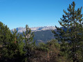
Variation on the classic Tour de Chabrier hike via the Col des Vallons and the Pas de la Bernarde, with a return via a tiny path overlooking the Drôme and the D93 between Saillans and Vercheny. Splendid views guaranteed over the Drôme Valley, the Massif des Trois-Becs and the Vercors.
Le Pré de Cinq Sous by Pierre Rousse
 6.77 mi
+3,048 ft
-3,045 ft
5h 45
Difficult
Departure from Beauregard-Baret (Drôme)
6.77 mi
+3,048 ft
-3,045 ft
5h 45
Difficult
Departure from Beauregard-Baret (Drôme)
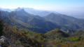
This alternative route to the Pré de Cinq Sous has the advantage of avoiding the classic, long path through the Ravin de Combins and bypasses the Col des Marchands. Via a steep path that’s tough on the calves, the route heads to Pierre Rousse, then Saragaillard and the famous meadow. After a round trip to the highest point of the Montagne de Musan, the descent is via Véreires (or Vairaires) and Champ Riant.
The Crête de Ramiat
 7.51 mi
+1,929 ft
-1,949 ft
5h 10
Moderate
Departure from Sainte-Croix (Drôme) (Drôme)
7.51 mi
+1,929 ft
-1,949 ft
5h 10
Moderate
Departure from Sainte-Croix (Drôme) (Drôme)
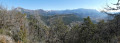
The Crête de Ramiat is the flagship hike from Sainte-Croix, and rightly so! Admittedly, there is a bit of road at the start, but then there are wide paths or well-marked trails and, above all, splendid panoramic views of the Drôme Valley and the Vercors. The passage along the ridge can be tricky in short sections for those prone to vertigo and requires sure-footedness in places. However, it is possible to avoid this section without missing out on the beauty of the landscape.
The Crêtes de Côte Belle and the Tour de Merly
 12.16 mi
+1,942 ft
-1,952 ft
7h 15
Difficult
Departure from Beaufort-sur-Gervanne (Drôme)
12.16 mi
+1,942 ft
-1,952 ft
7h 15
Difficult
Departure from Beaufort-sur-Gervanne (Drôme)
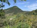
Côte Belle is a classic hike from Beaufort-Sur-Gervanne. Here we offer a longer and more complete version, covering almost all of the ridges and extending around Merly, a pointed mountain overlooking Eygluy. As a bonus, you can enjoy views not only of the Massif des Trois-Becs and the Drôme Valley, but also of the Montagne de Glandasse, the But Saint-Genix, Ansage, the Falaises d'Omblèze and the Rochers du Vellan. No difficulty except for the length.
Around Combovin
 4.37 mi
+1,214 ft
-1,214 ft
3h 05
Moderate
Departure from Combovin (Drôme)
4.37 mi
+1,214 ft
-1,214 ft
3h 05
Moderate
Departure from Combovin (Drôme)
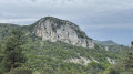
This short circular route through woods, hillsides and balconies offers multiple views of the Rhône Valley and the Ardèche at various points along the route, rewarding your efforts...
Moderator's note: this hike was modified on 5 May 2023 between points 3 and 4 to stay on the marked trail and respect private property.
Circular from Les Ollières-sur-Eyrieux to Conjols
 4.91 mi
+1,053 ft
-1,056 ft
3h 10
Moderate
Departure from Les Ollières-sur-Eyrieux (Ardèche)
4.91 mi
+1,053 ft
-1,056 ft
3h 10
Moderate
Departure from Les Ollières-sur-Eyrieux (Ardèche)
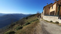
This circular loop above the Eyrieux leads to the pretty hamlet of Conjols and offers beautiful views of the Eyrieux Valley. Due to some steeper and stony sections before Conjols, this short walk has been rated as moderately difficult. The return journey is along beautiful paths and then the Voie Verte cycle path along the Eyrieux.
Faraud Mountain and Sadous Chapel from Chastel-Arnaud
 9.81 mi
+2,877 ft
-2,867 ft
7h 00
Difficult
Departure from Chastel-Arnaud (Drôme)
9.81 mi
+2,877 ft
-2,867 ft
7h 00
Difficult
Departure from Chastel-Arnaud (Drôme)
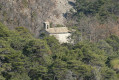
Montagne de Faraud offers magnificent views of the Trois Becs and all the surrounding mountains. This hike offers an alternative to the classic hike, starting from the hamlet of Saint-Moirans (Chastel-Arnaud) rather than La Chaudière. At the start, you will have the opportunity to visit the 12th-century Church of Saint-Moirans and, during the hike, the charming Chapelle des Sadous chapel. The hike follows good paths or tracks, with a few slightly steep sections.
Aumont-Aubrac - Prinsuéjols
 8.86 mi
+764 ft
-282 ft
4h 45
Moderate
Departure from Aumont-Aubrac (Lozère)
8.86 mi
+764 ft
-282 ft
4h 45
Moderate
Departure from Aumont-Aubrac (Lozère)
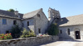
The first stage of the 5-day Tour de l'Aubrac, this hike already offers a good glimpse of the magnificent landscapes of the Aubrac: fields, woods, hills, beautiful granite-stone houses, crosses at almost every crossroads, and of course, the proud Aubrac cows.
Prinsuéjols - Buron des Rajas
 17.14 mi
+1,985 ft
-1,575 ft
8 hrs
17.14 mi
+1,985 ft
-1,575 ft
8 hrs
 Very difficult
Departure from Prinsuéjols (Lozère)
Very difficult
Departure from Prinsuéjols (Lozère)
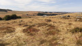
This second, long stage, which is partly shaded, ends at Buron des Rajas, at the foot of Signal de Mailhebiau, the highest point in Aveyron, in a vast, wild desert landscape.
Buron des Rajas - Saint-Chély-d'Aubrac
 11.30 mi
+371 ft
-2,093 ft
5h 30
Moderate
Departure from Les Salces (Lozère)
11.30 mi
+371 ft
-2,093 ft
5h 30
Moderate
Departure from Les Salces (Lozère)
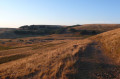
This third stage of the Tour des Monts d'Aubrac is one of the most varied. It contrasts the crossing of the wild, desert-like expanses of the Monts d'Aubrac in the first half with the coolness of the Aubrac National Forest and the Tourbières Nature Reserve in the second half. From the Buron des Rajas, isolated at an altitude of 1,300 metres, the stage ends in the small village of Saint-Chély-d'Aubrac, at the bottom of the Boralde de Saint-Chély valley, 500 metres lower down.
Saint-Chély-d'Aubrac – Nasbinals
 10.19 mi
+1,962 ft
-732 ft
6h 25
Difficult
Departure from Saint-Chély-d'Aubrac (Aveyron)
10.19 mi
+1,962 ft
-732 ft
6h 25
Difficult
Departure from Saint-Chély-d'Aubrac (Aveyron)
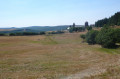
This fourth stage follows theGR® 65 Way of St James in reverse; it is one of the most beautiful stages of the route, listed in its entirety as a UNESCO World Heritage Site. After a steady, shaded climb, the path crosses the Aubrac plateaus, passing through the exceptional site of Aubrac.
Nasbinals - Aumont-Aubrac
 16.02 mi
+873 ft
-1,296 ft
8h 10
Difficult
Departure from Nasbinals (Lozère)
16.02 mi
+873 ft
-1,296 ft
8h 10
Difficult
Departure from Nasbinals (Lozère)
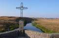
This last stage of the Tour de l'Aubrac, shared with theGR®®65Chemin de Saint-Jacques de Compostelle à l'envers, once again showcases the vast wilderness of the Aubrac plateau. In the last third of the stage, which is a little more shaded, you can admire the imposing granite bell tower of the Church of La Chaze-de-Peyre and the Chapel of La Bastide.
Tour of the Monts d'Aubrac
63.52 mi
+5,955 ft
-5,978 ft
5 days
Difficult
Departure from Aumont-Aubrac (Lozère)
The Aubrac is a granite plateau partly covered in basalt. A vast grazing area for the famous Aubrac cattle, it is criss-crossed by numerous paths, the most famous of which is the Way of St James, the Via Podensis starting from Le Puy-en-Velay. This short five-day Tour of the Monts d'Aubrac allows you to explore the southern half, passing through iconic locations such as Aumont-Aubrac, Prinsuéjols, Les Rajas, Saint-Chely-d'Aubrac, Aubrac, and Nasbinals.
Château de Pierre Gourde and Serre de Meran
 6.99 mi
+1,942 ft
-1,929 ft
4h 55
Moderate
Departure from Saint-Laurent-du-Pape (Ardèche)
6.99 mi
+1,942 ft
-1,929 ft
4h 55
Moderate
Departure from Saint-Laurent-du-Pape (Ardèche)
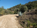
From Saint-Laurent-du-Pape, this pleasant hike to the ruins of Pierre Gourde Castle offers a beautiful overview of the Ardèche: the route is almost exclusively along ridges, with magnificent views of the Eyrieux Valley, the Ardèche Mountains, the Rhône Valley and the Vercors.
Please note: some steep and rugged climbs before reaching the château and, above all, the ascent of the Serre de Girbaud may discourage some hikers. It is not advisable to do the hike in reverse!
Meyrueis – Hyelzas
 8.77 mi
+1,401 ft
-538 ft
5h 15
Moderate
Departure from Meyrueis (Lozère)
8.77 mi
+1,401 ft
-538 ft
5h 15
Moderate
Departure from Meyrueis (Lozère)
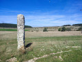
Thisfirst stage of the Tour du Causse Méjean takes the hiker up onto the Causse from Meyrueis on the banks of the Jonte. A gentle climb to get you going, featuring a picturesque stretch before reaching the Causse, the Aven Armand, and a renowned cheese dairy at the entrance to the pretty hamlet of Hyelzas. If you arrive early enough, you may be able to visit the Ferme Caussenarde in Hyelzas.
Hyelzas - Le Rozier
 9.94 mi
+1,424 ft
-3,281 ft
5h 50
Moderate
Departure from Hures-la-Parade (Lozère)
9.94 mi
+1,424 ft
-3,281 ft
5h 50
Moderate
Departure from Hures-la-Parade (Lozère)
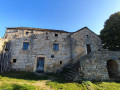
Thissecond stage of the Tour du Causse Méjean crosses the lush south-western part of the Causse before descending to Le Rozier, at the confluence of the Tarn and the Jonte. Along the way, the beautiful church of Saint-Pierre-des-Tripiers, the Gallo-Roman village of Les Résiniers, and the Rocher de Capluc. The route described does not pass through the famous Vases de Chine and Sèvres above the Gorges de la Jonte; this more technical and better-known section can easily be found on other Visorando guides for those who are keen to see them.
Le Rozier - Les Vignes
 7.50 mi
+1,099 ft
-1,043 ft
4h 25
Moderate
Departure from Le Rozier (Lozère)
7.50 mi
+1,099 ft
-1,043 ft
4h 25
Moderate
Departure from Le Rozier (Lozère)
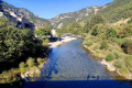
Thisthird stage of the Tour du Causse Méjean takes place entirely within the Gorges du Tarn. Following wide tracks or good footpaths, sometimes beneath overhanging rock formations, sometimes along the banks of the Tarn, this easy, shaded stage offers a very pleasant way to explore this part of the gorges.
Les Vignes - Mas-Saint-Chély
 12.03 mi
+2,690 ft
-883 ft
7h 50
Difficult
Departure from Les Vignes (Lozère)
12.03 mi
+2,690 ft
-883 ft
7h 50
Difficult
Departure from Les Vignes (Lozère)
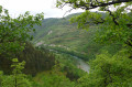
Thisfourth stage of the Tour du Causse Méjean leaves the Gorges du Tarn to climb back up onto the Causse Méjean and cover nearly half of its northern section. After a steep climb to the hamlet of La Caxe, the walker first passes through wooded areas and fields before reaching more open terrain beyond Montignac. A detour via the Roc des Hourtous, with its breathtaking views of the Gorges du Tarn and the vultures, is one of the highlights of the stage.
Mas-Saint-Chely - Drigas
 7.12 mi
+584 ft
-387 ft
3h 45
Moderate
Departure from Mas-Saint-Chély (Lozère)
7.12 mi
+584 ft
-387 ft
3h 45
Moderate
Departure from Mas-Saint-Chély (Lozère)
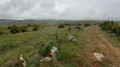
This5th stage of the Tour du Causse Méjean crosses the southern half of the Causse du Nord. From the path, you can take in the desert-like expanses of this part of the Causse. Short and easy, this stage can be completed in the same day as the6th stage from Drigas to Meyrueis for walkers wishing to complete the Tour in a circular fashion.
Drigas – Meyrueis
 5.99 mi
+331 ft
-1,404 ft
3h 05
5.99 mi
+331 ft
-1,404 ft
3h 05
 Easy
Departure from Hures-la-Parade (Lozère)
Easy
Departure from Hures-la-Parade (Lozère)
This6th and final stage of the Tour du Causse Méjean crosses the desert-like expanses of the Causse before descending into the Gorges de la Jonte to Meyrueis. This short, easy stage can be combined with the5th stage from Mas-Saint-Chely to Drigas for those wishing to shorten the Tour to five days.
Clockwise tour of the Causse Méjean starting from Meyrueis
51.39 mi
+7,661 ft
-7,667 ft
6 days
Moderate
Departure from Meyrueis (Lozère)
Exclusively on marked trails, this tour offers a comprehensive overview of the Causse: wooded or barren sections, ascents and descents through the Gorges de la Jonte, a walk along the Gorges du Tarn, beautiful villages, a famous karstic cave (Aven Armand), ancient remains (dolmens, menhirs), vultures – nothing is missing. The stages are generally easy, allowing you to focus on the beauty of the landscapes you pass through.
Planned as a six-day tour, it can be completed in five days by combining the last two stages.