Country:

 City:


Start from the car park opposite the town hall/school in Saint-Nazaire-le-Désert or in front of the church.
Section marked with yellow and redGRP® signs: Tour de la Vallée de la Roanne, marked in yellow, formerly marked with Yellow Triangles nos. 105 and 107.
(S/E) Take the D202, Route du Petit Paris, heading south, then take the first road on the right 100 m after the car park (Chemin du Clos de la Roche), towards Les Pradaux (signposts). Just after the second hairpin bend, before the farm buildings, take a wide track on the right heading north.
(1) After about 500 m, turn left (ignore a poorly marked path through a field on the right), then, after 300 m, go round a hairpin bend to the right, followed by a final hairpin bend to the left 200 m further on. 50 metres after this last hairpin, you’ll come to the start of a wide path on the right (a ‘private property’ sign to the left of the track, and signs marked ‘Chaffois’ and ‘Pradaux’).
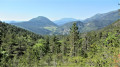
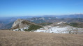
(2) Take this path to the right. Initially heading north, the path turns westwards and reaches a ridge (Pénatier, Champ Planier: lovely views of the Montagne d’Angèle to the south), then returns to the northern slope and reaches a crossroads of tracks at Chaffois (signpost) amidst tall pine trees.
Section marked with yellow markings and old Yellow Triangles no. 105
(3) Take the track on the left, towards Ronat and the Col de Muse. After a gentle descent and three hairpin bends, the track runs alongside the Montagne de Couspeau heading south, passes Barnier’s house, and after almost 2 km, arrives at Ronat at a junction with another track.
(4) Turn right (road sign prohibiting entry except to authorised vehicles); go through the barriers (make sure to close them properly behind you). About 300 m after the sharp right-hand bend, the track reaches a junction of tracks. Continue straight on heading north (there is a lavender field a little further on to the right). After 500 m, the track turns west at Clos Richard (a large lavender field on the left, topped by a small building). You’ll reach a three-way junction by a copse of pine trees.
(5) Ignore the track on the right with a road sign prohibiting access except to authorised persons, as well as the very tempting path on the left leading to the house. Take the path between the latter and the copse on your right-hand side; it is less well-maintained at the start (an old yellow and red sign with the very faded inscription ‘Serre Délégué’ on one of the pine trees). About a hundred metres past the pine copse, the path makes a hairpin bend to the right (cairn, post with faded directional signs, old Yellow Triangle). Take great care at this point. Take the path that branches off to the left at the hairpin bend. This path, which resembles a straight clearing cutting through the slope, crosses a path on the right (cairn) after about 200 metres.
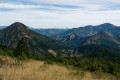
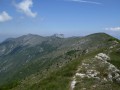
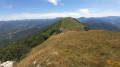
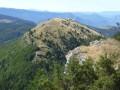
(6) Take this path to the right, which is more or less steep, heading north. It leads up to the Montagne de Couspeau. Continue along the ridge heading north, sometimes with a clear view, until you reach the Sommet de Serre Délégué (marker).
(7) Follow the ridge northwards and descend to the first pass, 500 m beyond the summit of Serre Délégué (cairn).
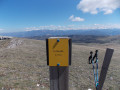
(8) Take the path that branches off to the right, sloping gently north-eastwards (not very visible at first, marked by cairns). Passing through open spaces and copse, over ridges on the northern slope and then more decisively eastwards, over more or less steep terrain, descend to the old Pradaux sheepfold on the left-hand side (signpost).
Section marked with yellow and redGRP® signs for the Tour de la Vallée de la Roanne (alternative route), yellow markings, and old Yellow Triangles nos. 105 and 107
(9) Turn left and walk past the ruins on your left. Immediately afterwards, at the junction with the signpost marked ‘Les Pradaux Belvédère’, continue along the path straight ahead, due east, towards Saint-Nazaire-Le-Désert. This lovely path, which runs almost constantly along the hillside, ends after approximately 2.6 km and a series of hairpin bends on a track at the bottom of the Vallon des Boutarys (signpost for “Les Boutarys”).
(10) Turn left towards Saint-Nazaire-Le-Désert. After 400 m, you’ll reach the D596 road. Turn right (take care), and when you reach the Pont de Pémia (junction with the D135), turn right again towards Saint-Nazaire-Le-Désert and head back to the car park where you started (S/E).

 Visorando Member
 Moderate

 Local authority