Country:

 City:
City:


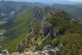
Car park at the exit of the hamlet of Les Boutons. If there are no spaces available, you can park a few hundred metres before the village, near the sewage treatment plant.
(S/E) Take the road (sign reading ‘no entry except for residents’) marked with yellow-green signs for about a hundred metres. Look out carefully for the small path on the left just behind the box trees and shrubs.
(1) Take this path which, after about thirty metres, turns left, goes past the hedge and joins the field above the car park. After the field, cross a small copse and head towards the hamlet of Les Bertrands. Walk past the houses, continuing straight on and following the yellow-green markings, until you reach the signpost marked ‘Plan de Baix, Léoncel’. Continue straight on, following the directions on the signpost along a track suitable for vehicles.
(2) Further on, go past the fence on the left (wire fence) and take the path marked by a sign on the ground with “Col de Comberoufle” written in red. Continue along this path (still following the yellow-green markings) until you reach a metal gate for livestock.
(3) After the gate (make sure to close it properly), turn right. Leave the path and the yellow-green markings.
Follow the fence, taking care to stay more or less level, or slightly uphill (never go downhill). Join a path running alongside a woodland and arrive above the Fontaines ruins.
(4) Do not go down to the ruins; stay above them and look out for the faint traces of an old path that winds its way uphill, passing several small ridges in the field dotted with scrub and hunters’ hides. At times, vertical marks painted red on tree trunks help you find your way. Pass between a hunter’s hide and a tree with the letter ‘A’ underlined in red on its trunk.
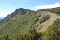
From there, the path becomes very visible, soon marked with yellow-green markings, then fluorescent orange dots. Cross several small scree slopes and enter the forest until you reach the foot of a large rock.
(5) Go round the boulder to the left; the path is very steep and very slippery!
Above the boulder, the path continues on the other side of the slope. Pay close attention to the various yellow-green, red or orange markings on the trees so as not to lose the path!
About 200 metres past the top of the boulder, the path turns sharply left (cairns). After the cairns, the path is more visible until another sharp bend to the right about a hundred metres further on.
(6) The path is then more or less visible; always pay close attention to the various markings.
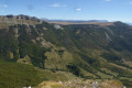
Further up, finally, it becomes clearly visible and emerges onto the ridge just below the Pas de la Sausse.
(7) Take in the view, then follow the fence eastwards along the cliffs (be careful not to get too close!). You may occasionally need to climb over the fence in either direction. This will take you back to the car park at the entrance to the Col de la Bataille tunnel.
(8) Pass through the tunnel (stay on the pavements on either side of the road), cross the Col de la Bataille, and take the lovely path on the right (GR® 93 towards Ambel and Tête de la Dame) which runs alongside the Roc de Toulau and leads to the Plateau d’Ambel.
After 2 km from the Col de la Bataille, ignore a wide path on the left, and about 300 m further on, you’ll come to a sign on the right (towards Omblèze) indicating the path down.
(9) Take this well-marked path and you’ll reach the car park where you started in about an hour (S/E).

 Visorando Member
 Moderate
 Very difficult