Country:

 City:
City:


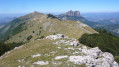
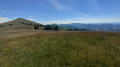
About 3.5 km from Bourdeaux towards Crupies (D 70), turn left onto the D 195 towards Les Tonils.
Walk through the hamlet, turn left immediately at the last houses (do not cross the Liouroux stream) and park on the right 100 m further on at the tourist information sign for the Pays de Dieulefit and Bourdeaux.
Occasional yellow markings along the entire route
(S/E) From the car park, continue along the road heading north (Chemin de Chirol). After 650 m, you’ll come to a fork in the road.
(1) Turn right. After a short descent and a building on the left, the road becomes a track suitable for vehicles. Continue along it, ignoring any paths to the right or left. After four hairpin bends and approximately 1.8 km, you will reach a junction almost level with the houses in Chirol.
(2) Take the track on the right (sign: ‘private property’). A fairly steady climb follows, punctuated by hairpin bends. After about 3.5 km and a very long straight stretch, you’ll reach a fork in the road (not shown on the map)
(3) Continue along the path on the left (the path on the right is marked with a crossed-out yellow symbol). After a few more hairpin bends – which you can cut across when you reach the Pré du Bœuf – you’ll arrive at the sheepfold (not marked on maps).
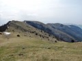
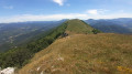
(4) Continue towards the ridges, heading north-west towards the Grand Delmas. The path is not always clearly marked around the sheepfold, but becomes clearly visible along the ridges.
(5) Leave the path on your right – which you’ll take on the way back – and reach the summit of the Grand Delmas (cairn).
(6) Retrace your steps.
(5) Do not descend to the sheepfold; stay on the ridges. For about 5 km, the path runs along the Montagne de Couspeau, passing through the Grande Plaine, the Col Puzaou, Chabrette and La Violette. You’ll reach the cairn marking the pass before Serre Délégué.
(7) Take the path on the right (hard to see if the grass is tall...) heading south-west, trying to spot the cairns scattered here and there, as well as the yellow markings. The path becomes more visible as you enter the forest and leads to a clearing with a table and benches set up by hunters.
(8) Take the track suitable for vehicles leading to this clearing. After a very long straight stretch and two hairpin bends, this track reaches the Col Soubeyrand, about thirty metres past a barrier.
(9) Follow the track on the right (barrier). After about 1 km and a hairpin bend, you’ll reach a fork at the Ferme du Col (barrier).
(10) Take the track on the right. After a long straight stretch, at the hairpin bend, turn left (there is a barrier on the track to the right), and you will reach Magnan (sign commemorating Konrad Spittel).
(11) Continue along the track to the right, and after about 1.5 km and several hairpin bends, you’ll reach a crossroads.
(12) Carry on straight ahead; the track now runs alongside the Ruisseau de Souleure, and you’ll reach Les Tonils (S/E).

 Local authority
 Easy
Easy 
 Visorando Member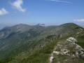
 Very difficult