Refine your search for walks in Visp
Visp walks


 From Visp to Raron, overlooking the Rhône Valley
 Visorando Member
 9.07 mi
 +1,660 ft
 -1,686 ft
 5h 35
5h 35
 Moderate
 Departure from Visp (Valais)
A route following part of the ‘Sun Trail’ on the southern face of the Bernese Alps, offering panoramic views over the Rhône Valley. The hike takes in typical Valais villages with a rich architectural heritage, such as Eggerberg, Ausserberg, St. German and Raron. In several places, the route runs alongside the railway line between Brig and Bern via the Lötschberg Tunnel, offering an opportunity to appreciate the technical feats involved in its construction at the start of the20th century. Due to its south-facing aspect and relatively low altitude, this hike is best enjoyed in spring or autumn.
Gspon - Simplon Hospiz
 14.45 mi
+3,566 ft
-3,202 ft
9h 45
14.45 mi
+3,566 ft
-3,202 ft
9h 45
 Very difficult
Departure from Staldenried (Valais)
Very difficult
Departure from Staldenried (Valais)
Final stage to finish at the Hospice (du Simplon). To round off this hike in style, you must spend a night at the Hospice du Simplon, where you will receive a warm welcome.
Hike with a brief description, to be followed with the Visorando app.
Gspon - Simplon Hospice
 11.24 mi
+3,629 ft
-3,278 ft
8h 20
11.24 mi
+3,629 ft
-3,278 ft
8h 20
 Difficult
Departure from Staldenried (Valais)
Difficult
Departure from Staldenried (Valais)
A pleasant trail through the woods will take you to Gibidumpass, a viewpoint overlooking the Rhône Valley. You will gradually descend into the Nanztal, a quiet valley at the foot of the Fletschhorn. The Bistine Pass is the last pass to cross to complete this lovely loop and admire the Fletschhorn one last time. As you descend towards the Simplon Pass, Monte Leone will catch your eye.
Grachen - Saas-Fee
 11.39 mi
+5,226 ft
-4,606 ft
9h 45
Difficult
Departure from Grächen (Valais)
11.39 mi
+5,226 ft
-4,606 ft
9h 45
Difficult
Departure from Grächen (Valais)
And here is the last stage of this route, and what a stage it is! A pleasant climb to reach Hannigalp and find the famous balcony trail that overlooks the valley leading to Saas Fee.
Grachen - Europahutte
 9.30 mi
+4,780 ft
-2,789 ft
10 hrs
Very difficult
Departure from Grächen (Valais)
9.30 mi
+4,780 ft
-2,789 ft
10 hrs
Very difficult
Departure from Grächen (Valais)
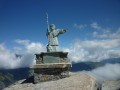
Grachen, an important village, dominates the Zermatt valley, which you will be flying over all day. After a gentle climb to Saint-Nicolas on its pedestal, you just need to pass from scree to scree to reach the welcome Refuge d'Europahutte after a long traverse.
Belalp - Riederalp via the Aletsch Panoramaweg
 7.13 mi
+2,215 ft
-2,615 ft
5h 15
Difficult
Departure from Naters (Valais)
7.13 mi
+2,215 ft
-2,615 ft
5h 15
Difficult
Departure from Naters (Valais)
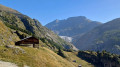
A superb route that quickly offers views of the Aletsch Glacier. You’ll descend towards the gorges of the River Massa (Massschlucht), which flows from the Aletsch Glacier. To cross to the other side of the canyon, you’ll take the Massa suspension bridge, which is 124 metres long and sits at a height of over 80 metres. After the pleasant Riederfurka Pass, you’ll descend to the peaceful, car-free village of Riederalp.
Walk in Belalp
 1.93 mi
+394 ft
-394 ft
1h 15
1.93 mi
+394 ft
-394 ft
1h 15
 Easy
Departure from Naters (Valais)
Easy
Departure from Naters (Valais)
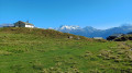
This short hike is a prelude to the panoramic Aletsch Glacier Trail. This small car-free village is primarily a winter sports resort. Belalp is divided into two parts, Bäll, the traditional village, and the residential district of Sattle, close to the ski lifts. This route will allow you to discover both sides of Belalp. The trail also offers numerous views of the high peaks of the Valais, such as the Matterhorn, the Weisshorn, Monte Leone and the Fletschhorn.
Aletsch Panorama Trail
 22.67 mi
+6,181 ft
-7,799 ft
4 days
Difficult
Departure from Naters (Valais)
22.67 mi
+6,181 ft
-7,799 ft
4 days
Difficult
Departure from Naters (Valais)
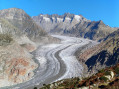
Three-day itinerary featuring the two largest glaciers in the Alps. Numerous viewpoints of the Alpine glaciers and three- and four-thousand-metre peaks in Valais, such as the Matterhorn, the Weisshorn and the Fletschhorn.
Staldhorn from the Simplonstrasse
 4.41 mi
+1,663 ft
-1,667 ft
3h 30
Moderate
Departure from Simplon (Valais)
4.41 mi
+1,663 ft
-1,667 ft
3h 30
Moderate
Departure from Simplon (Valais)
This walk from the Simplon Road (which is very busy), slightly below the pass, allows you to enjoy a fairly wild environment. The summit of the Staldhorn, which is relatively low in altitude, offers a superb 360° panorama of Monte Leone and its glacier, the Fletschhorn, as well as the peaks of the Bernese Alps, including the Aletschhorn (4,194 m) and the impressive Bietschorn!
Jungu – Grüben
7.79 mi
+3,848 ft
-4,318 ft
6h 55
Difficult
Departure from St. Niklaus (Valais)
The first of the three stages that make up the northern traverse of the massif from east to west.No particular difficulties: you just need to take care on the first section, which follows a narrow path along the cliff face. Fixed equipment (ropes) secures the most exposed sections.The route starts from the same cable car used on the previous stage to descend to St-Niklaus.
From the Simplon Pass (Valais) to San Bernardino (Graubünden)
 139.75 mi
+53,894 ft
-55,164 ft
15 days
Difficult
Departure from Simplon (Valais)
139.75 mi
+53,894 ft
-55,164 ft
15 days
Difficult
Departure from Simplon (Valais)
Following on from ‘From the Great St Bernard Pass to the Simplon Pass’, here is ‘From the Simplon Pass to the San Bernardino Pass’.
This is not the return journey from the Great St Bernard Pass to the Simplon, following a language study trip to Italy, but rather the continuation of the route towards the San Bernardino Pass in the Canton of Graubünden. This hike requires a very high level of fitness, as several stages involve more than 1,300 metres of ascent or descent. After two days in Wallis (the German-speaking part of Valais), the atmosphere becomes entirely Italian: two days in Italy (Val Formazza), nine days in Ticino (Tessin in Italian), and two days in Grigioni (Grisons in Italian). Lake Maggiore and Locarno are also on the itinerary.
Simplon Hospiz - Rosswald
 12.21 mi
+3,563 ft
-4,114 ft
8h 45
Difficult
Departure from Simplon (Valais)
12.21 mi
+3,563 ft
-4,114 ft
8h 45
Difficult
Departure from Simplon (Valais)
Departure from the Simplon Hospice. From the hospice, take the Stockalperweg on the right after the tunnel under the Simplon road. Follow the signs for Rothwald. At Rothwald, the trail continues on the other side of the road and leads to Wäse and then Wintrigmatte. The trail bypasses the Furggubaum torrent at Scrickboden at the foot of the Furggubaumlicke and begins to climb towards the Bortelhütte. The trail descends towards the Schiess torrent (small bridge) and climbs slightly towards Stafel, which offers a panoramic view of the Bortelhorn. A gravel road leads to the top of the village of Rosswald.Markings: White-red-white.
Fletschorn Tour
 73.12 mi
+25,331 ft
-25,341 ft
7 days
Difficult
Departure from Simplon (Valais)
73.12 mi
+25,331 ft
-25,341 ft
7 days
Difficult
Departure from Simplon (Valais)
A remarkable route along little-used paths where nature has remained unspoilt. The Fletschhorn is just seven metres short of reaching the 4,000-metre mark. In this massif, it stands alongside peaks taller than itself, such as the Lagginhorn (4,010 m) and the Weissmies (4,017 m), yet it has nevertheless lent its name to this route: the Simplon Fletschhorn Trekking (SFT).This route requires excellent physical fitness; some sections are quite long and involve significant elevation gain. See $ practical information
Simplon Hospice - Zwischbergen
 10.54 mi
+2,218 ft
-4,341 ft
6h 45
Difficult
Departure from Simplon (Valais)
10.54 mi
+2,218 ft
-4,341 ft
6h 45
Difficult
Departure from Simplon (Valais)
Although Napoleon was responsible for the construction of the Simplon Hospice, this Alpine pass, already frequented by the Romans, has been developed many times. In the 17th century, Kaspar Stockalper developed a mule track here. From the Simplon Hospice to Simplon Dorf and Gabi, you will follow this path, known as the Stockalperweg. After Gabi, crossing the Furggu pass, you will descend into the steep-sided Zwischbergen valley.
Riederhorn
 7.91 mi
+3,035 ft
-3,025 ft
6h 15
Moderate
Departure from Bitsch (Valais)
7.91 mi
+3,035 ft
-3,025 ft
6h 15
Moderate
Departure from Bitsch (Valais)
A circular walk from a small parking area on the road named Fure (Marked Fure on Swiss map 3324T) which is above Ried-Morel. It takes a higher path above the Massaweg towards Stausee Gibidum, climbs to the Villa Cassel and then the top of the Riederhorn. The descent is through the forest. A pleasant and interesting excursion.
Rosswald - Binn
 10.62 mi
+3,025 ft
-4,423 ft
7h 30
Difficult
Departure from Ried-Brig (Valais)
10.62 mi
+3,025 ft
-4,423 ft
7h 30
Difficult
Departure from Ried-Brig (Valais)
Classic stage of the Mineralien Tour. In Rosswald, signs point to the Saflisch Pass trail, Binn. The climb is quite steep up to the Fleshboden chairlift station. The path is always well marked and becomes more pleasant up to the Saflisch Pass. Stay on the AlpenPässe Weg to Binna Stausee. Descend to Binn via the Via Alpina Blue. The Saflischpass is the French/German language border. Markings: White-RedBwhite. AlpenPässe Weg - Via Alpina Blue D4
Saint Nicklaus - Gruben
 9.72 mi
+6,283 ft
-3,980 ft
8 hrs
Very difficult
Departure from St. Niklaus (Valais)
9.72 mi
+6,283 ft
-3,980 ft
8 hrs
Very difficult
Departure from St. Niklaus (Valais)
A beautiful mountain stage with a pass bearing the sweet name of Augstbordpass.
Sankt Niklaus - Zermatt
 12.37 mi
+2,178 ft
-541 ft
7h 35
Difficult
Departure from St. Niklaus (Valais)
12.37 mi
+2,178 ft
-541 ft
7h 35
Difficult
Departure from St. Niklaus (Valais)
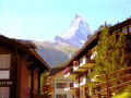
This fourteenth and final stage is the longest, but does not present any difficulties. The route from Sankt Niklaus to Zermatt is obvious. It follows the Matter Vispa, the river that flows down from Zermatt, and the rack railway line, which terminates in Zermatt. All the ingredients for a picture-postcard Swiss scene are there: the Matterhorn, glaciers, the torrent, churches with bulbous steeples, the little rack railway and the magnificent car-free village of Zermatt.
Bettmerhorn and back from Ried-Morel
 11.65 mi
+5,568 ft
-5,591 ft
10h 10
Difficult
Departure from Riederalp (Valais)
11.65 mi
+5,568 ft
-5,591 ft
10h 10
Difficult
Departure from Riederalp (Valais)
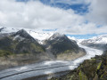
An out and back walk to the summit of the Bettmerhorn starting at Ried-Morel (or alternatively, Riederalp, Bettmeralp or Morel)
Hangebrucke, Belalp, Stausee Gibidum and the Massaweg
 14.13 mi
+6,699 ft
-6,690 ft
12h 20
Difficult
Departure from Riederalp (Valais)
14.13 mi
+6,699 ft
-6,690 ft
12h 20
Difficult
Departure from Riederalp (Valais)
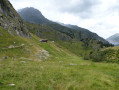
A Circular walk from Ried Morel (alternatively Morel or Riederalp) taking in an easy descent through woodland to glaciated rock scenery and the hanging bridge over the Massa which is the water flowing from the Aletsch Glacier. Then crossing peaceful alpine pastures to make the ascent up the steps to Hotel Belalp before dropping again on paths and roads to the dam at the end of Stausee Gibidum. The final section follows the scenic Massweg trail back to Reid Morel.
Riederalp - Märjelenseestube via the Aletsch Panoramaweg
 7.85 mi
+2,569 ft
-1,138 ft
5h 50
Difficult
Departure from Riederalp (Valais)
7.85 mi
+2,569 ft
-1,138 ft
5h 50
Difficult
Departure from Riederalp (Valais)
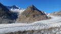
This second stage passes through the Rieder Furka and Villa Cassel again. The trail then follows a moraine offering several views of the glacier. The climb to the Härdernagrat offers exceptional views of both the Aletsch Glacier and the Valais peaks rising to over 4,000 metres, including the Matterhorn. After HohBalm, the Aletsch Glacier remains your faithful companion before disappearing at the Märjelenseestube.
Grüben – Zinal
8.56 mi
+3,284 ft
-3,845 ft
6h 50
Very difficult
Departure from Oberems (Valais)
Stage2 of the northern section of the Tour du Cervin: this takes you to the Val d’Anniviers.NB: Originally, we had planned to walk all the way from Grüben to Zinal, but in two stages: stage 1 from Grüben to the Hôtel Weisshorn, and stage 2 from the Hôtel Weisshorn to Zinal. For financial reasons, this wasn’t possible; so we carried on to Saint-Luc, from where a bus service took us to Zinal.The first section (up to Meidu) does not follow the classic Tour du Cervin route; the section through the forest and mountain pastures between the end of the track and the buildings at Jäniltigu Oberstafil is no longer marked at all; that said, there are no particular difficulties: the track reflects the route I took, based on the path as shown on the maps and the terrain.
Gruben - Sankt Niklaus
 10.22 mi
+4,055 ft
-6,407 ft
8h 15
Very difficult
Departure from Oberems (Valais)
10.22 mi
+4,055 ft
-6,407 ft
8h 15
Very difficult
Departure from Oberems (Valais)
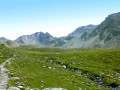
This thirteenth stage takes place in the high mountains and, depending on the season, may involve crossing snowfields. The trail is shared with the Apenpässe-Weg, marked with green vignettes No. 6. From the hotel, the trail climbs towards the Augstbordpass, crossing alpine pastures to Grüobu Oberstafel. Then the landscape becomes increasingly rocky until you reach the Augstbordpass. At the pass, you will have earned a well-deserved break. The descent continues through numerous scree slopes and rock fields, but the path is always well marked. From Abiheiji (Twraa Ridge), the route to Jungen is more pleasant and the path is often paved. From Jungen, there is still an 850-metre descent to Sankt Niklaus. (You can take the cable car to avoid this last descent.)
Gruben - Zinal
 12.78 mi
+3,150 ft
-3,629 ft
8h 35
Difficult
Departure from Oberems (Valais)
12.78 mi
+3,150 ft
-3,629 ft
8h 35
Difficult
Departure from Oberems (Valais)
Another high-altitude stage with a stop in Saint-Luc, then transfer to Zinal by post bus.
Gruben - Grachen
 10.56 mi
+5,505 ft
-6,040 ft
9h 40
Difficult
Departure from Oberems (Valais)
10.56 mi
+5,505 ft
-6,040 ft
9h 40
Difficult
Departure from Oberems (Valais)
Today's stage is divided into three parts: on foot from Gruben to Jungu, by cable car from Jungu to Saint-Niklaus, and by bus from Saint-Niklaus to Grachen.
Simplon Dorf - Simplon Pass
 5.45 mi
+1,690 ft
-33 ft
4h 00
Moderate
Departure from Simplon (Valais)
5.45 mi
+1,690 ft
-33 ft
4h 00
Moderate
Departure from Simplon (Valais)
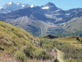
This final stage will take you from the village of Simplon to the Simplon Pass. Along the way, you will notice two remarkable buildings in this arid landscape: the Alte Spittel and the Barralhaus. Once you reach the Simplon Pass, you can take a short detour to see the Simplon Eagle and the imposing hospice.
Lauchernalp - Leukerbad (Rinderhütte)
 9.12 mi
+2,854 ft
-2,011 ft
6h 40
Difficult
Departure from Wiler (Lötschen) (Valais)
9.12 mi
+2,854 ft
-2,011 ft
6h 40
Difficult
Departure from Wiler (Lötschen) (Valais)
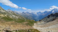
This last stage will take you from Lauchernalp to Leukerbad. The route passes through several mountain pastures, including Kummenalp and Restialp. As you climb up to the Restipass, you will enjoy magnificent views of the Lötschental and the peaks, from the Jungfrau to the Aletschhorn. The Weisshorn will also often be visible. The western slope of the Restipass will take you easily to the upper station of Leukerbad at the Rinderhütte.
Topalihütte – Jungu
6.94 mi
+1,860 ft
-4,055 ft
4h 50
Difficult
Departure from St. Niklaus (Valais)
Jungu/Jungen (1,954 m) is a village situated above St-Niklaus. The journey is made by cable car. If the cable cars are not running, an intercom at the Jungu station allows you to contact the operator: payment is made at the bottom.The descent down the Wasulicke features several sections secured with fixed ropes and ladders, as the ground is quite unstable and sloping. The descent is currently not particularly exposed: a 45° slope, which allows for a fairly safe descent with the safety measures in place. There is currently no route across what remains of the glacier. This forms the second stage of the Tour du Cervin, passing through the western part of the Matter Vispa valley.
The Riederhorn from Bettmeralp
 7.49 mi
+1,811 ft
-1,804 ft
5h 00
Difficult
Departure from Riederalp (Valais)
7.49 mi
+1,811 ft
-1,804 ft
5h 00
Difficult
Departure from Riederalp (Valais)
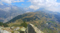
The Riederhorn is a peak overlooking the village of Riederalp. From Bettmeralp, the route follows the Aletsch Promenade and then the UNESCO Promenade to reach Rieder Furka and Villa Cassel. The route continues with the ascent of the Riederhorn and follows the ridge. The return to Villa Cassel takes you through the Bettwald forest, which overlooks the Gibidum reservoir, a lake fed by the Aletsch Glacier.
 Bettmeralp, Hohfluh and Riederfurka circular loop
 7.02 mi
+1,204 ft
-1,198 ft
4 hrs
Moderate
Departure from Riederalp (Valais)
7.02 mi
+1,204 ft
-1,198 ft
4 hrs
Moderate
Departure from Riederalp (Valais)
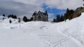
A superb panoramic hike offering views of the Aletsch Glacier to the north and, to the south, of numerous peaks over 4,000 metres, including the Matterhorn, the Weisshorn and the Monte Rosa massif.
In the Aletsch Forest and on the Aletsch Panorama Weg
 8.85 mi
+2,073 ft
-2,073 ft
5h 55
Difficult
Departure from Riederalp (Valais)
8.85 mi
+2,073 ft
-2,073 ft
5h 55
Difficult
Departure from Riederalp (Valais)
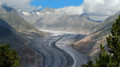
A circular walk starting from Bettmeralp. It passes through the village of Riederalp before climbing up to Rieder Furka. From this pass, you’ll descend through the beautiful Aletsch Forest to Silbersand. As you climb back up towards Alte Stafel, you’ll gradually come to see the Aletsch Glacier. At Moosfluh and along the ridge, you’ll enjoy panoramic views of the glacier. To the south, you can admire the 4,000-metre peaks, from the Weismiess to the Weisshorn via the Matterhorn. The return to Bettmeralp takes you past the lakes of Blausee and Bettmersee.
Bettmeralp-Golmenegg circular winter loop
 2.55 mi
+410 ft
-417 ft
1.5 hrs
Easy
Departure from Riederalp (Valais)
2.55 mi
+410 ft
-417 ft
1.5 hrs
Easy
Departure from Riederalp (Valais)
This pleasant winter hike partly follows the Aletschpromenade. Along this route, you will notice some beautiful old Valais houses. This route also offers several views of the Valais peaks over 4,000 metres.
Circular walk from Bettmeralp to Fiescheralp, returning via the Panoramaweg
 7.52 mi
+1,585 ft
-1,565 ft
5 hrs
Moderate
Departure from Riederalp (Valais)
7.52 mi
+1,585 ft
-1,565 ft
5 hrs
Moderate
Departure from Riederalp (Valais)
A beautiful panoramic hike linking the resorts of Bettmeralp and Fiescheralp. Along the route, there are numerous vantage points offering views of the Valais peaks over 4,000 metres, including the Weissmies, the Mischabel massif, the Monte Rosa massif, the Matterhorn and the Weisshorn. It is possible to ascend to the Eggishorn by cable car.
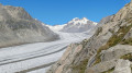
From Märjelen Gletscherstube to Platta
 13.23 mi
+3,737 ft
-3,717 ft
9h 20
Difficult
Departure from Riederalp (Valais)
13.23 mi
+3,737 ft
-3,717 ft
9h 20
Difficult
Departure from Riederalp (Valais)
A magnificent route between Bettmeralp and Platta, with a viewpoint overlooking the Aletsch Glacier. You can admire the Aletsch Glacier all the way to Konkordia Platz, where several glaciers converge. This phenomenon forms the mid-moraines – lines of pebbles and rocks in the middle of the ice – which are clearly visible on the Aletsch Glacier. Along the way, before the tunnel under the Tälligrat, you can also see the Fischergletscher, another glacier in a valley further to the east.