Country:

 City:
City:


(S) From the refuge, follow the path towards Jungu (signs very close to the refuge). Follow the track which winds up the hillside towards the scree slopes of the Undere Stelligletscher.
(1) Take an ascending moraine ridge (small herds of goats may be present), then head off towards the north-east to reach the Stelline pastures.
(2) Continue along the path.
(3) The path veers eastwards and then climbs up to a rocky ridge.
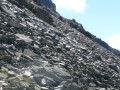
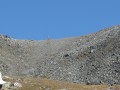
(4) Then follow the top of the scree slope (do not go down too far; keep an eye out for the painted markings) heading north, then climb up to Wasulicke.
(5) The descent is on the right-hand side (traces of old paths further to the left, which must have led to what remains of the glacier, are visible but blocked off), using the safety equipment in place (fixed ropes, 2x2 small ladders) to avoid slipping on the rather unstable ground. A section through a couloir is marked as being exposed to rockfalls.
(6) Do not linger there; continue along the path. Leave the upper section to cross a rather rugged moraine.
(7) Carry on until the path becomes more pleasant, descending towards a meltwater lake.
(8) The path heads north and crosses the Junbach.
(9) Carry on until the path turns eastwards, soon leaving the scree behind.
(10) The path continues, descending gently towards the stream, to an alpine hut.
(11) Normally, the path goes to the west of the building, but the track cuts across to the east and the going is very easy as you’re in an alpine pasture. Then turn left.
(12) Next, of the various paths, follow the one that continues straight ahead along the flattest section of the slope; this keeps you higher up and avoids descending to the valley floor. The path reaches a rocky outcrop.
(13) Carry on until you reach a wooded area at the upper edge of the slope.
(14) The path then descends more steeply; a sign at a junction points eastwards towards Jungu.
(15) Continue to the right.
(16) Then head eastwards again, turning left and crossing a stream. Keep to the left and you will soon reach Lake Jungen, keeping to the left and then to the right. There is a bar-restaurant next to the lake. The cable car station is situated below (S/E).
 Visorando Member
 Very difficult
 Moderate