Grächen – Gruben

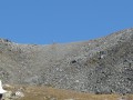
This ninth stage will take you from Crächen to Gruben. The route begins with a descent to the village of Sankt Niklaus. You will then need to tackle the long climb to Jungu before beginning the ascent of the Augstbord Pass (2,892 metres). From Abiheiji (Twära Ridge), the well-signposted path leads through a vast scree slope to the Augstbord Pass. The descent to Gruben is pleasant; it first follows the Grüobbach stream and then crosses the Grüobwald forest.

It is possible to avoid an 850-metre climb by taking the cable car between Sankt Niklaus and Jungu.

This walk is part of a multi-day hike: From Airolo to Grimentz via the Alpine Passes Trail

Details

n°110754695
Creation:
Last update:
Last review:
–
  • Walking
    Activity: Walking
  • ↔
    Distance: 13.52 mi
  • ◔
    Average duration: 11h 50 
  • ▲
    Difficulty: Very difficult

  • ⚐
    Back to start: No
  • ↗
    Ascent: + 6,430 ft
  • ↘
    Descent: - 5,712 ft

  • ▲
    Highest point: 9,469 ft
  • ▼
    Lowest point: 3,586 ft

Waypoints

  1. S : mi 0 - alt. 5,315 ft - Grächen – Hotel Walliserhof
  2. 1 : mi 0.42 - alt. 5,285 ft - Sign No. 6
  3. 2 : mi 0.84 - alt. 4,859 ft - Sign No. 6
  4. 3 : mi 1.17 - alt. 4,810 ft - Sign No. 6
  5. 4 : mi 1.64 - alt. 4,304 ft - Sign No. 6
  6. 5 : mi 2 - alt. 3,953 ft - Sign No. 6 – Wichel
  7. 6 : mi 2.5 - alt. 3,612 ft - Sign No. 6
  8. 7 : mi 2.92 - alt. 3,648 ft - Signpost No. 6 – Sankt Niklaus
  9. 8 : mi 3.03 - alt. 3,701 ft - Sign No. 6 - St. Niklaus Bahnhof
  10. 9 : mi 4.01 - alt. 4,573 ft - Sign No. 6
  11. 10 : mi 4.18 - alt. 4,728 ft - Sign No. 6
  12. 11 : mi 4.95 - alt. 5,640 ft - Sign No. 6
  13. 12 : mi 5.51 - alt. 6,447 ft - Sign No. 6 – Jungu
  14. 13 : mi 6.26 - alt. 7,077 ft - Signpost No. 6 – Fork in the road
  15. 14 : mi 7.68 - alt. 8,107 ft - Abiheiji – Twära Ridge
  16. 15 : mi 8.81 - alt. 8,284 ft - Sign No. 6
  17. 16 : mi 9.99 - alt. 9,462 ft - Sign No. 6 - Augsbordpass (2892 m)
  18. 17 : mi 11.58 - alt. 8,048 ft - Sign No. 6
  19. 18 : mi 11.86 - alt. 7,769 ft - Grüobu Oberstafil
  20. 19 : mi 12.17 - alt. 7,411 ft - Sign No. 6
  21. 20 : mi 12.49 - alt. 7,126 ft - Sign No. 6
  22. E : mi 13.52 - alt. 6,017 ft - Gruben – Hotel Schwarzhorn

Notes

This hiking route follows the Alpine Passes Trail, which is marked on Swiss maps.

Signposting: at every major junction, you will find signposts:
- Sign No. 6 with a No. 6 sticker indicating this trail.
- R sign: Yellow sign with a hiker pictogram

Before setting off, it is advisable to check the Suisse Topo website for any trail closures and diversions. This information is updated in real time.

As well as the Visorando app, you can also download the swisstopo app ( free of charge), where you’ll find this information too.

Transport: Timetables

Weather: before setting off, check the Swiss Weather Service or Météo Blue

Hiking kit, including good walking boots.

Accommodation:

Other walks in the area

For more walks, use our search engine .

The GPS track and description are the property of this route's author. Please do not copy them without permission.