Gspon – Saas Fee

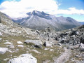
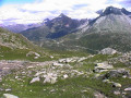
This seventh stage will take you from Gspon to Saas-Fee. This scenic route follows the Saastal valley as far as Saas-Grund. Very soon, the Balfrin will be your companion for the day, followed by the peaks of the Mischabel massif, including the Dom, which rises to 4,546 metres. Once you reach Saas-Grund, the final ascent to Saas-Fee involves a climb of just 200 metres.

This walk is part of a multi-day hike: From Airolo to Grimentz via the Alpine Passes Trail

Details

n°110754308
Creation:
Last update:
Last review:
–
  • Walking
    Activity: Walking
  • ↔
    Distance: 10.96 mi
  • ◔
    Average duration: 7h 35 
  • ▲
    Difficulty: Difficult

  • ⚐
    Back to start: No
  • ↗
    Ascent: + 2,884 ft
  • ↘
    Descent: - 3,163 ft

  • ▲
    Highest point: 7,461 ft
  • ▼
    Lowest point: 5,105 ft

Waypoints

  1. S : mi 0 - alt. 6,194 ft - Gspon – Hotel Alpenblick
  2. 1 : mi 0.16 - alt. 6,112 ft - Sign No. 6
  3. 2 : mi 1.57 - alt. 6,558 ft - Sign No. 6 – Finilu
  4. 3 : mi 1.91 - alt. 6,913 ft - Sign No. 6
  5. 4 : mi 2.54 - alt. 7,241 ft - Sign No. 6
  6. 5 : mi 4.25 - alt. 7,224 ft - Sign No. 6
  7. 6 : mi 5.26 - alt. 7,333 ft - Fork in the road
  8. 7 : mi 5.95 - alt. 6,877 ft - Sign No. 6 – Heimischgarten
  9. 8 : mi 6.27 - alt. 6,601 ft - Sign No. 6 – Oberi Brend
  10. 9 : mi 6.45 - alt. 6,407 ft - Sign No. 6 – Unneri Brend
  11. 10 : mi 6.65 - alt. 6,332 ft - Sign No. 6
  12. 11 : mi 7.8 - alt. 5,797 ft - Sign No. 6
  13. 12 : mi 8.8 - alt. 5,121 ft - Sign No. 6 – Saas Grund
  14. 13 : mi 9.22 - alt. 5,121 ft - Sign No. 6
  15. 14 : mi 9.73 - alt. 5,167 ft - Sign No. 6
  16. 15 : mi 9.87 - alt. 5,197 ft - Sign No. 6
  17. 16 : mi 10.3 - alt. 5,666 ft - Sign No. 6
  18. 17 : mi 10.72 - alt. 5,906 ft - Sign No. 6
  19. E : mi 10.96 - alt. 5,945 ft - Saas Fee – Hotel Marmotte

Notes

This hiking route follows the Alpine Passes Trail, which is marked on Swiss maps.

Signposting: at every major junction, you will find signposts:
- Sign No. 6 with a No. 6 sticker indicating this trail.
- R sign: Yellow sign with a hiker pictogram

Before setting off, it is advisable to check the Suisse Topo website for any trail closures and diversions. This information is updated in real time.

As well as the Visorando app, you can also download the swisstopo app ( free of charge), where you’ll find this information too.

Transport: Timetables

Weather: before setting off, check the Swiss Weather Service or Météo Blue

Hiking equipment, particularly good walking boots.

Accommodation:

Other walks in the area

For more walks, use our search engine .

The GPS track and description are the property of this route's author. Please do not copy them without permission.