In the Aletsch Forest and on the Aletsch Panorama Weg

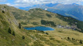
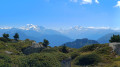
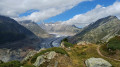
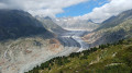
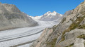
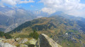
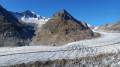
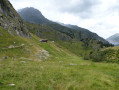
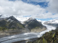
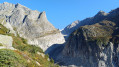
A circular walk starting from Bettmeralp. It passes through the village of Riederalp before climbing up to Rieder Furka. From this pass, you’ll descend through the beautiful Aletsch Forest to Silbersand. As you climb back up towards Alte Stafel, you’ll gradually come to see the Aletsch Glacier. At Moosfluh and along the ridge, you’ll enjoy panoramic views of the glacier. To the south, you can admire the 4,000-metre peaks, from the Weismiess to the Weisshorn via the Matterhorn. The return to Bettmeralp takes you past the lakes of Blausee and Bettmersee.

Details

102628181
Creation:
Last update:
Last review:
  • Walking
    Activity: Walking
  • ↔
    Distance: 8.85 mi
  • ◔
    Average duration: 5h 55 
  • ▲
    Difficulty: Difficult

  • ⚐
    Back to start: Yes
  • ↗
    Ascent: + 2,073 ft
  • ↘
    Descent: - 2,073 ft

  • ▲
    Highest point: 7,648 ft
  • ▼
    Lowest point: 6,142 ft

Photos

Waypoints

  1. S/E : mi 0 - alt. 6,335 ft - Bettmeralp – Bergstation
  2. 1 : mi 0.99 - alt. 6,198 ft - Riederalp
  3. 2 : mi 1.71 - alt. 6,293 ft - Route to Rieder Furka
  4. 3 : mi 2.36 - alt. 6,781 ft - Rieder Furka – Towards Moosfluh / Silbersand
  5. 4 : mi 3.64 - alt. 6,309 ft - Silbersand
  6. 5 : mi 3.95 - alt. 6,375 ft - Fork in the road towards Moosfluh
  7. 6 : mi 4.24 - alt. 6,598 ft - Junction towards Moosfluh
  8. 7 : mi 4.84 - alt. 6,880 ft - Junction
  9. 8 : mi 4.99 - alt. 7,014 ft - Turn-off towards Alte Stafel
  10. 9 : mi 5.37 - alt. 7,247 ft - Alte Stafel: viewpoint overlooking the glacier
  11. 10 : mi 5.71 - alt. 7,395 ft - Fork in the road towards Biel
  12. 11 : mi 5.92 - alt. 7,523 ft - Junction towards Moosfluh
  13. 12 : mi 6.23 - alt. 7,635 ft - Moosfluh: viewpoint overlooking the glacier
  14. 13 : mi 6.7 - alt. 7,379 ft - Fork in the road towards Blausee
  15. 14 : mi 6.85 - alt. 7,349 ft - Turn-off towards Blausee
  16. 15 : mi 7.07 - alt. 7,267 ft - Blausee
  17. 16 : mi 8.09 - alt. 6,581 ft - Bettmersee
  18. 17 : mi 8.3 - alt. 6,457 ft - Fork in the road for the Bettmeralp Bergstation cable car
  19. S/E : mi 8.85 - alt. 6,335 ft - Bettmeralp – Bergstation

Notes

Hike completed by the author on 27 July 2026

This hike starts and finishes at the Bettmeralp Bergstation.

  • Before setting off, it is advisable to check the Suisse Topo website for any trail closures and diversions. This information is updated in real time.
  • As well as the Visorando app, you can also download the swisstopo app ( free of charge), where you’ll find this information too.

Transport: Timetables
Weather:before setting off, check the Swiss Weather Service or Météo Blue
Hiking equipment, particularly good walking boots.

Worth a visit

  • Bettmeralp: one of Switzerland’s 11 car-free villages.
  • Rieder Furka and the Victorian-style Villa Cassel , dating from the early20th century.
  • The Aletsch Glacier, the largest glacier in the Alps, stretching 23 km in length.
  • Numerous vantage points overlooking the three- and four-thousand-metre peaks of Valais, such as the Matterhorn, the Weisshorn, the Weissmies and the Dom...
  • Numerous vantage points overlooking the Aletsch Glacier and the peaks of the canton of Bern, such as the Aletschhorn, the Mönch, the Sphinx and the Trugberg...
  • Märjelensee, the Gletscherstube and the dam.

Other walks in the area

For more walks, use our search engine .

The GPS track and description are the property of this route's author. Please do not copy them without permission.