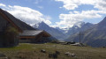
Grüben – Zinal

Stage2 of the northern section of the Tour du Cervin: this takes you to the Val d’Anniviers.
NB: Originally, we had planned to walk all the way from Grüben to Zinal, but in two stages: stage 1 from Grüben to the Hôtel Weisshorn, and stage 2 from the Hôtel Weisshorn to Zinal. For financial reasons, this wasn’t possible; so we carried on to Saint-Luc, from where a bus service took us to Zinal.
The first section (up to Meidu) does not follow the classic Tour du Cervin route; the section through the forest and mountain pastures between the end of the track and the buildings at Jäniltigu Oberstafil is no longer marked at all; that said, there are no particular difficulties: the track reflects the route I took, based on the path as shown on the maps and the terrain.

This walk is part of a multi-day hike: Tour du Cervin

Details

103652933
Creation:
Last update:
Last review:
  • Walking
    Activity: Walking
  • ↔
    Distance: 8.56 mi
  • ◔
    Average duration: 6h 50 
  • ▲
    Difficulty: Very difficult

  • ⚐
    Back to start: No
  • ↗
    Ascent: + 3,284 ft
  • ↘
    Descent: - 3,845 ft

  • ▲
    Highest point: 9,117 ft
  • ▼
    Lowest point: 5,446 ft

Description of the walk

(S) From the Schwartzhorn Hotel, followthe road to the right for 200 metres.

(1) Then take the footpath.

(2) Cross the stream at Jäniltigu. Please note: the path is poorly marked; you need to head straight west into the woodland and then join a track.

(3) Follow this track uphill.

(4) When you reach a hairpin bend, leave the track and head back up into the forest (which is not very dense; follow the grassy patches). You will then emerge onto the slopes of an alpine pasture.

(5) It’s easy to follow the cow tracks.

(6) You’ll eventually reach the alpine pasture buildings and then, after 100 metres along the track, join a well-marked path heading south-south-west; follow this to the left until you reach the Tour du Cervin path, a classic route.

(7) Turn right. You will then reach the Meidu–Oberstafel alpine pastures.

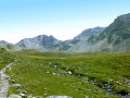
(8) Continue along the path which climbs west-north-west towards Lake Meidsee.

(9) Then head due west towards the Meidpass.

(10) The descent is steeper until you reach one of the branches of the Torrent de l’Armina.

(11) Continue descending to the left along a much quieter path.

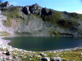
(12) At the junction, follow the path on the left which leads to Lac de Combavert.

(13) Turn right onto the path which rejoins the main track shortly afterwards. Keep to the left. The path continues to the Combavert mountain pasture buildings.

(14) Pass the buildings on your left, then keep to the right.

(15) Head down the Sentier des Cascades, which runs entirely through woodland but, as indicated on the signposts, is very rugged as it follows the course of the torrent and its waterfalls as closely as possible. An alternative is to take a ski run, but this is less interesting. Return to the track.

(16) Cut across this track and then continue straight ahead. When you reach the cross, keep to the right onto the Route du Funiculaire. Walk past the funicular station before reaching Saint-Luc (E).

Waypoints

  1. S : mi 0 - alt. 6,017 ft - Grüben (Hotel Schwartzhorn)
  2. 1 : mi 0.15 - alt. 5,945 ft - Path
  3. 2 : mi 0.4 - alt. 5,899 ft - Crossing the torrent
  4. 3 : mi 0.49 - alt. 5,984 ft - Path through the woodland
  5. 4 : mi 0.86 - alt. 6,473 ft - Sign indicating to leave the track
  6. 5 : mi 1.12 - alt. 6,755 ft - Start of the mountain pasture
  7. 6 : mi 1.31 - alt. 7,031 ft - Jäniltigu Oberstafil
  8. 7 : mi 1.95 - alt. 7,444 ft - Junction with the Matterhorn Trail
  9. 8 : mi 2.1 - alt. 7,644 ft - Meidu – Oberstafel
  10. 9 : mi 3.44 - alt. 8,760 ft - Lake Meidsee
  11. 10 : mi 4.11 - alt. 9,117 ft - Meidpass (2,800 m)
  12. 11 : mi 4.58 - alt. 8,602 ft - End of the steep descent
  13. 12 : mi 5.12 - alt. 8,182 ft - Fork in the road towards Lac de Combavert
  14. 13 : mi 5.5 - alt. 8,005 ft - Lake Combavert
  15. 14 : mi 6.45 - alt. 7,218 ft - Combavert mountain pasture
  16. 15 : mi 6.69 - alt. 7,037 ft - Torrent des Moulins, Sentier des Waterfalls
  17. 16 : mi 7.2 - alt. 6,188 ft - Back on the trail
  18. E : mi 8.56 - alt. 5,456 ft - Saint-Luc: bus stop

Other walks in the area

For more walks, use our search engine .

The GPS track and description are the property of this route's author. Please do not copy them without permission.