Rosswald – Simplon Hospiz

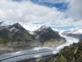
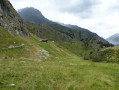
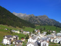
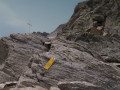
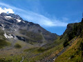
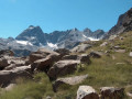
This fifth stage will take you from Binn to the Simplon Hospiz. The start of the route is pleasant and straightforward. After crossing the Mischibach, you’ll enjoy views of the Mischabel massif. You’ll need to navigate a few exposed sections – though these are well secured – to reach the Bortelhütte. The walk continues downhill until you cross the Furgguböümbach. From Bärufalla, a final climb takes you up to the Simplon Pass via Schallbett.

This walk is part of a multi-day hike: From Airolo to Grimentz via the Alpine Passes Trail

Details

n°110753339
Creation:
Last update:
Last review:
–
  • Walking
    Activity: Walking
  • ↔
    Distance: 11.77 mi
  • ◔
    Average duration: 8h 45 
  • ▲
    Difficulty: Very difficult

  • ⚐
    Back to start: No
  • ↗
    Ascent: + 3,825 ft
  • ↘
    Descent: - 3,261 ft

  • ▲
    Highest point: 7,300 ft
  • ▼
    Lowest point: 5,997 ft

Waypoints

  1. S : mi 0 - alt. 6,001 ft - Rosswald
  2. 1 : mi 0.36 - alt. 6,329 ft - Sign No. 6
  3. 2 : mi 1.59 - alt. 6,532 ft - Stafel
  4. 3 : mi 2.19 - alt. 6,476 ft - Sign No. 6
  5. 4 : mi 2.83 - alt. 6,444 ft - Sign No. 6
  6. 5 : mi 3.5 - alt. 6,398 ft - Sign No. 6
  7. 6 : mi 3.57 - alt. 6,355 ft - Sign No. 6
  8. 7 : mi 4.32 - alt. 6,785 ft - Sign No. 6
  9. 8 : mi 4.42 - alt. 6,909 ft - Sign No. 6 - Bortelhütte
  10. 9 : mi 5.82 - alt. 6,299 ft - Signpost No. 6 – Schrickbodo
  11. 10 : mi 6.08 - alt. 6,608 ft - Sign No. 6
  12. 11 : mi 7.47 - alt. 6,703 ft - Sign No. 6 – Wintrigmatta
  13. 12 : mi 7.79 - alt. 6,844 ft - Bärufalla
  14. 13 : mi 9.09 - alt. 7,165 ft - Sign No. 6
  15. 14 : mi 9.82 - alt. 6,365 ft - Sign No. 6
  16. 15 : mi 11.24 - alt. 6,542 ft - Sign No. 6
  17. E : mi 11.77 - alt. 6,572 ft - Simplon Hospiz

Notes

This hiking route follows the Alpine Passes Trail, which is marked on Swiss maps.

Signposting: at every major junction, you will find signposts:
- Sign No. 6 with a No. 6 sticker indicating this trail.
- R sign: Yellow sign with a hiker pictogram

Before setting off, it is advisable to check the Suisse Topo website for any trail closures and diversions. This information is updated in real time.

As well as the Visorando app, you can also download the swisstopo app ( free of charge), where you’ll find this information too.

Transport: Timetables

Weather: before setting off, check the Swiss Weather Service or Météo Blue

Hiking equipment, particularly good walking boots.

Accommodation:

Other walks in the area

For more walks, use our search engine .

The GPS track and description are the property of this route's author. Please do not copy them without permission.