From Märjelen Gletscherstube to Platta

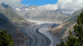
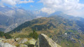
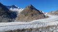
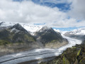
A magnificent route between Bettmeralp and Platta, with a viewpoint overlooking the Aletsch Glacier. You can admire the Aletsch Glacier all the way to Konkordia Platz, where several glaciers converge. This phenomenon forms the mid-moraines – lines of pebbles and rocks in the middle of the ice – which are clearly visible on the Aletsch Glacier. Along the way, before the tunnel under the Tälligrat, you can also see the Fischergletscher, another glacier in a valley further to the east.

Details

102724679
Creation:
Last update:
Last review:
  • Walking
    Activity: Walking
  • ↔
    Distance: 13.23 mi
  • ◔
    Average duration: 9h 20 
  • ▲
    Difficulty: Difficult

  • ⚐
    Back to start: Yes
  • ↗
    Ascent: + 3,737 ft
  • ↘
    Descent: - 3,717 ft

  • ▲
    Highest point: 8,527 ft
  • ▼
    Lowest point: 6,276 ft

Photos

Description of the walk

The start and finish of this hike are at the Betten–Bettmeralp–Bergstation cable car station.

(S/E) From the Bettmeralp top station, follow the main road (Hauptstrasse) north-eastwards to the junction with Seestrasse.

(1) Turn left onto Seestrasse, which becomes a track suitable for vehicles after the tennis courts. After a fairly steep climb, you’ll reach a junction.

(2) Take the path on the left and continue uphill to Bättmet-Hitta (Inn and Restaurant).

(3) Continue along the track, keeping straight on and following the signs for Fiescheralp. Walk through the village to the Eggishorn cable car station.

(4) At the signs for Märjelensee, take the path furthest to the left and head, on almost level ground, towards another junction.

(5) Turn left onto the track towards Märjelensee. After a few bends, you’ll reach the entrance to the tunnel beneath the Tälli ridge.

(6) Go through the 1-kilometre-long tunnel, which is lit approximately every 30 metres. Take care, as the tunnel is also used by cyclists.

(7) At the tunnel exit, head back to the Gletscherstube.

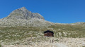
(8) Take the opportunity to have a break here. Refreshments are available at the Gletscherstube. At the signpost near the Gletscherstube, follow the sign for Platta.

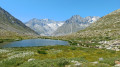
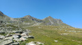
(9) Turn left towards Platta. Follow a good, almost flat path overlooking the small lake of Märjelensee, which leads to a viewing platform just above the Aletsch Glacier.

(10) Enjoy the superb panoramic view of the glacier and, in the distance, the Jungfrau, the Mönch, the Truberg and the Eiger, not to mention the Aletschhorn. Return via the same route as the outward journey, but in the opposite direction (S/E).

Waypoints

  1. S/E : mi 0 - alt. 6,276 ft - Bettmeralp – Bergstation
  2. 1 : mi 0.44 - alt. 6,411 ft - Seestrasse
  3. 2 : mi 0.8 - alt. 6,644 ft - Fork in the road towards Bättmer-Hitta
  4. 3 : mi 1.76 - alt. 7,133 ft - Bättmer-Hitta
  5. 4 : mi 3.11 - alt. 7,228 ft - Junction towards Märjelensee
  6. 5 : mi 3.74 - alt. 7,165 ft - Fork
  7. 6 : mi 5.09 - alt. 7,694 ft - Tunnel entrance
  8. 7 : mi 5.73 - alt. 7,700 ft - Tunnel exit
  9. 8 : mi 5.84 - alt. 7,776 ft - Gletscherstube Märjelen
  10. 9 : mi 5.91 - alt. 7,795 ft - Fork in the road towards Platta
  11. 10 : mi 6.6 - alt. 7,815 ft - Platta: viewing platform overlooking the glacier
  12. S/E : mi 13.23 - alt. 6,296 ft - Bettmeralp – Bergstation

Notes

Hike completed by the author on 28 July 2026

  • Before setting off, it is advisable to check the Suisse Topo website for any trail closures and diversions. This information is updated in real time.
  • As well as the Visorando app, you can also download the free swisstopo app, where you’ll find this information too.

Transport: Timetables
Weather: before setting off, check the Swiss Weather Service or Météo Blue
Hiking equipment, particularly good walking boots.
Tunnel under the Tälligrat: between the points (6) and (7) – a tunnel approximately 1 km long and lit. Take care, as it is also used by cyclists

Worth a visit

  • Bettmeralp and Fiescheralp: two of Switzerland’s 11 car-free villages.
  • The Aletsch Glacier, the largest glacier in the Alps, measuring 23 km in length.
  • Numerous vantage points overlooking the three- and four-thousand-metre peaks of Valais, such as the Matterhorn, the Weisshorn, the Weissmies and the Dom...
  • Numerous vantage points overlooking the Aletsch Glacier and the peaks of the canton of Bern, such as the Aletschhorn, the Mönch, the Sphinx and the Trugberg...
  • Märjelensee, the Gletscherstube and the dam.
  • The Bettmerhorn
  • The Eggishorn

Other walks in the area

For more walks, use our search engine .

The GPS track and description are the property of this route's author. Please do not copy them without permission.