Gruben – Hotel Weisshorn

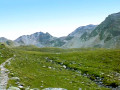
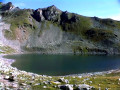
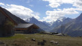
This tenth stage will take you from Gruben to the Hotel Weisshorn. The route begins in the last village of the Turtmann Valley and, via a steep climb, leads to Lake Meidsee, about 100 metres below the pass. The Meid Pass marks the border between German-speaking and French-speaking Valais. The descent from the Meid Pass is pleasant. In Combavert, there is one final climb to reach the historic Hotel Weisshorn.

This walk is part of a multi-day hike: From Airolo to Grimentz via the Alpine Passes Trail

Details

n°110755325
Creation:
Last update:
Last review:
–
  • Walking
    Activity: Walking
  • ↔
    Distance: 6.62 mi
  • ◔
    Average duration: 6h 10 
  • ▲
    Difficulty: Difficult

  • ⚐
    Back to start: No
  • ↗
    Ascent: + 3,583 ft
  • ↘
    Descent: - 1,936 ft

  • ▲
    Highest point: 9,117 ft
  • ▼
    Lowest point: 5,971 ft

Waypoints

  1. S : mi 0 - alt. 6,024 ft - Gruben – Hotel Schwarzhorn
  2. 1 : mi 0.08 - alt. 5,974 ft - Sign No. 6 – Meiden
  3. 2 : mi 0.24 - alt. 6,020 ft - Sign No. 6
  4. 3 : mi 1.35 - alt. 7,431 ft - Sign No. 6 – Meidu Mittilstafil
  5. 4 : mi 1.5 - alt. 7,628 ft - Sign No. 6 – Meidu Oberstafil
  6. 5 : mi 2.84 - alt. 8,766 ft - Sign No. 6 - Meidensee
  7. 6 : mi 3.52 - alt. 9,104 ft - Sign No. 6 - Meidpass (2790 m)
  8. 7 : mi 4.01 - alt. 8,622 ft - Sign No. 6
  9. 8 : mi 4.9 - alt. 7,982 ft - Sign No. 6
  10. 9 : mi 5.46 - alt. 7,487 ft - Sign No. 6
  11. 10 : mi 5.71 - alt. 7,241 ft - Signpost No. 6 – Combavert
  12. 11 : mi 5.9 - alt. 7,257 ft - Sign No. 6
  13. 12 : mi 6.5 - alt. 7,661 ft - Sign No. 6
  14. E : mi 6.62 - alt. 7,674 ft - Hotel Weisshorn

Notes

This hiking route follows the Alpine Passes Trail, which is marked on Swiss maps.

Signposting: at every major junction, you will find signposts:
- Sign No. 6 with a No. 6 sticker indicating this trail.
- R sign: Yellow sign with a hiker pictogram

Before setting off, it is advisable to check the Suisse Topo website for any trail closures and diversions. This information is updated in real time.

As well as the Visorando app, you can also download the swisstopo app ( free of charge), where you’ll find this information too.

Transport: Timetables

Weather: before setting off, check the Swiss Weather Service or Météo Blue

Hiking kit, including good walking boots.

Accommodation:

Other walks in the area

For more walks, use our search engine .

The GPS track and description are the property of this route's author. Please do not copy them without permission.