


Refine your search for walks in Thuir
Thuir walks


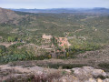
 Circular route in the Aspres via Castelnou
 Visorando Member
 11.56 mi
 +2,379 ft
 -2,352 ft
 7h 25
 Difficult
 Departure from Thuir (Pyrénées-Orientales)
A long circular route starting from Thuir, winding through a landscape of heath and limestone. A visit to one of the most beautiful villages in France will allow you to explore the castle and the medieval site of Castelnou and, further on, the hilltop chapel of Sant Martí de la Roca. Splendid views of the Roussillon plain, the Albères mountain range, the Pyrenees and the Canigou massif, as well as the Fenouillèdes and the Corbières, can be enjoyed throughout the route.
Roc Majorque from Sainte-Colombe-de-la-Commanderie
7.81 mi
+1,309 ft
-1,283 ft
4h 45
 Moderate
Departure from Sainte-Colombe-de-la-Commanderie (Pyrénées-Orientales)
Starting from the village of Sainte-Colombe-de-la-Commanderie, we will take paths through the heath to Castenou, one of the most beautiful villages in France, then on to Roc Majorque with a 360° view of the Roussillon plain.
 Route in the Aspres
9.66 mi
+902 ft
-889 ft
3 hrs
Moderate
Departure from Terrats (Pyrénées-Orientales)
Here is a lovely walk that takes place in the foothills of the Aspres, at the foot of Mont Canigou.
Roc de Majorque in Castelnou
 2.98 mi
+738 ft
-741 ft
2h 00
 Easy
Departure from Pyrénées-Orientales
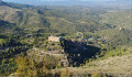
This loop offers breathtaking views of the castle and village of Castelnou from Roc de Majorque. It was from this highest point that several destructive attacks were launched on the castle.
From Castelnou to Camélas
 5.92 mi
+1,004 ft
-1,004 ft
3h 35
Moderate
Departure from Pyrénées-Orientales
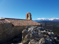
A beautiful heritage getaway in the heart of the Aspres. However, pay attention to strategic points as this is an unmarked hike.
The starting point is at the car park (unfortunately subject to a charge) of the Sainte-Marie du Mercadal Church (listed as a Historic Monument).
Discovering the two Corbères
 7.27 mi
+994 ft
-984 ft
4h 15
Moderate
Departure from Corbère-les-Cabanes (Pyrénées-Orientales)
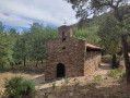
A superb getaway in the heart of Catalan heritage, punctuated by chapels, panoramic views and history.
Força Réal Hermitage from Corneilla-la-Rivière
 10.71 mi
+1,545 ft
-1,545 ft
6h 15
Moderate
Departure from Corneilla-la-Rivière (Pyrénées-Orientales)
You will cross dirt tracks and a few tarmaced sections, through vineyards, heath and olive groves... which will take you to Castell de Força Réal, at an altitude of 507 m...
No particular difficulty apart from the climb up the north face to the observation post.
Once at the top, enjoy a picnic and discover the breathtaking view of the Canigou massif and the Têt valley...
You can even see the sea on a clear day.
Return via some very pleasant paths...
Chapels of Sant Amanç and Vallpuig from Montauriol
 6.50 mi
+715 ft
-719 ft
3h 35
Moderate
Departure from Montauriol (Pyrénées-Orientales) (Pyrénées-Orientales)
The hike is mainly on beautiful trails, mostly wooded and dotted with various information panels. There are many beautiful landscapes. Unfortunately, two chapels are closed along the route (20 April 2023), but there is an old well and an information panel explaining how the forest landscape is maintained through traditional pastoral farming.This hike is called the Iron Trail, used by the Romans to transport iron from the Batère mines. It passes through the pretty hamlet of Els Hostalets.This hike can be done by mountain bike.
Mount Helena
 6.09 mi
+1,355 ft
-1,355 ft
4h 00
Moderate
Departure from Caixas (Pyrénées-Orientales)
Starting from the town hall in Caixas, the ascent of Mont Helena, the highest point in the area, offers a few surprises in terms of heritage and botany. And above all, an extraordinary panorama of the Roussillon.
Néfiach circular loop
 4.91 mi
+738 ft
-741 ft
2h 55
Easy
Departure from Néfiach (Pyrénées-Orientales)
This circular route in the hills above Néfiach takes you on a route through the heath along various paths and tracks. Starting from the ford, it climbs towards Caladroy without actually reaching it, as it descends back into the valley below Caladroy, passing close to Pic Haut, which can be visited as an optional detour.
Route from the Battle of Le Boulou to Tresserre
7.45 mi
+715 ft
-738 ft
4h 05
Moderate
Departure from Tresserre (Pyrénées-Orientales)
Circular loop following the route of the Battle of Le Boulou with numerous information panels. You will also pass by the small Saint-Luc Chapel, which has been restored.
Serrat de la Pedrera
 4.15 mi
+282 ft
-262 ft
2h 10
Easy
Departure from Calce (Pyrénées-Orientales)
This circular walk, located in the commune of Pézilla-la-Rivière - Calce, circles the Serrat de la Pedrera. Starting from the recycling centre, it follows vineyard paths, then a track through the heath. This is followed by a descent towards the Mas de les Fonts, then the return via vineyard paths.
Ille-sur-Têt - Montalba-le-Château - Rodès via old paths and canals
 12.77 mi
+1,660 ft
-1,670 ft
7h 20
Difficult
Departure from Ille-sur-Têt (Pyrénées-Orientales)
A hike to explore this low-lying mountain range, which was once farmed by humans. Numerous terraces bear witness to this past. Vines were once cultivated here. Mechanisation brought an end to farming in these wild and hard-to-reach areas.Yellow markings are virtually non-existent, and recent directional posts have been installed (as observed at the end of January 2024). These are not particularly relevant to the route. A GPX track is essential for this route, which features numerous paths.
Author’s note: The main sites of the fires in early July 2026 in the Pyrénées-Orientales were Ille-sur-Têt and Rodès. This walk has been affected by them. Much of the vegetation has been destroyed.
The tour of Lake Villeneuve-de-la-Raho
4.33 mi
+39 ft
-39 ft
2h 00
Easy
Departure from Villeneuve-de-la-Raho (Pyrénées-Orientales)
A pleasant walk around the Villeneuve de la Raho lake with a semi-wild section where you can see a large number of birds.
Boule d'Amont - Coll de Seleig - Coll de Les Arques - Serrabona
 8.41 mi
+2,480 ft
-2,454 ft
6h 00
Moderate
Departure from Boule-d'Amont (Pyrénées-Orientales)
The suggested walk takes you up to the ridge, where you can enjoy a superb panoramic view.Serrabona Abbey, on the route described, is well worth a visit. This site, which is in excellent condition, is currently being refurbished.An additional route starting from Serrabona can be added to this hike. *The walk will be moderately difficult (sense of direction required) and will take an extra hour and a half.Please note. Observed on 14 January 2024: after the (6), the track has been widened, the pastures cleared, and trees felled. The original path is very difficult to follow: the markings and posts have disappeared! The GPX track is very useful from this point onwards.
 Circular walk around Villeneuve-de-la-Raho
14.27 mi
+154 ft
-154 ft
2 hrs
Easy
Departure from Villeneuve-de-la-Raho (Pyrénées-Orientales)
A pleasant circular route that mainly follows cycle paths, plus a short stretch of track easily accessible on a hybrid bike. You’ll cross the plains of Roussillon (vineyards, but also a lot of wasteland these days…) through unspoilt countryside. You’ll pass through three villages without any particular difficulty (no traffic).
Snow wells – Coll de les Arques, de Saleig, de l'Aspic from Serrabona
 6.90 mi
+2,001 ft
-1,975 ft
4h 55
Difficult
Departure from Boule-d'Amont (Pyrénées-Orientales)
A beautiful hike, with a significant section along the ridge, which requires the use of a GPS or the Visorando app.
Take care on the steep descent between (6) and (7). Hike classified as difficult (no signposting, sense of direction).
Early January 2024: path blocked from the Coll de les Arques. Then, after the Coll de Saleig, tree felling, pasture clearing and track widening have removed all the markings and directional signs! At Coll de l’Aspic: a large area has been cleared and widened! So no more markings; the only landmark is the old blue van at this pass.
The landscape, stretching as far as the eye can see, remains as beautiful as ever.
You should allow around 5 hours to complete this circular route, including breaks and trips to the viewpoints.
The .gpx track may prove useful at the start of the route from (2) to (6), and from (13) to (14).
Serrabonne ridge circular walk
5.50 mi
+1,765 ft
-1,749 ft
4h 05
Moderate
Departure from Boule-d'Amont (Pyrénées-Orientales)
This circular route goes around the ridges of the Serrabone priory in the Eastern Pyrenees. Starting from the priory, the trail climbs to the right towards the ridges, then follows them before descending back to the priory. Landscape of moorland and heath in the mid-mountains. The hike can be continued with a visit to the Serrabone priory in the commune of Boule d'Amont.
Circular route from Saint-Jean-Pla-de-Corts to Sant Ferriol
 Association / Club / Walk leader7.79 mi
+951 ft
-945 ft
4h 25
Moderate
Departure from Saint-Jean-Pla-de-Corts (Pyrénées-Orientales)
A pleasant hike starting from Saint-Jean-Pla-de-Corts, especially during the mimosa season, to reach the Hermitage of Sant Ferriol via the Serra del Mas d'en Janet ridge. On the way back, visit the exterior of Aubiry Castle. Several viewpoints over Céret and the Canigou massif.
Tracks, paths and dirt trails, with a tarmac road on the return journey. No difficulties along the route.
The Chemin de Vivès and the Sentier du Liège from Saint-Jean-Pla-de-Corts
 9.25 mi
+1,181 ft
-1,178 ft
5h 15
Moderate
Departure from Saint-Jean-Pla-de-Corts (Pyrénées-Orientales)
From Saint-Jean-Pla-de-Corts, these two marked trails lead up to Vivès and then Llauro*.E beautiful hike on wide, comfortable paths and tracks, which can be split into two.The markings are visible in the direction described.The return from Llauro is along a ridge path and then from the (12) along a DFCI track.Not recommended for those who do not like tracks and wide paths.Fortunately, the landscape makes up for this monotony.
The starting point is accessible by "€1 bus" from Perpignan or Argelès via Le Boulou, for example.
Circular around the ponds of Saint-Jean-Pla-de-Corts
3.90 mi
+62 ft
-62 ft
1h 50
Easy
Departure from Le Boulou (Pyrénées-Orientales)
A pleasant walk for the whole family around the ponds. Water activities available in summer, tree-top adventure course, meeting place for anglers.
In search of the boundary markers of 1258
 6.90 mi
+938 ft
-945 ft
4h 00
Moderate
Departure from Bélesta (Pyrénées-Orientales) (Pyrénées-Orientales)
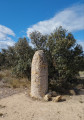
Before the current border was established, Roussillon was officially part of Spain between 1258 and 1659.
Very few boundary markers from this original border remain.
The trail allows you to discover three of them, as well as a cave and an ice well; it also offers superb views of the Pyrenees and the Corbières.
The Chapel of Saint-Philippe and La Font Sant Martí in Le Boulou
 2.76 mi
+381 ft
-390 ft
1h 35
Easy
Departure from Le Boulou (Pyrénées-Orientales)
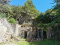
Short hike with a slight incline on the first part of the route.
Pic Aubeill
 4.90 mi
+755 ft
-719 ft
2h 55
Easy
Departure from Bélesta (Pyrénées-Orientales) (Pyrénées-Orientales)
This circular route, marked in yellow, starts from the village of Belesta and climbs up to Pic d'Aubeil, then descends towards the sheepfold, the dolmen and finally the village.
The Hermitage of Notre-Dame de Pène
 0.88 mi
+325 ft
-325 ft
0h 40
Easy
Departure from Cases-de-Pène (Pyrénées-Orientales)
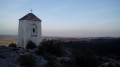
A short climb on a rocky trail leads to an old hermitage in a superb setting with a beautiful view from the top.
The Coll de Formenta from Saint-Marsal via Taulis
 8.84 mi
+2,270 ft
-2,267 ft
6h 00
Moderate
Departure from Saint-Marsal (Pyrénées-Orientales)
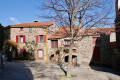
A discovery walk in the Aspres.
From Saint-Marsal, a descent through the forest along a path to the ruins of the Molí d’en Just (watermill) and an ascent to Taulis.
The rest of the route to Coll de Formenta is based on the ‘Coll de Formentera’ walk starting from Taulis, by Hubert Gites-Vallespir.
From the Coll de Formenta, a picturesque return route along the old railway line (tunnel). A descent to the Pla de l’Abbella, then a walk along an ancient Roman road to the Collada del Pou (small pass of the snow well). The route then follows a firebreak track to Saint-Marsal. The scenery, the passage through Santa Creu (Holy Cross) and the Rochers de la Fustera (carpenter’s forest) add charm to the otherwise monotonous track.
The route description, map and GPX track are essential.
Roc Rodon
 9.46 mi
+1,644 ft
-1,640 ft
5h 45
Moderate
Departure from Cases-de-Pène (Pyrénées-Orientales)
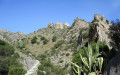
A climb to Roc Rodon which, despite its modest altitude, offers exceptional views of the Pyrenees and the Corbières. After passing the Hermitage of Notre-Dame de Pène, a long ridge walk leads to the village of Calce. The route continues through the vineyards, leading to the Chapel of Sainte-Catherine before climbing back up to the ridge and returning to the starting point via a balcony path overlooking the Agly valley. A very varied and exotic route on the outskirts of Perpignan.
Bucolic walk to the Bachous Pond
 3.33 mi
+59 ft
-59 ft
1h 35
Easy
Departure from Villelongue-dels-Monts (Pyrénées-Orientales)
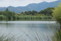
A lovely walk for the whole family. You will walk alongside the vineyards on your right on the way there. Then the vineyards give way to wild nature on easy paths leading to the Étang des Bachous, a lake known for fishing.
The mining history of Les Aspres
 10.82 mi
+2,566 ft
-2,575 ft
7h 15
Difficult
Departure from Saint-Marsal (Pyrénées-Orientales)
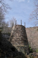
Mountain passes, the Els Menerots open-cast mines, old miners’ buildings, a roasting furnace, hoppers, a former mining railway line, mine trolleys, a tunnel, and finally, a Roman road and a snow pit.All these points of interest punctuate this beautiful and unusual route through this Catalan mountain range, which was long exploited for its iron ore.The route consists of a mix of road and track.The signposting is in good condition, but the GPX track will be a real help in some places, despite the accurate IGN base map.
Mimosa circular in Céret
 7.14 mi
+1,079 ft
-1,079 ft
4h 15
Moderate
Departure from Reynès (Pyrénées-Orientales)
This is a pleasant route in the foothills of Vallespir, above Reynes, where you can enjoy the scent and colour of the mimosas in mid-February and the cork oak forests (suberaies). There are several viewpoints offering views of the Sant-Ferriol Chapel, the town of Céret, the Tech Valley and the Canigou Massif.
Saint-Paul circular
2.60 mi
+492 ft
-489 ft
1h 40
Easy
Departure from Reynès (Pyrénées-Orientales)
A short walk around the Chapel and the Mas de Sant-Pau. Beautiful panoramic views of Reynes and Céret.
First part along the tarmac road (very little traffic) then along the paths.
From the Pont du Diable in Céret to the Château d'Aubiry
 4.49 mi
+823 ft
-840 ft
2h 45
Easy
Departure from Céret (Pyrénées-Orientales)
A short, easy family walk that takes you from the beautiful Pont du Diable bridge in Céret to the Château d'Aubiry and its grounds. The imposing Canigou massif dominates the Têt valley in the distance. The château was built by Jean Bardou (founder of the JOB brand) for one of his children.
Coll de Formentera, starting from Taulis
5.19 mi
+1,867 ft
-1,867 ft
4h 00
Moderate
Departure from Taulis (Pyrénées-Orientales)
This walk connects the village of Taulis directly to the Coll de Formentera, from where you can set off on several other walks. Please note that this is a new route currently being signposted, most of which does not appear on the various base maps.
Batère Tower via the Col de Formentera
 8.90 mi
+2,907 ft
-2,933 ft
6h 40
Moderate
Departure from Taulis (Pyrénées-Orientales)
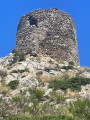
This is a beautiful round-trip hike that can be done in summer as it takes place mostly in the woods and on the northern slope for the most part. The trail markings, which were recently redone (PR® Yellow), make it easy to follow the path from Taulis to the Col de Formentera. The Tour de Batère, at the end of the hike, crowns the outing with beautiful 360° views.
Former talc mine from Pont de Reynès
6.92 mi
+1,775 ft
-1,788 ft
4h 45
Moderate
Departure from Reynès (Pyrénées-Orientales)
An easy hike through the woods on good paths, mostly signposted, which will take you to the
remains of the old talc mine.
 Circular route between Estagel and Tautavel
14.28 mi
+702 ft
-666 ft
1h 13
Moderate
Departure from Estagel (Pyrénées-Orientales)
A short cycle route between the Corbières and the Fenouillet plain, through vineyards and the heath. The village of Tautavel is world-famous for the discovery, at the ‘Grotte de la Caune de l’Arago’ site, of the skull of the oldest man in Europe.
The Tautavel Tower
 5.05 mi
+1,555 ft
-1,558 ft
3h 40
Moderate
Departure from Cases-de-Pène (Pyrénées-Orientales)
This is an alternative way to the Tour de Tautavel from Cases-de-Pène. Advantage: sheltered from the tramontana wind. Disadvantage: sunny in summer.
The mysterious Touréze
 6.97 mi
+1,250 ft
-1,230 ft
4h 20
Moderate
Departure from Latour-de-France (Pyrénées-Orientales)
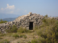
This circular loop, starting from Latour-de-France, takes you around the Touréze massif, with visits to several stone orri dotted along the route. Southern heath and a mix of tracks, roads and paths.
The six fountains and the Coll de l'Espinassa from Montesquieu-des-Albères
 6.84 mi
+1,827 ft
-1,841 ft
4h 45
Moderate
Departure from Montesquieu-des-Albères (Pyrénées-Orientales)
A beautiful, steady climb to Coll de l'Espinassa (Espinàs). It is entirely possible to follow the track to the large picnic area in order to maintain a constant gradient.There are no fewer than six working fountains on the way to the pass (10). Then there is a very steep descent to the picnic area passed on the way there (6). And a pleasant return to the village.During the hike, sheltered from the tramontane wind, there are views of the Roussillon plain, Les Aspres and Canigou.
The GPX track is necessary on this route given the paths taken, which are not necessarily maintained.It is possible to do this hike in the opposite direction, starting from the Trois Vents fountain (6), so that the return trip along the track is less steep. The aim of the hike is to reach the Coll de l'Espinàs (10), and the return journey can simply be made by the same route.
Sant Cristau from Montesquieu via Espinassa and the Mary Fort Gardens
 7.14 mi
+2,808 ft
-2,789 ft
5h 45
Difficult
Departure from Montesquieu-des-Albères (Pyrénées-Orientales)
A lovely well-maintained path and another very steep one lead up to the track heading for the Coll and the Espinassa Fountain. From the Coll de Llinàs, there is a lovely climb up to Sant Cristau.The return route passes by the Font de Sant Cristau, a lovely forest and a cross. To give your knees a rest, the rest of the descent follows a track and a path through Mary Fort’s abandoned gardens.During the walk, there are views over the Roussillon plain, the Canigou, etc.The .gpx track is strongly recommended and even essential in some places.
Sant Joan d'Albera and Coll de Sant Joan from Montesquieu-des-Albères
 8.74 mi
+3,474 ft
-3,461 ft
7h 05
Difficult
Departure from Montesquieu-des-Albères (Pyrénées-Orientales)
A fairly long circular walk in the Albères.
A good sense of direction is essential, as the route, which is marked with cairns in places, is signposted in different colours.
New signposts have been installed. Unfortunately, the signs have been removed in some places.
Accessible by public transport, bus for €1, see practical information.
Coll Palomeres and La Creu d’en Turon from La Bastide
 4.41 mi
+1,247 ft
-1,243 ft
3h 05
Moderate
Departure from La Bastide (Pyrénées-Orientales)
Partially signposted walk. The only difficulty is the steep climb up Coll Palomeres (S/E) to the highest point of Els Espinassets (altitude 1,173 m) (6).The ridge path from Coll Palomeres to Creu d’en Turon offers a 360° panoramic view.
Coll Palomeres - Creu d'en Turon - Santa Anna from La Bastide
 6.91 mi
+2,070 ft
-2,064 ft
5h 00
Moderate
Departure from La Bastide (Pyrénées-Orientales)
A beautiful hike in the open air with the aim of climbing Santa Anna dels Quatre Termes. First, a climb to Coll Palomeres, then a very beautiful ridge path to reach Creu del Turon (crossroads on the hill). Then a steep climb to reach the ruins of the chapel located on the cadastral boundary of four municipalities (hence its name). The return via the Chemin Rural from Creu d'en Turon is very interesting. Marked path on private property: please respect the areas you pass through and close gates and fences behind you.
Laroque Waterfall from Laroque-des-Albères
 3.17 mi
+604 ft
-604 ft
2h 00
Easy
Departure from Laroque-des-Albères (Pyrénées-Orientales)
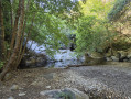
A picturesque walk starting from Laroque-des-Albères that will take you to the Laroque Waterfall. Along the way, you can climb up to the castle tower to enjoy the view; you’ll also pass by the Font de la Vallauria and the Moulin del Pava.
Pic d'Aureille from Laroque-des-Albères
7.86 mi
+2,986 ft
-2,992 ft
6h 15
Difficult
Departure from Laroque-des-Albères (Pyrénées-Orientales)
This peak is less well known than its neighbour, Pic Néoulous (Pic Neulos). Marked trail (PRLAR11) on beautiful paths through the woods in the Albères.
Puig d’Orella, Coll de l’Ullat, Casot d’en Lic from Laroque-des-Albères
 7.76 mi
+3,035 ft
-3,035 ft
6h 15
Difficult
Departure from Laroque-des-Albères (Pyrénées-Orientales)
All in all, a fairly challenging hike in places due to the steep gradient.
At Puig d’Orella, a beautiful viewpoint awaits you.
At Coll de l’Ullat, the view is also lovely and a welcoming chalet bar-restaurant awaits you.
At Casot d’en Lic, you can see information boards about the flora of the Albères.
See practical information regarding the Ribera de Roca section following heavy rain.
Tour de Batère, Col de Formentera and Pla de les Eugues
 4.61 mi
+1,010 ft
-1,033 ft
3h 00
Moderate
Departure from Corsavy (Pyrénées-Orientales)
A short, easy walk offering beautiful views of the eastern face of the Canigou massif from the Tour de Batère. You can also see the seaside resorts of Argelès-sur-Mer and others as you head north along the coast.