Country:

 City:


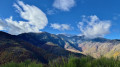
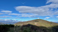
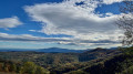
On entering Céret from Le Boulou, take thefirst road on the right (D615) towards Llauro. At the Coll de Llauro, turn left towards Oms (D13). At Oms, head towards Calmeilles (D13). From Calmeilles, head towards Coll d’en Forto, La Trinité and Saint-Marsal. At Coll d’en Forto (Fourtout), turn left towards Saint-Marsal, La Bastide (D618) and La Trinité. At Coll d’en Xatard, turn right towards La Bastide (D13). The roads are in very good condition, narrow and winding.
(S/E) From the campsite car park, head up the D13 towards Coll Palomeres for 50 metres.
Yellow markings
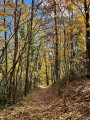
Turn left onto the flat, grassy track. Pass by the community hall. Climb steeply up a path between two low stone walls. Pass through and close a wire fence acting as a barrier. Climb up into the mountain pasture, making sure to follow the yellow markings. Walk alongside a forest on your left, then enter it and continue climbing along a good path. Pass through and close an electric wire fence with an insulated handle, and you’ll immediately come out onto the D13.
(1) Cross the road (very little traffic) and head uphill into the forest opposite. Cross a small grassy track and come out onto the D13.
(2) Cross it and head diagonally across, then come out onto the D13 again and follow it to the left for a few metres.
(3) Cross it, step over a small ditch and head uphill opposite, below a pretty farmhouse. Then head down to the D13 and follow it along the left-hand verge. Walk alongside a wire fence belonging to the Cortal d’en Bas estate (dogs present). Look out for the ‘Turn right’ sign on a post.
(4) Cross the road and head up the slope opposite into the woodland. Much further on, head downhill and rejoin the D13 one last time. Follow it along the left-hand verge, then keep right until you reach Coll Palomeres.
No signposting. Red paint marks may serve as a guide.
(5) Leave all tracks and paths on your left, the D13 straight ahead and the GRP® on your right. Turn sharply to the right, heading due north despite the Yellow Cross and the Red Cross. Climb steeply up this rugged path. Go round a tree that is blocking the path. Stay on the ridge on the left-hand side of the fence. Pass through the gaps in the cross-fences. Reach the highest point, Els Espinassets, at an altitude of 1,173 metres. Stunning 360° views. A lovely spot for a break.
(6) Descend, continuing due north. The villages of Valmanya and Baillestavy are clearly visible on the left.
If the cleared path allows (as observed in mid-November 2026), continue along the ridge on the left-hand side of the fence, following the suggested route.
- Otherwise, go over a large homemade gate and simply head down the grassy track on the right-hand side of the fence.
Much further on, you’ll reach the open area of Creu d’en Turon. Beautiful 360° views. A lovely spot for a break.
White and yellow markings
(7) Turn sharply right onto a small track and follow it for a few metres. Look out for a ‘Turn left’ sign on the right and a steel gate on the left.
(8) Go through and close the gate behind you , then head down a charming hillside path. Pass through a wetland area with a metal drinking trough. There may be sheep and a Patou dog in the area. Join a rough track and follow it steadily downhill. After a sharp bend to the right and crossing a stream, look out for a ‘Turn left’ sign.
(9) Turn sharply left, heading north, onto another smaller track leading to a pretty gate (private property).
(10) Just before this, head down to the right along the wire fence. Go through and close a small metal gate (as observed in mid-November 2026). Much further down, go through and close a large metal gate and immediately join the D13.
(11) Follow it to the left and, further on, join the (S/E).
 Visorando Member

 Difficult