Country:

 City:
City:


To get to the start:
- Either, at the entrance to Céret, just before the Pont du Diable, turn right onto the D615 towards Llauro. At the Coll de Llauro, turn left onto the D13 towards Calmeilles, passing through Oms, and head for the Coll de Forto (Col du Fourtou). Continue left onto the D618 to Saint-Marsal.
- Or, from Amélie-les-Bains, cross the River Tech and take the D618 towards Palada and Taulis to reach Saint-Marsal.
Park in the car park in the village square (Agence Communale).
Off the marked route
(S/E) From the car park, head down the D618 towards the south-west, keeping to the left-hand verge for 250 metres. You will reach the sign marking the village boundary, just below the last house on the right at the top of the hill.
Scattered old markings: yellow and red-and-white barrier tape (observed in November 2024).
(1) Just before the low protective wall at the side of the road, head down to the left, below the road. Initially running along the hillside, beneath the road’s retaining wall, the path descends steeply, generally heading south, then, after four hairpin bends, turns right (alt. 610 m), south-west for 200 m, until you reach an ambiguous fork (alt. 565 m) with a cairn on the opposite side and barrier tape in place.
(2) Caution: do not continue descending to the left.
Keep to the right along the hillside, heading west. Pass the Còrrec de les Postes and climb up to the left, due south, along a wider path, until you reach a high point in a rocky passage. Then begin a fairly steep descent along a good, stony path with hairpin bends. At the bottom, you’ll reach the banks of the Rivière de Saint-Marsal; without crossing it, follow the river to the right (on the left bank) for about 100 metres until you reach the ruins of the Molí d’en Just and its footbridge, which is now unusable due to its height.
(3) Forde the river at this point and climb very steeply until you reach a track that is partly overgrown with grass. Follow it to the left, climbing steadily. Pass a track on the right leading to a farmhouse, another on the left, and, whilst continuing to climb gently, you will reach a road (D618).
Unmarked
(4) Follow it to the left along the left-hand verge until you reach the entrance to Taulis, with its car park situated higher up on the right. Make sure you stay on the left-hand side on a pavement marked on the ground by a line. Cross at the next pedestrian crossing and go through the wooden gate. Walk up through the grass and you’ll immediately spot a large cairn.
(5) Head up to the right, south-west, skirting a property on your left, and join a road at a bend.
(6) Continue straight ahead, again following a property on your left, until you reach a wide, motorised track (Route du Col de Formentère).
(7) Cross it and continue the climb straight ahead, through the Parc aux Chênes, heading towards two enormous water tanks used for firefighting. Go round them on the right and continue left along the wide, ascending track. Very soon, look out for a yellow marker on the right on a path leading up towards the pastures.
Scattered old yellow markings and red-and-white barrier tape (observed in November 2024)
(8) From this point onwards, be sure to follow the old yellow markings that are still in place.
Climb up this path, go over the fence and, after 50 m, look out for a tree on your left. Then turn left towards it. Keep it on your right and continue south-west along the edge of the field. Much further on, at the edge of a wood, go through another fence, climb a little, then pass by a small water trough for animals. Go through a final fence and you’ll immediately come to a track.
(9) Cross it, look out for a cairn, go round it on the right and head uphill opposite (slightly to the right) along a lovely path; much higher up, you’ll come to a bend in a grassy track.
(10) Continue climbing to the left along this cleared track, which bends to the left, then stay beneath the high-voltage power line – which confirms you’re heading in the right direction – and reach the end of the track, which is no longer maintained.
(11) Leave it and head up to the left, following the small cairns. The path turns left and climbs steeply. You’ll reach another grassy track.
(12) Follow it to the right for about 70 m until you come to a path on the left, marked by a cairn at its start.
(13) Climb steeply to the left along this narrow path, heading almost due south. The path then curves to the right, turning due west and passing under the high-voltage power line once more. You’ll emerge onto another track.
(14) Cross it and follow the path continuing due west. You’ll reach the bottom of the valley and head completely to the left, climbing steeply to join a track suitable for vehicles. Follow it to the right, pass a movable fence for mountain bikes and reach the Coll de Formentera. Old water cistern 421, painted green as a landmark.
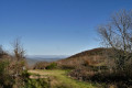
(15)A vast and very beautiful spot for a restorative break with stunning scenery. Head right along a flat stretch for 90 metres. The signposts are of no use for the rest of the route.
Ignore the climb up theGRP® and the first track on the left.
Off the marked route
(16) At the information board here, go through the gate and continue along the flat section of the old railway line. Much further on, go through a curved tunnel and then reach a crossroads in the forest with a wide variety of signposts!
Scattered old yellow markings
(17) Head down to the right, towards Saint-Marsal, along a good but fairly steep path. Leave the forest and arrive at a former grazing area known as the Pla de l’Abella, at the start of a track suitable for vehicles leading to Saint-Marsal (elevation 1040).
Take care: there are no signposts and neither markings nor signage are present; the area is confusing.
(18) Make a quick first turn right then left and head off parallel to the track on the left along the Roman road. Very soon, you’ll pass an area with grooves cut into the stone, left by the wheels of horse-drawn carriages. There are two more similar sections further on and, after a stretch through the forest, you’ll reach a vast area at Collada del Pou (Little Well Pass) at an elevation of 893.
The snow well is now secured: its depth is impressive, bearing in mind that the dome has collapsed and fills part of the well. An information board explains all this.
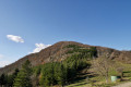
(19) Continue straight on along the firebreak track, quickly pass a fenced-off water reservoir on the left and arrive at Santa Creu (Holy Cross) at an elevation of 853. A very beautiful spot, still used for grazing, with lovely scenery.
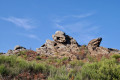
(20) Continue along the track, passing the curious Rochers de la Fustera on your left, and arrive at a three-way junction at an elevation of 819.
(21) Leave the track suitable for vehicles on your left and head down to the right along a small, rough track which leads to the village of Saint-Marsal via the Carrer d’Amunt (Upper Street), near the church.
(22) Head down to the right along the Carrer des Vents (Rue des Vents), emerging onto a small square with the school, the playground and the Bistrot de Pays (opening December 2024). Continue downhill to reach the car park at the village square (Agence Communale) (S/E).


 Visorando Member
 Difficult