Country:

 City:


From Perpignan, take the D612A towards Thuir. Continue following signs for Castelnou via the D615, which bypasses the town to the north, then the D48, which leads to a very large quarry. Park in the car park just before the entrance to the quarry.
(S/E) Take the stony track heading south-east, passing through a barrier at the foot of a Thuir waterworks building. Shortly after the barrier, ignore the first path which climbs steeply to the right and take the next one instead, which follows a rugged, ascending path towards a reservoir.
(1) Continue along a stony track heading south-south-west, which soon reaches a wire fence running alongside the quarry on the right; follow this until you come to a PR® (yellow and white markings) at elevation 286. Leave the edge of the quarry and, after a concrete post (yellow marker), take the path branching off to the right.
(2) This path crosses a trough and joins a stony track. Head right for about 250 m until you reach the start of a path on the left (cairn).
(3) Follow this path, which climbs gently towards the Roc de Majorca. Further on, ignore the path branching off to the left which joins a visible track. The climb continues through low heath in a fairly desolate area. It emerges onto a track.
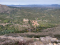
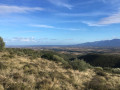
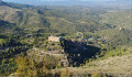
(4) Turn right to soon reach the Roc de Majorca (elevation 444). There is a survey table here and, above all, from this plateau: an extraordinary bird’s-eye view of the beautiful village of Castelnou.
(5) Take the fairly steep descent below the orientation table, or else retrace your steps a few metres until you reach the signpost for Castelnou.
(6) Once at the bottom of the rocky outcrop, follow the path on the right, which descends rather steeply to join the PR® trail leading to the village.
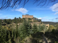
(7) At the path junction, turn right, then right again at the next junction. You’ll reach the foot of the village of Castelnou. Head up towards the village along a cobbled path that passes to the right of a dry-stone tower. As you enter the village (which is well worth a visit), pass between a restaurant and its terrace and continue to the village gate, which leads onto the tarmac road (D48) heading towards the village of Saint-Michel-de-Llotes. Walk down the road for a few metres until you reach a wide bend to the right.
(8) At the start of the bend, turn left towards a car park (reserved for authorised users), leave the car park on your right and continue along the stony track. You’ll reach a hairpin bend in the track by a stream (Còrrec de Llana) and come to a junction of tracks (elevation 254). (Private property on the left), head down to the right along a stony track for about a hundred metres and note, on the left, an earthen ledge where you must leave this track (at the top of this sort of step, a wire-mesh gate blocks the way to the left).
(9) Take a path to the right, climbing up through brown scree along a heavily eroded route. The somewhat challenging climb leads to a stony track (elevation 330). Follow the track to the left towards the village of Camélas. Before entering the village, look out for a sign for ‘Chapelle’.
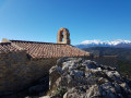
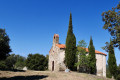
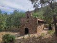
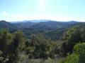
(10) Follow a wide, open area for a few metres, at the foot of a reservoir, which quickly turns into a path. Another sign points you in the right direction for a steep climb up to the Chapel of St Martí de Roca. But the effort is rewarded with a magnificent 360° panorama.
(11) Continue westwards along the ridge to reach the next peak (elevation 522) and then begin the descent along the track leading to Coll de la Roca.
(12) Head along the track on the left, heading south, to reach a junction where several tracks meet.
(13) Cross a concrete ford and take the DFCI A78 track, which descends to the south-east on the left. Follow this main track for several hundred metres, ignoring all offshoots, until you reach the D48.
(14) Turn left and continue along the tarmac road for about 400 metres until you reach a junction with a track on the left that climbs gently towards an aerial. A path then descends towards the Château de Castelnou. Walk a few metres to the left along the D48 and take the road on the right to cross the car park reserved for residents. Walk a few metres along the road leading to the village.
(15) Leave this and take the path leading down to the right. You’ll very quickly rejoin a section of the path you took on the way down (to reach the village a few hours earlier) for a few metres. You’ll come to a junction you passed on the way there.
(7) Turn right at the fork to reach the Coll de la Creu (elevation 366). Turn left immediately onto the track that leads back to the foot of the Roc de Majorca, which you passed earlier.
(6) Continue along the level path to the right, heading east. This path through the heath overlooks the Roussillon plain, offering views of the Albères and the Col du Perthus. At the junction with the PR® trail, signposted at intervals, turn right, admire the restoration of a ruin (Cortal Noell) and, shortly afterwards, leave the PR® to climb up to the right and reach a track that is partly tarmac-surfaced.
(16) Turn left onto this track, then right at the next junction of tracks. Continue northwards after a hairpin bend, ignoring all the side tracks on either side of the main track. You’ll reach the gate marking the end of the circular route and the return to the car park (S/E) ..
 Visorando Member
 Moderate

 Easy