Country:

 City:
City:


Park in the car park in the village of Taulis, opposite the church.
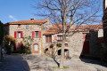
(S/E) Go to the far end of the car park and go down the steps. Walk up the main street on the left-hand side. (Pedestrian zone marked on the ground, against the direction of motor traffic.) You’ll come to a pruned lime tree and a pedestrian crossing.
(1) Cross the Route du Pont (D618) and take the small concrete path that climbs up opposite the lime tree. Follow the Ruelle des Rocailles. Cross the Route du Col de Formentère – which is tarmac-surfaced at this point – and take the overgrown path opposite. Pass through a wooden gate.
(2) Cross the Route du Col de Formentère again, which is now just a track. Go through the galvanised gate and close it properly; you’ll come to a meadow where cattle may be grazing – please leave the livestock undisturbed. Some old yellow markings are still visible on a few trees. Head up towards the south-west, then turn south. Go through a fence, then rejoin the Route du Col de Formentère, now a DFCI track. Go through a fence.
(3) Cross it again and continue straight ahead. Further up, you’ll come to an old, little-used track.
(4) Follow it to the left, uphill, almost directly beneath a high-voltage power line.
(5) Carry on, moving away from the power line to the left. Further up, the signposting suggests climbing the embankment. It is better to continue along the track, which easily goes round it without adding much to the route.
(6) Leave the track and take the path on the left. The signposting is sometimes hard to follow: stick closely to the GPX track, which is occasionally confirmed by yellow markings. Return one last time to the Route du Col de Formentère.
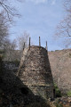
(7) Head back down to the right for about fifty metres before rejoining the path on the left. At Coll de Formentera (Col de Formentère), climb over the fence to reach the old mining railway line from Formentère to Rapaloum (iron mine).
(8) Follow the route back in the opposite direction to return to Taulis (S/E).






 Visorando Member

 Difficult