


Refine your search for walks in Regierungsbezirk Darmstadt
Regierungsbezirk Darmstadt walks


 A wonderful Odenwald walk: across the Tromm from Fürth to Wald-Michelbach
 Visorando Member

 9.65 mi
 +1,572 ft
 -1,093 ft
 5h 50
 Moderate
 Departure from Fürth (Regierungsbezirk Darmstadt)
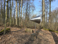
This walk follows the Main-Stromberg Trail, but whenever the forest tracks became too wide, I tried to find an alternative. The result is a wonderful route that leads over the Tromm ridge through the Hessian Odenwald. The absolute highlight of the tour is the newly built Ireneturm (Trommturm) – for me, the Leaning Tower of the Odenwald.
A short loop over the hills near Frankenstein Castle
 5.73 mi
+814 ft
-804 ft
3h 20
 Easy
Departure from Seeheim-Jugenheim (Regierungsbezirk Darmstadt)
This tour takes us along lesser-known paths, first from Malchen to Frankenstein Castle, then downhill towards Mühltal and finally back to Malchen via the area above Darmstadt – Eberstadt.
European Cultural Walking Trail “Along Old Trade Routes and New Roads”
 Tourism professional3.62 mi
+318 ft
-292 ft
1h 55
Easy
Departure from Gelnhausen (Regierungsbezirk Darmstadt)
The circular walk leads from what is now the “Hauptstraße” up to the Wendelinus Chapel and then along the edge of the woodland to the viewpoint overlooking the Kinzig Valley. From there, the route returns to the village, where you reach the starting point again.
European Cultural Trail “Nobility – Lion – Diamonds”
10.57 mi
+499 ft
-495 ft
5h 20
Moderate
Departure from Hasselroth (Regierungsbezirk Darmstadt)
The route passes through all three districts – Gondsroth, Neuenhaßlau and Niedermittlau – taking in their sights. Another stop is the panoramic trail at the Heiligenkopf in Niedermittlau, which offers a lovely view of Hasselroth and Freigerichter Bay, as well as Frankfurt and the Taunus.
Aar circular loop: Taunussteiner Doppelbach
5.18 mi
+535 ft
-509 ft
2h 50
Easy
Departure from Taunusstein (Regierungsbezirk Darmstadt)
Who has a ‘double stream’? Taunusstein does – the Kotzebach. And the curious thing is that the two streams of the same name, flowing towards each other from the direction of Watzhahn, used to feed the Hahner outdoor swimming pool in years gone by. Incidentally, the name comes from ‘korz’, meaning ‘short’.
Spessart Trail “Wildly Romantic Hirschborn Ponds”
3.20 mi
+518 ft
-495 ft
1h 55
Easy
Departure from Bad Soden-Salmünster (Regierungsbezirk Darmstadt)
The Spessart Trail ‘Wildly Romantic Hirschborn Ponds’ is a beautiful walking route through the impressive forests of the Hessian Spessart Nature Park. The circular trail along the slopes of the Klingbach Valley runs largely through ancient, pure deciduous forests, which have been part of the ‘Alsberger Hang’ natural forest reserve since 1997. The coexistence of woodrush and wood sorrel beech forests, as well as the stands of old, gnarled sessile oaks, provide a nursery and habitat for bats, rare birds and other wildlife. Enjoy and respect the tranquillity of this beautiful woodland area alongside them.
Spessart Trail “Wegscheide – Bad Orb and Burgjosser Heiligen”
2.91 mi
+256 ft
-279 ft
1h 35
Easy
Departure from Bad Orb (Regierungsbezirk Darmstadt)
From the Burgjosser Heiligen car park, the path winds its way towards Roßkopf and then continues westwards at the same elevation to the former military cemetery. There, it crosses the country road and continues northwards towards Wegscheide (an alternative starting point for the tour). Passing the school camp, the route continues to Ameisenrain and through the Orber Stadtwald back to the starting point at the Burgjosser Heiligen car park.
Spessart Trail “Vorderspessartblick Horbach”
5.90 mi
+554 ft
-558 ft
3h 10
Easy
Departure from Freigericht (Regierungsbezirk Darmstadt)
From the Gondelteich, the Spessart trail ‘Vorderspessartblick Horbach’ leads across open hills and quiet stream valleys around Horbach. Time and again, sweeping views open up over the Kinzig Valley, into the Wetterau and as far as the Vogelsberg. Along the way, the Krötenweiher, the near-natural Näßlichbach stream and the impressive Mariengrotte provide a variety of sights.
Spessart Trail “Ulmbacher Höhenrunde”
3.40 mi
+230 ft
-230 ft
1h 45
Easy
Departure from Steinau an der Straße (Regierungsbezirk Darmstadt)
The Ulmbach High-Altitude Circuit takes you through the open countryside around the western hills of Ulmbach and rewards you with sweeping views of the Vogelsberg, the Kinzig Valley and the Spessart. As you walk alongside the ‘Stubbach bei Ulmbach’ nature reserve, you’ll experience tranquil nature and charming distant views.
Spessart Trail “Steinau High”
7.02 mi
+961 ft
-988 ft
4h 05
Moderate
Departure from Steinau an der Straße (Regierungsbezirk Darmstadt)
The Spessart Trail ‘Steinauer Hochgefühl’ combines sweeping views across the Kinzig Valley as far as the Vogelsberg with peaceful paths through meadows, fields and woodland. Along the way, open landscapes, small clearings and dense deciduous forests alternate in a particularly charming way. There are also impressive natural and cultural sites to explore around Steinau: the historic old town with its castle and the Brothers Grimm House, as well as important nature reserves on the Bellinger Berg and near the Neudorfwiesen.
Spessart Trail “Sunny Slopes of Lohrhaupten”
9.86 mi
+1,050 ft
-1,050 ft
5h 25
Moderate
Departure from Flörsbachtal (Regierungsbezirk Darmstadt)
Sunbeams illuminate the forest-surrounded valley of Lohrhaupten, tickling the walker’s nose and giving them a cosy, warm feeling – always walking towards the sun, or, walking anti-clockwise with its glow at your back, is the motto of the ‘Fine Weather Trail’, which offers that very special mountain feeling.
Spessart Trail “Quellwinkel Kinzig”
8.71 mi
+807 ft
-807 ft
4h 40
Moderate
Departure from Sinntal (Regierungsbezirk Darmstadt)
Around the source of the Kinzig, walkers will find a slice of the Rhön within the Spessart: ridges offering unobstructed views contrast with the densely wooded hills typical of the Spessart. They allow you to see for miles – all the way to the Wasserkuppe in the Rhön. The abundance of panoramic views is what makes this 13.6 km-long Spessart trail around the basin formed by the Kinzig and its first tributaries so special.
Spessart Trail “Niederrodenbach’s Barbarossa Spring and Monastery Ruins”
6.46 mi
+213 ft
-203 ft
3h 10
Moderate
Departure from Hanau (Regierungsbezirk Darmstadt)
The Spessart Trail ‘Niederrodenbach’s Barbarossa Spring and Monastery Ruins’ runs almost entirely along shaded woodland paths and combines the enjoyment of nature with special, atmospheric spots. Along the way, you’ll find the mystical ruins of St Wolfgang’s Monastery and the Barbarossa Spring, idyllically situated in the woods with seating by the spring pond. At the old Hanau Wolfgang Forestry Office, you’ll also be impressed by Hanau’s tallest tree, a giant sequoia.
Spessartspur “Neuseser Fernblick”
3.90 mi
+594 ft
-594 ft
2h 20
Easy
Departure from Freigericht (Regierungsbezirk Darmstadt)
The trail starts at the Fernblick car park and follows the Spessartbogen downhill to the old Rodfeldeiche oak and on into the valley. From the edge of the forest, there are many different and new views and panoramic vistas of the landscape. Along the outskirts of Neuses, the path leads gently uphill again, offering further stunning views of the Vorspessart landscape. After crossing the access road to Fernblick, the Spessartspur runs through the forest and rejoins the Spessartbogen long-distance hiking trail. Together, the Bogen and the Spur lead back to the Fernblick car park.
Spessart Trail “Neuenhaßlauer Ysenburg Loop”
3.32 mi
+299 ft
-289 ft
1h 45
Easy
Departure from Hasselroth (Regierungsbezirk Darmstadt)
The Spessartspur trail starts at the Jahnstraße car park in the municipality of Hasselroth. The circular route leads into the forest past the burnt fir trees and, through ever-changing woodland scenery, steadily uphill to the summit of the Karlsberg. The route descends out of the forest via the Sauloch, offering fantastic views of Somborn and into the Spessart. Shortly afterwards, you reach the Edelweißhütte in Somborn, which is open at weekends. From there, the route continues through fields and orchard meadows towards Gondsroth, offering beautiful views, before returning to the starting point.
Spessartspur “Lohrhaupter Widdehuh”
4.39 mi
+630 ft
-600 ft
2h 35
Easy
Departure from Flörsbachtal (Regierungsbezirk Darmstadt)
The route starts in front of the community centre. From there, the path leads uphill, past the ‘Matthäuskirche’ parish church. Here, the first view of Lohrhaupten and the Gelnhäuser Valley opens up, inviting you to take it all in. At the “Widdehuh” hilltop, at an altitude of 507.8 metres, walkers are treated to a wealth of unique views. The Spessartspur circular route leads back to Lohrhaupten via paths through fields, woods and meadows, offering a variety of natural sights along the way.
Spessart Trail “Lettgenbrunner Langer Grund”
2.85 mi
+292 ft
-292 ft
1h 35
Easy
Departure from Jossgrund (Regierungsbezirk Darmstadt)
The Spessart Trail starts at the ‘Langer Grund’ car park and, accompanied by the clear, young River Jossa, leads towards the source of this small Spessart stream. On the outskirts of Lettgenbrunn, the path climbs gently uphill and runs alongside dense green hedgerows, offering sweeping views over the Jossa Valley and the wooded hilltops of the Spessart. In the forest, by the moss-green charcoal burner’s hut and an old boundary stone adorned with a coat of arms, the trail crosses the Spessart trail ‘Junge Jossa Lettgenbrunn’ and leads downhill along quiet, unspoilt paths back to the starting point. In this way, the route combines tranquil forest sections and stretches offering splendid views in a particularly charming manner.
Spessart Trail “Junge Jossa Lettgenbrunn”
7.99 mi
+879 ft
-879 ft
4h 25
Moderate
Departure from Jossgrund (Regierungsbezirk Darmstadt)
The circular walk starts in Lettgenbrunn. Not far from the source of the Jossa, this scenic route alternates between narrow paths through the forest, along the edges of woodland and across colourful meadows. Coming from the direction of Pfaffenhausen, in spring – alongside the beautiful panoramic views that can be enjoyed all year round – an avenue of wild cherry trees, cloaked in white blossom, is a real sight to behold. Another highlight is the legendary Beilstein – a basalt rock formation with numerous columns that has been a protected natural site for a very long time.
Spessart Trail “Jossgrund – Wachhütte and Minenwerfergrund”
5.17 mi
+436 ft
-436 ft
2h 45
Easy
Departure from Jossgrund (Regierungsbezirk Darmstadt)
The Minenwerfergrund car park is situated in the valley of the young River Jossa and still bears its name from the Second World War. Today, however, the starting point of the Spessartspur is a wonderfully peaceful spot in the heart of nature. Along the way, the many impressive mounds of the red forest ant are particularly eye-catching.
Spessart Trail “Brachttaler Steingut Panorama”
7.34 mi
+745 ft
-725 ft
4h 00
Moderate
Departure from Brachttal (Regierungsbezirk Darmstadt)
This Spessart trail is particularly appealing to anyone wishing to experience the landscape, history and regional industrial heritage in combination. Along the route, historic sites, distinctive buildings and sections of the trail set amidst nature alternate. Information boards bring the history of industrialisation to life, with a regional focus.
Spessart Trail “Aufenauer Mountain and Valley Trail”
6.53 mi
+679 ft
-689 ft
3h 35
Moderate
Departure from Wächtersbach (Regierungsbezirk Darmstadt)
The “Aufenauer Berg- und Talspur” combines sweeping views, tranquil forest paths and charming valley sections to create a varied hiking experience. From the Kirchberg, the view opens out over Aufenau and the Kinzig Valley. Historic boundary stones at the tri-border area and the valuable Zelleraue wetland make this Spessart trail particularly varied and rewarding.
Mountains by the River, Neckarsteinach
14.25 mi
+2,073 ft
-2,077 ft
8h 20
 Difficult
Departure from Neckarsteinach (Regierungsbezirk Darmstadt)
This walk runs from Neckarsteinach, the ‘town of four castles’, to the picturesque village of Dilsberg, which has retained its medieval charm with its castle complex and winding alleyways. As the route continues, we pass through Mückenloch and walk through the Sotten nature reserve and via Haag to Schönbrunn. The tour ends in Hirschhorn, where we have the opportunity to visit the well-preserved Hirschhorn Castle complex.
In Frankfurt’s Green Belt from Frankfurt Stadium station
 11.24 mi
+243 ft
-230 ft
5h 25
Moderate
Departure from Frankfurt (Regierungsbezirk Darmstadt)
Circular route through a beautiful part of Frankfurt’s Green Belt, following sections of the “GrünGürtel Wanderweg”. Mainly through woodland, this walk connects various ponds and the area’s key points of interest: the iron-rich spring at Königsbrünnchen, and the Tyrol Pond with its armadillo sculptures by the sculptor Andreas Rohrbach. Often with beautiful beech trees overhead and vast patches of wild garlic at our feet.A hike that is very easy to adapt and shorten.
Neckarsteig (E4) from Hirschhorn to Eberbach
7.77 mi
+1,398 ft
-1,385 ft
4h 50
Moderate
Departure from Hirschhorn (Regierungsbezirk Darmstadt)
Through the Neckar Valley along the Neckarsteig, a quality hiking trail (Qualitätsweg Wanderbares Deutschland) covering around 128 km from Heidelberg to Bad Wimpfen. The long-distance hiking trail can be hiked as a multi-day or day tour. This stage takes you from Hirschhorn to Eberbach.
From Hetzbach via the Marbach Reservoir to the beautiful view at Etzean
 5.28 mi
+591 ft
-607 ft
2h 55
Easy
Departure from Oberzent (Regierungsbezirk Darmstadt)
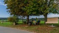
The walk starts in Hetzbach and leads to the nearby Marbach Reservoir. Swimming enthusiasts should pack their swimwear in summer. The route takes you almost directly to the bathing spot by the lake. From the Marbach Reservoir, the path leads through the woods, up to one of the Odenwald’s characteristic open hilltops.
At the turning point, a lovely rest area with a view and a ‘bird box’ awaits the walkers. The return route takes you through the fields back to the starting point in Hetzbach.
From the Himbächel Viaduct to Beerfelden
 4.93 mi
+837 ft
-358 ft
3h 00
Easy
Departure from Oberzent (Regierungsbezirk Darmstadt)
A varied walking tour from the Marbach Reservoir – artificially created for flood protection – up to the panoramic heights of the Odenwald.
Once you reach Beerfelden at the top, the Odenwald slopes from north to south, dividing the flowing waters towards the Main and Neckar rivers.
Western Limes Trail (E3) from Hesselbach to Limbach-Wagenschwend
 11.59 mi
+1,073 ft
-1,004 ft
6h 15
Moderate
Departure from Oberzent (Regierungsbezirk Darmstadt)
After conquering France, the Romans advanced across the Rhine. The Odenwald Limes was built to secure the route between the Main and Neckar rivers, which were considered natural borders. This border wall, built around 85 AD, was intended to protect the Roman province of Germania Superior.
The third stage of your hike takes you along the former border line from Hesselbach to Limbach-Wagenschwend.
During this scenically and culturally enriching tour, you will pass the remains of Roman watchtowers, forts (troop quarters), bathing facilities and border fortifications. Informative boards point out the sights and provide insights into life in the former border region.
Western Limes Trail (E2) from Michelstadt-Vielbrunn to Hesselbach
 12.89 mi
+794 ft
-659 ft
6h 35
Difficult
Departure from Michelstadt (Regierungsbezirk Darmstadt)
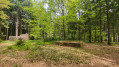
After conquering France, the Romans advanced across the Rhine. The Odenwald Limes was built to secure the route between the Main and Neckar rivers, which were considered natural borders. This border wall, built around 85 AD, was intended to protect the Roman province of Germania Superior.
The second stage of your hike takes you along the former border line from Michelstadt-Vielbrunn to Hesselbach.
During this scenically and culturally enriching tour, you will pass the remains of Roman watchtowers, forts (troop quarters), bathing facilities and border fortifications. Informative boards point out the sights and provide insights into life in the former border region.
Mossautal Dragon Trail “Dorn”
 10.97 mi
+1,339 ft
-1,339 ft
6h 15
Moderate
Departure from Mossautal (Regierungsbezirk Darmstadt)
There are four circular routes in the Mossau Valley, each with its own charm and marketed under the name ‘Drachenwege’ (Dragon Trails). These hiking routes have all been awarded the ‘Wanderbarer Odenwald’ seal of approval by the Odenwald Club, guaranteeing a high-quality hiking experience. The circular walks are:
"Dorn" (the circular route described here), "Fafnir", "Triumphalis" and "Saphira"
The length of each route varies between 15 and 21 kilometres, making them ideal for day hikes.
Castle Trail (4): Heppenheim – Hemsbach
 10.92 mi
+1,886 ft
-1,870 ft
6h 40
Moderate
Departure from Heppenheim (Regierungsbezirk Darmstadt)
"Nature experience combined with athletic hiking" ... this is how the Burgensteig trail is described in the official flyer of the Tourismus Service Bergstraße e.V. The Burgensteig trail leads from Darmstadt-Eberstadt along the heights of the Odenwald to Heidelberg. Along the approximately 120 km, you will pass over 30 historical sights and cross two other well-known trails, the Nibelungensteig near Zwingenberg and the Neckarsteig in Heidelberg. We took the liberty of deviating from the "standard" route here and there.
We have put together the stages so that you can get to your starting point and back from your destination by public transport.
From Ober-Ramstadt to Brandau in the Modau Valley
 11.81 mi
+1,785 ft
-1,385 ft
7h 00
Moderate
Departure from Ober-Ramstadt (Regierungsbezirk Darmstadt)
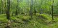
A section of the relatively little-known Main-Stromberg Trail runs from Ober-Ramstadt to Lützelbach. This route frequently deviates from the original trail and does not end until you reach Brandau in the Moda Valley. This allows you to bypass a number of wide forest tracks and create a lovely circular walk: either park your car in Brandau and take the bus to Ober-Ramstadt first thing in the morning (recommended, as bus services are limited), or park in Ober-Ramstadt and take the bus back to your car after the walk.
The secluded path through the Hessian Odenwald to the River Neckar
 16.99 mi
+1,719 ft
-2,480 ft
9h 20
Moderate
Departure from Wald-Michelbach (Regierungsbezirk Darmstadt)
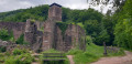
This walk takes us from Wald-Michelbach to Neckarsteinach without any cultural or historical highlights. We walk along or parallel to the Main-Stromberg Trail. Our aim was to avoid the ‘forest motorways’ and focus on walking on forest paths or at least on unpaved forest tracks.The route is ideal for switching off and simply walking – no sights, no places to stop for refreshments and absolutely nothing to distract you along the way. In return, there are hardly any changes in altitude, and at the end of the route, the castles around Neckarsteinach do offer a little highlight after all.
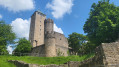
Burgensteig (3): Bensheim-Auerbach – Heppenheim
 11.44 mi
+1,955 ft
-1,936 ft
7h 00
Moderate
Departure from Bensheim (Regierungsbezirk Darmstadt)
"Nature experience combined with sporty hiking"... this is how the Burgensteig trail is described in the official flyer of the Bergstraße Tourist Association. The Burgensteig trail leads from Darmstadt-Eberstadt along the heights of the Odenwald to Heidelberg. Along the approximately 120 km, you will pass over 30 historical sights and cross two other well-known trails, the Nibelungensteig near Zwingenberg and the Neckarsteig in Heidelberg. We took the liberty of deviating from the "standard" route here and there.
We have put together the stages so that you can get to your starting point and back from your destination by public transport.
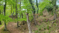
From Jugenheim along paths that are partly unknown
 12.30 mi
+2,900 ft
-2,890 ft
8h 10
Moderate
Departure from Seeheim-Jugenheim (Regierungsbezirk Darmstadt)
This circular walk takes you from Jugenheim via Heiligenberg Castle to the Felsenmeer in Reichenbach, then on towards Balkhausen, to the ruins of Jossa Castle and back to Jugenheim.
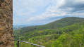
Castle trail (2): Jugenheim – Bensheim-Auerbach
 8.16 mi
+1,204 ft
-1,270 ft
4h 50
Moderate
Departure from Seeheim-Jugenheim (Regierungsbezirk Darmstadt)
"A nature experience combined with sporty hiking" ... this is how the Burgensteig trail is described in the official flyer of the Bergstraße Tourist Association. The Burgensteig trail leads from Darmstadt-Eberstadt along the heights of the Odenwald to Heidelberg. Along the approximately 120 km route, you will pass over 30 historical sights and cross two other well-known trails, the Nibelungensteig near Zwingenberg and the Neckarsteig in Heidelberg. We took the liberty of deviating from the "standard" route here and there.
We have put together the stages so that you can get to your starting point and back from your destination by public transport.
In 10 stages on the Nibelungensteig
 87.49 mi
+14,931 ft
-14,793 ft
10 days
Difficult
Departure from Zwingenberg (Regierungsbezirk Darmstadt)
The Nibelungensteig is a certified Qualitätsweg "Wanderbares Deutschland" (Quality Trail "Hiking in Germany") that leads from west to east across the Odenwald and thus through three federal states (Hesse, Bavaria, Baden-Württemberg) over 130 km in several stages, some of which are very strenuous, with a total of more than 4,000 metres of elevation gain.
Our division differs from the official stages. We have chosen some shorter sections, added a few extra metres and stayed overnight in some different places. When planning your tour, please note that accommodation, refreshment and catering facilities are not always available.
Via the Neunkircher Höhe along the Main-Stromberg walking trail
 8.38 mi
+1,020 ft
-1,699 ft
4h 45
Easy
Departure from Modautal (Regierungsbezirk Darmstadt)
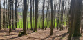
From Lützelbach in the Moda Valley, via the Neunkircher Höhe – at 605 metres, the highest point in the Hessian Odenwald – on to Lindenfels and finally to Fürth im Odenwald, this walk takes us along the relatively little-known Main-Stromberg Walking Trail, which runs from Frankfurt through the Odenwald to Maulbronn Monastery.
Nibelungensteig (7): Hesselbach - Kirchzell-Preunschen
 7.56 mi
+1,417 ft
-1,499 ft
4h 45
Moderate
Departure from Oberzent (Regierungsbezirk Darmstadt)
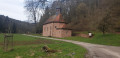
The Nibelungensteig is a certified Qualitätsweg "Wanderbares Deutschland" (Quality Trail "Hiking in Germany") that runs for 130 km in several stages, some of which are very strenuous, with a total of more than 4,000 metres of elevation gain from west to east across the Odenwald and thus through three federal states (Hesse, Bavaria, Baden-Württemberg). Our division differs from the official stages. We have chosen some shorter tours, added a few extra metres and stayed overnight in different places in some cases. When planning your tour, please note that accommodation, refreshment and catering facilities are not always available.
Nibelungensteig (6): Bullau – Hesselbach
 11.13 mi
+1,155 ft
-1,247 ft
6h 05
Moderate
Departure from Erbach (Regierungsbezirk Darmstadt)
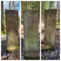
The Nibelungensteig is a certified Qualitätsweg "Wanderbares Deutschland" (Quality Trail "Hikeable Germany") that runs for 130 km in several stages, some of which are very strenuous, with a total of more than 4,000 metres of elevation gain from west to east across the Odenwald and thus through three federal states (Hesse, Bavaria, Baden-Württemberg). Our division differs from the official stages. We have chosen some shorter tours, added a few extra metres and stayed overnight in different places in some cases. When planning your tour, please note that accommodation, refreshment and catering facilities are not always available.
Nibelungensteig (5): Güttersbach – Bullau
 14.50 mi
+2,251 ft
-1,585 ft
8h 40
Difficult
Departure from Mossautal (Regierungsbezirk Darmstadt)
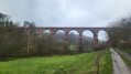
The Nibelungensteig is a certified Qualitätsweg "Wanderbares Deutschland" (Quality Trail "Hikeable Germany") that runs for 130 km in several stages, some of which are very strenuous, with a total of more than 4,000 metres of elevation gain from west to east across the Odenwald and thus through three federal states (Hesse, Bavaria, Baden-Württemberg). Our division differs from the official stages. We have chosen some shorter tours, added a few extra metres and stayed overnight in different places in some cases. When planning your tour, please note that accommodation, refreshment and catering facilities are not always available.
Nibelungensteig (4): Grasellenbach – Güttersbach
 4.56 mi
+682 ft
-902 ft
2h 40
Easy
Departure from Grasellenbach (Regierungsbezirk Darmstadt)
The Nibelungensteig is a certified Qualitätsweg "Wanderbares Deutschland" (Quality Trail "Hiking in Germany") that runs for 130 km in several stages, some of which are very strenuous, with a total of more than 4,000 metres of elevation gain from west to east across the Odenwald and thus through three federal states (Hesse, Bavaria, Baden-Württemberg). Our division differs from the official stages. We have chosen some shorter tours, added a few extra metres and stayed overnight in different places in some cases. When planning your tour, please note that accommodation, refreshment and catering facilities are not always available.
Along the Hessian Bergstraße, starting in Jugenheim
 11.48 mi
+2,014 ft
-2,011 ft
7h 00
Moderate
Departure from Seeheim-Jugenheim (Regierungsbezirk Darmstadt)
Circular walk along the Hessian Bergstraße, starting and finishing in Seeheim-Jugenheim, in the district of Jugenheim, via Heiligenberg Castle, the Tanneberg castle ruins and Frankenstein Castle.
Hirschhorn Castle and views of the Neckar River
 Association / Club / Walk leader
 2.11 mi
+410 ft
-187 ft
1h 20
Moderate
Departure from Hirschhorn (Regierungsbezirk Darmstadt)
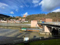
This walk will bring you to some great panorama over the Neckar River where you can enjoy watching the boats (peniches) and the old Hirschhorn village and its nice castle. Along the way, you will find benches to enjoy the views and bring some picnic with you.
Nibelungensteig (3): Lindenfels – Grasellenbach
 8.23 mi
+1,713 ft
-1,637 ft
5h 15
Moderate
Departure from Lindenfels (Regierungsbezirk Darmstadt)
The Nibelungensteig is a certified Qualitätsweg "Wanderbares Deutschland" (Quality Trail "Hiking in Germany") that runs for 130 km in several stages, some of which are very strenuous, with a total of more than 4,000 metres of elevation gain from west to east across the Odenwald and thus through three federal states (Hesse, Bavaria, Baden-Württemberg). Our division differs from the official stages. We have chosen some shorter tours, added a few extra metres and stayed overnight in different places in some cases. When planning your tour, please note that accommodation, refreshment and catering facilities are not always available.
Nibelungensteig (2): Reichenbach - Lindenfels
 9.82 mi
+2,087 ft
-1,634 ft
6h 20
Moderate
Departure from Lautertal (Regierungsbezirk Darmstadt)
The Nibelungensteig is a certified Qualitätsweg "Wanderbares Deutschland" (Quality Trail "Hikeable Germany") that runs for 130 km in several stages, some of which are very strenuous, with a total of more than 4,000 metres of elevation gain from west to east across the Odenwald and thus through three federal states (Hesse, Bavaria, Baden-Württemberg). Our division differs from the official stages. We have chosen some shorter tours, added a few extra metres and stayed overnight in different places in some cases. When planning your tour, please note that accommodation, refreshment and catering facilities are not always available.
Nibelungensteig (1): Zwingenberg - Reichenbach
 7.69 mi
+2,241 ft
-1,854 ft
5h 30
Moderate
Departure from Zwingenberg (Regierungsbezirk Darmstadt)
The Nibelungensteig is a certified Qualitätsweg "Wanderbares Deutschland" (Quality Trail "Hikeable Germany") that runs for 130 km in several stages, some of which are very strenuous, with a total of more than 4,000 metres of elevation gain from west to east across the Odenwald and thus through three federal states (Hesse, Bavaria, Baden-Württemberg). Our division differs from the official stages. We have chosen some shorter tours, added a few extra metres and stayed overnight in different places in some cases. When planning your tour, please note that accommodation, refreshment and catering facilities are not always available.
More walks in Regierungsbezirk Darmstadt
Select an area below: