Country:
 City:
City:


The route starts in Lützelbach at the Brandauer Straße bus stop (towards Brandau) by the Spitzenwirt inn (Brandauer Straße 3, 64397 Modautal, Lützelbach).
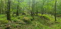
(S) We turn left up the road ‘Zum Eichwäldchen’ until we reach the house by the small alpine pasture, following the red square markings. At the junction, we turn left onto Rodensteinweg, past the August-Wondra-Wäldchen nature reserve (Eichwäldchen). We walk along the edge of the village, with a paddock on our right, and reach the edge of the forest. At the first fork, we follow the signpost to the right, uphill along a gravelly forest track; at the next junction, we turn right towards Neunkirchen, continuing gently uphill.
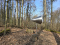
(1) We pass a forest xylophone and continue straight on along the unmarked path through the woods. After about 150 metres, we see the green ‘A’ trail marker on the right. As soon as we leave the woods, we spot the red square trail marker again, which we follow towards Neunkirchen. As soon as we reach the road, we follow it to the left and uphill, first rounding a right-hand bend, then continuing straight on until we reach the village centre.
(2) We reach the village square in Neunkirchen, cross through the centre of the village, past the Olybüste, and keep to the right as we head uphill, passing St Cosmas and Damian’s Church, crossing the car park and leaving Neunkirchen via the road, with the cemetery on our left. We cross the country road and walk straight ahead up the tarmacked path.
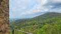
(3) We reach an information board. The signposting here is misleading! We stay on the tarmacked path past the information board and continue walking along the edge of the forest, not without looking back every now and then: in good weather, we can see the Frankfurt skyline, the airport, the Hoher Feldberg and the Taunus.
(4) At the information board for the Main-Stromberg Trail, carry on straight ahead and, at the next junction, turn left round a bend, following the red square and the signpost for the ‘Gaststätte im Kaiserturm ’. We follow the tarmac road uphill, past a small field of boulders. At the top, we reach a junction; we continue straight on towards Winterkasten and, after about 50 metres, at a tree nursery (fir trees), we turn right along the fence.
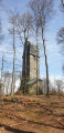
(5) At the source of the Gersprenz, we continue along the unpaved forest track and then, just before the signpost, turn left onto an inconspicuous path, with the Kaiserturm directly ahead of us.
(6) At the Neunkirchener Höhe, we have reached the highest point of the walk and of the Hessian Odenwald; we cross the clearing, take the left-hand path after the tower and follow the red square down a narrow track through the woodland. As soon as the woodland thins out, we can make out the first houses of Winterkasten to our left in the valley. As soon as we reach the tarmac road, we follow it to the left towards Winterkasten. At a left-hand bend, we follow the path (shortcut) straight ahead downhill into the village. On the main road, we turn right and walk through the village, crossing the road towards Bensheim. The signposting here in the village is very poor. Continue straight on and, shortly after the ‘Am Raupenstein’ bus stop – immediately after the Pfeiffer joinery – turn right onto Röttweg, towards the Protestant church.
(7) At the war memorial, we follow the road to the left and walk along the ridge across meadows and fields – on sunny days it can get uncomfortably hot here. The signposting is poor here too, but we stay on the main path, heading slightly uphill, and do not turn off. We are now walking along the hillside above Winterkasten.
(8) From the gabbro rock at Buch, the path winds gently downhill; we reach a clearing and, directly ahead of us, we see a tower, with the first houses of Lindenfels to our right.
(9) We pass the Bismarkwarte and, at the next junction, turn left and then immediately right again, past a magnificent entrance archway to a private property. On the road, we stay on the left-hand side for a few metres and then immediately turn onto the footpath leading down to the left. We follow the red square straight on again, continuing along the edge of the forest.
(10) We come to a wooden bench and take the path up to the left, entering the woods again and following the signpost until, on our right, we have an unobstructed view of Lindenfels Castle on the other side of the valley.
(11) We turn right towards a mountain hut. Just in front of it, we follow the beautiful path marked with a green ‘N’ (feeder path to the Nibelungensteig) or a green ‘6’ as it winds downwards through fascinating rock formations. After a hairpin bend, we can see the red square again, which we can now follow clearly.
(12) At the ‘Nibelungentour’ signpost, we come to the Nibelungensteig, which we follow to the right. Whilst the Nibelungensteig branches off onto the ‘Insektenpfad’ after a few metres (which we could also take, as the paths rejoin), we stay on the road, Schenkenbergstraße, which takes us directly and steeply down to the centre of the village. We cross Nibelungenstraße and follow Burgstraße into the Lindenfels pedestrian zone.
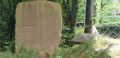
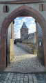
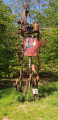
(13) We reach the Haus des Gastes in Lindenfels. If you’d like to make a detour to Lindenfels Castle, head straight up here; our route takes us down a cobbled street in the town in front of the Haus des Gastes, past the Dragon Museum. After the archway, we continue downhill to the left, following Wilhelm-Baur-Straße further downhill until we reach a fork. Here, we turn left onto Burgackerweg, heading steeply downhill alongside a natural hedge. At the turning point, we continue to the left along Burgackerweg, still heading steeply downhill. Before the first house, we carry on straight ahead, past garages, and re-enter the wood. We pass a barrier and head uphill along the forest track. We follow the path along the edge of the woodland, then across fields, keeping straight on the main path until we pass two small copses and the Am Gänsberg air traffic control station. There are several sculptures to admire along the way. At the entrance to the new housing estate, we turn left downhill, then right at the next T-junction.
(14) We take the poorly signposted footpath opposite the car park – or in front of the cemetery – on the left and follow it downhill along the cemetery wall. At the end of the wall, we turn left again and, as soon as the cobblestones begin, we take a sharp right. At a large square with a striking half-timbered house, we leave our route markings and follow the main road to the left, crossing the Weschnitz at the next junction, then Heppenheimer Straße, and walking along Kröckelbacher Straße as far as the Schützenhof restaurant. Here, we turn right into Brunnengasse, then left into Bahnhofstraße and then right again to reach the bus stops and railway tracks (E).
 Visorando Member
 Moderate