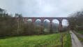
From the Himbächel Viaduct to Beerfelden

A varied walking tour from the Marbach Reservoir – artificially created for flood protection – up to the panoramic heights of the Odenwald.

Once you reach Beerfelden at the top, the Odenwald slopes from north to south, dividing the flowing waters towards the Main and Neckar rivers.

Details

64395374
Creation:
Last update:
Last review:
  • Walking
    Activity: Walking
  • ↔
    Distance: 4.93 mi
  • ◔
    Average duration: 3h 00 
  • ▲
    Difficulty: Easy

  • ⚐
    Back to start: No
  • ↗
    Ascent: + 837 ft
  • ↘
    Descent: - 358 ft

  • ▲
    Highest point: 1,398 ft
  • ▼
    Lowest point: 873 ft
  • ⚐ Country: Germany
  • ⚐ City: Oberzent 
  • ⚑
    Start: N 49.602885° / E 8.992522°
  • ⚑
    End: N 49.567567° / E 8.973749°
  • Hour-by-hour weather

Photos

Description of the walk

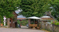
Start: Our walk begins at the Himbächel Viaduct car park, near Hetzbach. Just a few minutes’ walk away is the Oberzent-Hetzbach Viaduct bus stop. Buses on route 50, which stop here, run between Michelstadt and Eberbach am Neckar. This is also the bus route that will take us back from our destination, Beerfelden, to the starting point if required.

(S) We walk back from the car park to the road and follow it to the right for about 100 metres until we reach the main road. There, we turn right again and walk along the footpath and cycle path for about 150 metres.

(1) At the end of the footpath and cycle path, we cross the main road to the left and take the forest track into the woods. We follow the track to the right. We stay on this track until we reach the dam wall of the Marbach Reservoir.

(2) Just behind the dam, a narrow path leads down to the reservoir on the right. We follow this path along the lake to the jetty in the lake.

(3) At the jetty, we now turn left and continue along the forest track, leaving the Marbach Reservoir behind us. The forest track now climbs slowly and steadily. Just before the path curves to the right, we turn left and follow the signposts for Hessenweg 2.

(4) Once we reach the edge of the wood, we continue to the left until we reach the next junction.

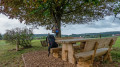
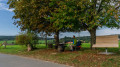
(5) At this junction, we turn right. At the top of the hill there is a lovely rest area with a view over the valley and a ‘birdbox’. We carry on until we reach the village of Etzean.

(6) At the fork in the road, by the village pond in Etzean, we keep to the left and follow Beerfelder Weg out of Etzean. Once we reach the edge of the wood, the path narrows and forks a short while later. Here, we can either head straight into the wood or stay at the edge of the wood. After a sharp left-hand bend, the two paths meet again.

(7) The path forks and we keep to the right. We leave the woods and can already see Beerfelden.

(8) Just before Beerfelden, we reach the first farmsteads in the village. The path forks here. We follow the path on the right and shortly afterwards arrive in Beerfelden on Walterbachweg.

(9) At the first junction in Beerfelden, we turn left, down Walterbachweg.

(10) At the very next road, we turn right, up the hill along Hafengasse. Towards the end, Hafengasse curves slightly to the right.

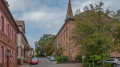
(11) After this bend, we turn left and continue past the market square. The Protestant St Martin’s Church is also located here. From the market square, it is only a few metres further down Marktstraße.

(E) We reach the main road in Beerfelden and can find the nearest bus stop from here for the return journey.

Waypoints

  1. S : mi 0 - alt. 899 ft - Car park at the Himbächel Viaduct
  2. 1 : mi 0.18 - alt. 892 ft - Crossing the main road
  3. 2 : mi 0.87 - alt. 942 ft - Marbach Reservoir dam
  4. 3 : mi 1.19 - alt. 915 ft - Footbridge at the Marbach Reservoir
  5. 4 : mi 2.37 - alt. 1,329 ft - Junction at the edge of the forest
  6. 5 : mi 2.59 - alt. 1,385 ft - Crossroads at the edge of the forest
  7. 6 : mi 3.01 - alt. 1,325 ft - Junction in Etzean
  8. 7 : mi 3.63 - alt. 1,289 ft - Turn right at the fork in the path
  9. 8 : mi 4.19 - alt. 1,257 ft - The first farms before Beerfelden
  10. 9 : mi 4.55 - alt. 1,306 ft - Walterbachweg turn-off
  11. 10 : mi 4.63 - alt. 1,276 ft - Turn-off into Hafengasse
  12. 11 : mi 4.83 - alt. 1,385 ft - Protestant St Martin’s Church
  13. E : mi 4.93 - alt. 1,365 ft - Junction of the main roads in Beerfelden

Notes

No special equipment is required for the walk.

Worth a visit

“Zwitscherkasten” at the rest area near Etzean
Fancy a schnapps? A little box containing various bottles of spirits and a tin with a slot for your contribution. This is how the locals cater to this desire for a refreshment break.

(11)St Martin’s Church, Beerfelden
On 29 April 1810, large parts of Beerfelden were destroyed by fire. Among the buildings lost was St Martin of Tours Church, built in the early 16th century. Between 1812 and 1816, a new building was therefore constructed as a classical hall church in the round-arched style

The source of the Mümling
The source of the Mümling, a river almost 50 kilometres long, lies at an altitude of 400 metres above sea level in the heart of the Beerfelden district of Oberzent. The ‘Zwölfröhrenbrunnen’ (Twelve-Pipe Fountain), from which the water of the Mümling bubbles up, was the main water supply for the local population until the water main was built.

Tourist information in the region:

Michelstadt Tourist Information

Marktplatz 1
64720 Michelstadt
Telephone: 06061-74610
Email: touristik@michelstadt.de

Tourist Information Centre in the Old Town Hall

Market Square 1
64711 Erbach
Telephone: 06062 64-880
Email: tourismus@erbach.de

Other walks in the area

For more walks, use our search engine .

The GPS track and description are the property of this route's author. Please do not copy them without permission.