Country:
 City:
City:


Start: Neckarsteinach railway station
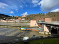
(S/E) At Neckarsteinach railway station, we turn right and walk along the Neckar until we reach the nearby lock, where we can cross the river.
(1) Behind the lock, a woodland path begins, which initially leads to the left and then winds steeply uphill to the picturesque village of Dilsberg. At the ‘Burgsteige’ junction, we keep to the left and continue along the woodland path.
(2) Once at the top, we turn briefly to the right and then straight back to the left onto ‘Untere Straße’, continuing on to a T-junction.
(3) In Dilsberg, we walk along the road ‘An der Stiege’, which turns into the ‘Bannholzweg’ at a junction on the left. At the end of the path, there is a crossroads; here, we turn left onto the ‘Schänzel’.
(4) The narrow road eventually splits, and we take the left-hand track into the woods. After a while in the shady woods, we reach a fork with a goat enclosure on the right-hand side.
(5) Here we turn left again into the woods. The path now continues downhill and, immediately after the woods thin out, we can enjoy a lovely view of the Mückenloch to the north.
(6) At the next junction, we head briefly onto the country road and then immediately turn half-left onto the dirt track towards the signposted riding arena. We stay on this track and cross the Sotten Nature Reserve until we reach the crossroads at the ‘Steinerner Tisch’ (322 m above sea level).
(7) We continue along the Mittlerer-Hohe-Buche-Weg to the left of the hut.
(8) We come to a country road, which we follow, and shortly afterwards turn right into the woods towards Haager Mühle.
(9) We follow the signposted H 1 through Haager Mühle, continuing along the edge of the woodland in a right-hand bend until we turn left onto a path. At the first houses, we turn left and then immediately right again, following the stream into the centre of Haag as far as Heidelberger Straße.
(10) We follow the road to the right and then further to the right up the steep slope along Kirchweg, past the romantic little church on Haag Hill and the nature-inspired memorial complex, and then turn left onto Mannbachweg. After the right-hand bend, we turn left and continue to the right along the edge of the woodland. At the next junction, we turn left and follow the H 1.
(11) We follow the H1 until we cross the district road and later the country road (L595).
(12) We turn right, leave the H 1 and walk parallel to the country road towards Schönbrunn.
(13) We turn left and, along Schwannheimer Straße, enter the village. We turn right onto Hauptstraße and follow it round the left-hand bend, then left into Rinnengässel and left again onto Aueweg. We continue straight on into Herdestraße and then onto Hauptstraße.
(14) At the little ‘Kircherl’ in the village, we turn left and leave the village via Hainbuchenstraße. We take the second right and walk slightly downhill past fields into the Hirschhornberg forest, which is already visible.
(15) The route meets a forest track, which we turn into on the left, before turning right shortly afterwards and walking down the slope. We are now walking across the Hirschhornberg. We keep left twice and briefly follow Hirschhorner Straße before turning sharply right onto the signposted Alte Hirschhorner Steige.
(16) This path takes us straight on directly to Hirschhorn, where we cross the Neckar to the left at the lock.
(17) After the lock, we turn left (south) and walk through the small village towards the signposted railway station. We cross the main road and follow the Neckarsteinacher Straße on the opposite side to the station, to begin our return journey to Neckarsteinach. (S/E)
 Visorando Member
 Moderate
  Association / Club / Walk leader