Country:
 City:
City:


The walk starts at the HEAG mobilio bus stop on Ludwigstraße in Jugenheim; there is car parking available along Schwarztannenstraße and its extension, Ludwigstraße.
(S/E) Depending on where you park, cross the junction of ‘Heidelbergerstraße’ and ‘Alte Bergstraße’ and walk along ‘Ludwigstraße’ into Jugenheim.
You’ll come to a roundabout, which you cross straight ahead onto ‘Hauptstraße’, heading towards a large house with green shutters.
In front of the house with the green shutters, turn left (still on “Hauptstraße”), and after a few metres, turn right through a gate and up a narrow path. To help you find your way, look out for the Blue Castle on the Burgensteig or the red ‘A’ on the Allemannenweg.
You’ll reach the track leading to Heiligenberg Castle, which you follow further uphill to the right. After the third hairpin bend, walk straight on past the barrier and, immediately afterwards, up the steps on the left.
The steps lead onto a beaten track, which joins a wider path (“Oberer Wingertsweg”) directly opposite two benches.
Turn right and then immediately left onto a footpath leading up the embankment.
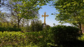
(1) Once at the top, cross a meadow and walk straight towards the Golden Cross. Before reaching the cross, turn left and follow the fence.
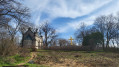
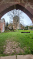
At the end of the fence, you’ll reach the monastery ruins. If the gate to the Kreuzgarten is open, it’s worth making a short detour to the Golden Cross.
In front of the monastery ruins, turn left. The path slopes gently downwards and you walk towards a small pond. Before the pond, turn right and follow the path, which leads you back uphill in a gentle left-hand bend.
You’ll pass the ‘Rehhäuschen’ on your right and enter the historic arbour. At the next junction, keep to the left and stay in the arbour.
Further uphill, a path branches off to the right from the arbour; follow this. At the next junction, turn left. You’ll now walk straight on towards Heiligenberg Castle.
(2) Your path takes you past the castle on the left; on your right you’ll see a blue gate, the entrance to the castle courtyard.
You’ll head down the tarmac road; after a while, a fork leads off to the right onto a narrow path. Here, you can again follow the Burgensteig signposts.
You’ll come to a junction; opposite you, you’ll see the Bergkirche. Here, turn sharply right and continue walking downhill.
Opposite the Waldfrieden house, you’ll reach the road to Stettbach. Here, continue to the left until you reach the ‘Welcome to Jugenheim’ sign. Before the sign, turn right past the barrier and head uphill again.
You’ll approach a fork in the path and keep to the right. After a few metres, your path turns right onto a narrow track. Here, too, you can follow the Burgensteig signposts.
At the end of the path, the Burgensteig signposts lead you to the left and then straight back to the right.
At the end of the narrow path, you’ll reach a gravel forest track, which you follow to the right.
(3) At the next junction (Tanneberg 139), there is a stone signpost on the right. Opposite this signpost, the red ‘A’ of the Alemannenweg shows you the direction along a narrow path.
(4) Just before the Tannenberg castle ruins, you’ll pass a signpost (“Ruine Tannenberg”, 319 m) bearing the symbols of the Alemannnenweg and the Saar-Rhine-Main Trail (yellow cross). Keep to the left and walk up to the castle ruins.
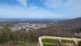
Here you can enjoy the view over the Rhine valley; on a clear day, you can see the Frankfurt skyline. Leave the inner courtyard to the right, walk past the “Fritz-Lockau-Hütte” refuge, through the outer bailey and, immediately afterwards, turn right onto a footpath.
This leads you up a hill, where you’ll find another seating area. The footpath then descends the hill again, bringing you back onto the main path.
Here, turn left over the bridge spanning the moat. The path continues downhill. After a while, you’ll reach a junction and turn right.
(5) You cross a small car park and walk towards the ‘Fünf-Schwestern-Linden’ natural monument. At the ‘Fünf-Schwestern-Linden’, continue to the left, cross a tarmac road (‘Lufthansaring’), walk a short distance to the right here, and then turn left again on the other side of the road onto a narrow path.
(6) Passing a small shelter, head down a few steps towards a signpost (“Seeheim”, 193 m). Here, turn right. After a while, you’ll come back to the tarmac road (“Lufthansaring”), which you follow down to the left until you reach the junction.
At the junction, cross the road towards Ober-Beerbach and, on the other side, head left up the hill again.
After a while on the gravel forest track, the Burgensteig sign points left onto a narrow path.
At the next two forks in the path, keep to the right each time.
(7) You’ll come to another mountain hut. The hut’s octagonal floor plan is based on the old foundations of the tea house, which was built on this spot in the 1830s using masonry and iron.
At the next fork after the tea house, keep to the right again. The path leads you to a gravelly forest track, which you follow to the left.
(8) You’ll come to a crossroads (“Zehn-Wege-Platz”); on the right is another shelter, the “Ernst-Ludwigs-Hütte”. Here, continue to follow the Burgensteig signposts.
Opposite you is a sign reading “Schulwald Schuldorf Bergstraße”. Next to it, a narrow path continues uphill. You can use the Burgensteig signpost as a further landmark.
At the next T-junction, turn right onto the gravel path. Follow the path round a sharp left-hand bend; shortly afterwards, another narrow path branches off to the right (Burgensteig signpost).
(9) The path leads you straight ahead uphill. Once you reach the top, you’ll see the remains of the Galgenbuche on your left. Immediately after that, a narrow path turns off to the right; follow it straight ahead.
(10) At the signpost marked “An der Galgenbuche”, continue straight on towards Burg Frankenstein.
(11) At the next junction, head straight on towards the next mountain hut (“Franz Bingel Hütte”). You can use signpost “3” to find your way.
You’ll come to a fork in the path; keep to the right and switch from trail marker “3” to “1”. In the distance, you’ll also see the Burgensteig trail marker again.
You will now reach the start of a Geopark nature trail, which begins here with a barefoot path. From here, follow the “L” sign. You will next come to a wide path; continue along this to the right. As you do so, you’ll pass the Burg Frankenstein/TV 1894 Nieder-Beerbach e.V. forest sports ground on your left.
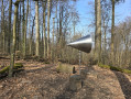
(12) Following the “L” sign, turn right off the wide path and you’ll reach the Summloch. Feel free to give it a go – it’s an interesting experience. Past the Summloch, the narrow path leads down to a car park.
(13) Cross the road to reach the signpost marked ‘Parkplatz Ruine Frankenstein’ and continue uphill along the tarmac path below the castle car park into the castle courtyard.
Once you’ve exited the castle gate, after a few metres turn right through the “Walderlebnispfad” gate and go down a few steps. Shortly after the steps, the path leads up to the right into the “Kräuter-Riech-Garten”. Here, continue to follow the “L” signpost.
After the “Fountain of Youth”, turn left. The signpost showing “two horizontal green bars” will now serve as your guide. Follow this signpost all the way to the village of Malchen.
As you reach the first houses, the path becomes tarmac and “Frankensteiner Straße” leads you downhill into the village.
(14) Further down, follow “Frankensteiner Str.” to the right as far as the village lime tree in Malchen. Then continue downhill and, when you reach three glass recycling bins, turn left onto the street “Im Weingarten”.
At the end of “Im Weingarten”, the route continues along a forest path. For the time being, use the Blütenweg signpost – a yellow ‘B’ on a white background – as your guide.
You now follow this signpost for quite some time. At a large junction, carry on straight across the junction.
A little later, when you reach some steps leading into a garden, turn left. Continue to follow the yellow ‘B’ for the Blütenweg.
You’ll reach a meadow. A footpath leads off to the left, heading straight towards a treehouse. Just before the treehouse, you’ll come to a fence; follow it to the left.
The path joins a tarmac road (“Im Schecken”). Here, turn left. At the end of the road, you’ll see a turning area; at the far end of this, a narrow path continues to the left in the corner.
Follow this path straight ahead, across the next road (“Am Blütenweg”) and continue to the left, past a garage, until you reach the next road. When you reach the transformer box, turn right (“Im Hahnböhl”).
At the next junction, turn left into “Lohndorfstraße”. Follow this road until you reach a T-junction. There, turn left (“Waldstraße”) and then immediately right again (“Burgstraße”).
At the end of “Burgstraße”, turn left into “Schlossstraße”. When you reach the “GlasArtWork” premises, turn right again.
(15) You cross “Ober-Beerbacher-Straße”, pass the historic Seeheim Town Hall and reach a square with various places to stop for a bite to eat.
After a well-deserved break, carry on straight ahead, past the Seeheim chemist’s along “Bergstraße”. “Bergstraße” becomes “Philipp-März-Straße” when you reach the small Landfrauenpark.
After a while, a footpath leads up the embankment to the left; follow this. It rejoins a tarmac path, which takes you past the Seeheim Volunteer Fire Brigade building.
After a bend to the left, another footpath branches off to the right across the meadow. You’ll emerge opposite the outdoor swimming pool’s car park. Cross this diagonally, walk past the swimming pool on the left-hand corner and turn right at the next opportunity.
Cross ‘Burkhardtstraße’ and continue along ‘Lindenstraße’ until you reach the roundabout. Turn right there and, after a few metres, you’ll reach the starting point of your walk (S/E).
 Visorando Member

 Easy
Easy 
 Difficult