


Refine your search for walks in Pierrefitte-Nestalas
Pierrefitte-Nestalas walks


 Circular route starting from Pierrefitte-Nestalas
 Visorando Member
 5.60 mi
 +1,135 ft
 -1,132 ft
 3h 35
3h 35
 Moderate
 Departure from Pierrefitte-Nestalas (Hautes-Pyrénées)
A circular route from Pierrefitte-Nestalas to visit the Abbey Church of Saint-Savin and its museum (if open). The Abbey Church is renowned for its furnishings; visit it with the description provided on the website to appreciate them fully. After a steep climb of about an hour up the mountain, the route follows the road, which in practice has very little traffic.The starting point can be adjusted to a car park in Pierrefitte-Nestalas.
Circular route starting from Artalens-Souin
3.32 mi
+994 ft
-971 ft
2h 25
Moderate
Departure from Artalens-Souin (Hautes-Pyrénées)
Circular path on the heights of Artalens-Souin, with beautiful views of the valley.
The duration is based on walking with two children aged 6 and 10, so it is for guidance only.
Lac d'Isaby via the Paspich and Pradets waterfalls, starting from Ortiac
8.88 mi
+3,205 ft
-3,225 ft
6h 50
 Difficult
Departure from Villelongue (Hautes-Pyrénées)
Difficult
Departure from Villelongue (Hautes-Pyrénées)
Here is another way to reach Lac d’Isaby from Ortiac. Along the way, you will visit the ruins of Saint-Orens Abbey and the Paspich and Pradets waterfalls before reaching Lac d’Isaby and climbing up to the Cabane Picourlet.
Saint-Orens Abbey and Lake Isaby from Ortiac
 7.88 mi
+2,608 ft
-2,608 ft
5h 55
Moderate
Departure from Villelongue (Hautes-Pyrénées)
7.88 mi
+2,608 ft
-2,608 ft
5h 55
Moderate
Departure from Villelongue (Hautes-Pyrénées)
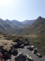
A beautiful hike that leads to Lake Isaby via the ruins of Saint-Orens Abbey and the Isaby Valley. A pleasant trail, sometimes steep, mostly in the forest before coming out onto the lake and the surrounding peaks (Soum and Pic de Léviste, Soum Arrouy, Soum de Lascours).
Pic du Cabaliros from Sireix
 7.31 mi
+2,516 ft
-2,513 ft
5h 35
Moderate
Departure from Arras-en-Lavedan (Hautes-Pyrénées)
7.31 mi
+2,516 ft
-2,513 ft
5h 35
Moderate
Departure from Arras-en-Lavedan (Hautes-Pyrénées)
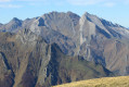
One of the most beautiful panoramas in the Cauterets region. Accessible without any particular difficulty. 360° view of the highest peaks in the central Pyrenees.
The Mont de Gez in a circular fashion from Arras-en-Lavedan
 5.80 mi
+1,663 ft
-1,637 ft
4h 05
Moderate
Departure from Arras-en-Lavedan (Hautes-Pyrénées)
5.80 mi
+1,663 ft
-1,637 ft
4h 05
Moderate
Departure from Arras-en-Lavedan (Hautes-Pyrénées)
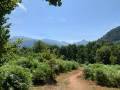
An easy and very pleasant walk, ideal if the weather prevents you from going to the high mountains.
Mont de Gez
 7.59 mi
+2,156 ft
-2,139 ft
5h 20
Moderate
Departure from Argelès-Gazost (Hautes-Pyrénées)
7.59 mi
+2,156 ft
-2,139 ft
5h 20
Moderate
Departure from Argelès-Gazost (Hautes-Pyrénées)
To the west of Argelès-Gazost, there is a very pretty, not too difficult circuit on well-maintained trails offering two viewpoints over the Gave de Pau valley and a 360° view of the Central Pyrenees!
 Hautacam Ridge and Pic du Mont towards Montaigu
 6.70 mi
+1,788 ft
-1,788 ft
6 hrs
6.70 mi
+1,788 ft
-1,788 ft
6 hrs
 Very difficult
Departure from Beaucens (Hautes-Pyrénées)
Very difficult
Departure from Beaucens (Hautes-Pyrénées)
A magnificent, challenging hike along the ridges at 2,000 m facing the Pic du Midi de Bigorre.
Although off the marked trails, it is quite busy in summer. In winter, it is completely off the beaten track for hikers, particularly in the final section (see note in Practical Information below).
In winter, as in summer, save this route for a perfectly clear, sunny day, as the views are remarkable and you won’t regret the effort.
Lac d'Ourrec from the Col de Tramassel
 6.65 mi
+1,496 ft
-1,476 ft
4h 20
Moderate
Departure from Beaucens (Hautes-Pyrénées)
6.65 mi
+1,496 ft
-1,476 ft
4h 20
Moderate
Departure from Beaucens (Hautes-Pyrénées)
Superb views of the surrounding mountains all along the route and from the Hourquette d'Ouscouaou.
Circular walk above Lac d’Isaby
7.26 mi
+1,621 ft
-1,627 ft
4h 45
Difficult
Departure from Beaucens (Hautes-Pyrénées)
A majestic landscape, an unmarked path that sometimes requires you to improvise. If you enjoy walking and finding your own way, this is for you.Difficult sections; not recommended for families with children.Do not attempt this hike if there is frequent fog in the area.GPX track recommended.
Hautacam
 7.56 mi
+1,234 ft
-1,237 ft
4h 35
Moderate
Departure from Beaucens (Hautes-Pyrénées)
7.56 mi
+1,234 ft
-1,237 ft
4h 35
Moderate
Departure from Beaucens (Hautes-Pyrénées)
Hike along the ridges with the ascent of Hautacam. The view is exceptional throughout the route.
This hike can be done when the snow conditions are stable.
This unmarked hike requires a good sense of direction and a GPX track.
Pic de Cabaliros, Malinat and Pic Arraillé de Sireix
 5.75 mi
+2,352 ft
-2,352 ft
4h 40
Moderate
Departure from Arras-en-Lavedan (Hautes-Pyrénées)
5.75 mi
+2,352 ft
-2,352 ft
4h 40
Moderate
Departure from Arras-en-Lavedan (Hautes-Pyrénées)
Hike to a first-class viewpoint in the Hautes-Pyrénées. The ascent along the ridges allows you to enjoy a 360° panorama for much of the route and to visit the Pics du Malinat and Arraillé.
The Pic du Viscos
 7.70 mi
+3,297 ft
-3,330 ft
6h 25
Difficult
Departure from Viscos (Hautes-Pyrénées)
7.70 mi
+3,297 ft
-3,330 ft
6h 25
Difficult
Departure from Viscos (Hautes-Pyrénées)
A very beautiful hike, but one that requires good physical fitness, good weather and sure-footedness.On a very short section along the ridge, you’ll need to be extra careful. The climb to the peak is difficult.Those prone to vertigo or wearing unsuitable footwear should take a lower path towards the pass, starting at (4), and reach the foot of the final ascent to the Pic de Viscos.
Lac de Bassias or Lac de Couey Seque from Hautacam
 6.22 mi
+1,312 ft
-1,325 ft
4h 00
Moderate
Departure from Beaucens (Hautes-Pyrénées)
6.22 mi
+1,312 ft
-1,325 ft
4h 00
Moderate
Departure from Beaucens (Hautes-Pyrénées)
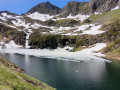
From the start, there is a superb panorama of the surrounding mountains. The view of the widening lake is splendid.
Isaby Lake
3.37 mi
+387 ft
-387 ft
1h 55
 Easy
Departure from Beaucens (Hautes-Pyrénées)
Easy
Departure from Beaucens (Hautes-Pyrénées)
This is an easy, short hike, ideal for young children. The lake, nestled in lush greenery and surrounded by mountains, is truly magnificent. Calm and peaceful, it makes you want to stay there for a long time.
Pic de Montaigu via the Hautacam ridges
 9.11 mi
+2,913 ft
-2,917 ft
6h 45
Difficult
Departure from Beaucens (Hautes-Pyrénées)
9.11 mi
+2,913 ft
-2,917 ft
6h 45
Difficult
Departure from Beaucens (Hautes-Pyrénées)
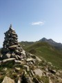
Montaigu is a beautiful peak in the Hautes-Pyrénées, facing the Pic du Midi de Bigorre and set back far enough from the main border range to offer a beautiful 360° view. This slope via the Hautacam ridges is the longest, but it is also the most beautiful and wildest. It offers a few aerial sections that add a certain interest! Only to be attempted if the weather is perfectly clear!
Lac dets Plagnous
4.59 mi
+577 ft
-564 ft
2h 35
Easy
Departure from Beaucens (Hautes-Pyrénées)
Lac dets Plagnous is a tiny lake above Lac d'Isaby. A little more difficult to access than the latter, it is neglected by hikers. However, it is very pleasant and makes you want to stay on its banks for a while.
Four-lake route from Moulata: Isaby, Plagnous, Ourrec and Bassias
10.45 mi
+2,680 ft
-2,664 ft
7h 10
Difficult
Departure from Beaucens (Hautes-Pyrénées)
This circular walk takes you to four magnificent high-altitude lakes nestled in the heart of the Hautes-Pyrénées: the lakes of Isaby, Plagnous, Ourrec and Bassias (or Couey Seque). The route alternates between mountain paths, mountain pastures and panoramic views of the surrounding peaks. Suitable for walkers accustomed to hiking in mountainous terrain, this route offers an immersion in an unspoilt environment featuring a succession of lakeside scenery, pastoral areas and remarkable viewpoints. A lovely outing to enjoy the diversity of the Pyrenean landscapes and discover several lakes in a single day, or with the option of camping at Lac de Bassias.
The Camparnas Mines
 3.18 mi
+1,480 ft
-1,473 ft
2h 45
Moderate
Departure from Chèze (Hautes-Pyrénées)
3.18 mi
+1,480 ft
-1,473 ft
2h 45
Moderate
Departure from Chèze (Hautes-Pyrénées)
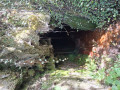
Once past the Pierrefite Gorges, you enter the Pays Toy, and Chèze is one of the first villages you come across. Its mining heritage is still visible, and the proposed route gives you a sense of the harshness of the trade, both in terms of the difficulty of accessing the mines and the extraction work itself. The Camparnas site still bears many traces of this activity. A mid-altitude hike best undertaken when the cloud cover is low.
See practical information.
Pic du Cabaliros and Lac d'Anapéou from Cauterets
 11.58 mi
+4,478 ft
-4,478 ft
9h 15
Difficult
Departure from Cauterets (Hautes-Pyrénées)
11.58 mi
+4,478 ft
-4,478 ft
9h 15
Difficult
Departure from Cauterets (Hautes-Pyrénées)
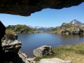
Le Cabaliros is a classic Pyrenean peak above Cauterets. Take the southern route, which is the longest, through woods, lush summer pastures and abundant mountain streams, rather than the Val d'Azun route. The length of the route and the significant elevation gain make this a challenging route reserved for experienced hikers. Enjoy a 360° view from the summit over the main Pyrenean range, the Saint-Pé-de-Bigorre massif and all the surrounding valleys.
Granges d'Espoune and d'Artigue Bourg on the slopes of Cabaliros
 4.04 mi
+1,585 ft
-1,591 ft
4 hrs
Moderate
Departure from Cauterets (Hautes-Pyrénées)
4.04 mi
+1,585 ft
-1,591 ft
4 hrs
Moderate
Departure from Cauterets (Hautes-Pyrénées)
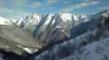
A short, family-friendly and easy hike in summer, but a challenging trek in winter under the snow. You’re in the heart of the Hautes-Pyrénées, amidst the highest peaks, on the route to the Pic du Cabaliros and Lake Anapéou.In both summer and winter, it offers a complete change of scenery in these traditional pastoral areas.
Pan and Hourmigous barns from Cauterets
6.25 mi
+1,788 ft
-1,772 ft
4h 25
Moderate
Departure from Cauterets (Hautes-Pyrénées)
A pleasant circular walk, starting from Cauterets, through the forests and ravines of the Saint-Savin Valley. The walk is classified as moderately difficult for hikers with some mountain experience. The route is circular and climbs through a beech forest towards abandoned barns. You’ll be charmed by the harmony of the pastoral setting. After a very steep climb, which you’ll need to tackle at a steady pace, you’ll return at a leisurely pace along a gentler route.
From Cauterets to La Fruitière
 6.46 mi
+1,890 ft
-1,860 ft
4h 35
Moderate
Departure from Cauterets (Hautes-Pyrénées)
6.46 mi
+1,890 ft
-1,860 ft
4h 35
Moderate
Departure from Cauterets (Hautes-Pyrénées)
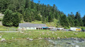
A walk, mainly through woodland, starting from Cauterets, towards the Lutour valley and the Fruitière guesthouse. This hike can be followed by the route leading to Lac d'Estom.
Circular Mont de Gez loop from Ouzous
8.79 mi
+2,418 ft
-2,451 ft
6h 10
Moderate
Departure from Ouzous (Hautes-Pyrénées)
Starting from Ouzous, this hike takes you along the discovery trail, around Argelès-Gazost and above the animal park. From there, a 500 m climb takes you to Mont de Gez via the south-southwest. The return route passes through Gez and the Bourdalat equestrian centre before reaching the Ouzous car park.
This shaded route mainly follows tracks and paths.
The Col de Riou from Cauterets
 9.64 mi
+3,593 ft
-3,579 ft
7h 35
Difficult
Departure from Cauterets (Hautes-Pyrénées)
9.64 mi
+3,593 ft
-3,579 ft
7h 35
Difficult
Departure from Cauterets (Hautes-Pyrénées)
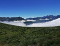
A variant ofthe GR®10which takes us from Cauterets to Col-de-Riou. A pleasant trail, mostly through woodland, then across mountain pastures to the pass. In summer, enjoy the magnificent fields of azaleas near the pass. Magnificent view from the pass over the valleys of Cauterets and Luz-Saint-Sauveur and the surrounding peaks.
Pic du Pibeste
 7.73 mi
+2,598 ft
-2,598 ft
5h 50
Moderate
Departure from Ouzous (Hautes-Pyrénées)
7.73 mi
+2,598 ft
-2,598 ft
5h 50
Moderate
Departure from Ouzous (Hautes-Pyrénées)
Round trip hike on a good path on the southern slope with Mediterranean-type vegetation, arriving at the station of the old cable car (1935-1969).
Short tour of Agos-Vidalos
3.89 mi
+423 ft
-410 ft
2h 10
Easy
Departure from Agos-Vidalos (Hautes-Pyrénées)
Starting from the Town Hall in Agos-Vidalos, head towards the church in Vidalos. Then, descend towards the Gave de Pau river at the Pont de Boô-Silhen bridge. Walk along the Gave de Pau (left bank) and then climb up to the Vidalos Tower. You can climb the tower (free of charge) and admire the view over the Argelès valley and the Pyrenees mountain range. Return along the Gave de Pau.
Sentier du Lisey - Return via the Chalet de la Reine Hortense
 6.96 mi
+2,500 ft
-2,484 ft
5h 25
Moderate
Departure from Cauterets (Hautes-Pyrénées)
6.96 mi
+2,500 ft
-2,484 ft
5h 25
Moderate
Departure from Cauterets (Hautes-Pyrénées)
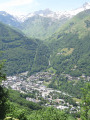
A pleasant hike in the heart of the Cauterets forests and their history.
Discover the superb Plateau du Lisey overlooking Cauterets. A real treat for the whole family!
Balade patrimoniale à Agos-Vidalos
2.86 mi
+548 ft
-548 ft
1h 50
Easy
Departure from Agos-Vidalos (Hautes-Pyrénées)
Set off to discover this pretty little village between Argelès-Gazost and Lourdes. Don't forget to look up at the sky, where you're sure to spot bearded vultures, black kites and vultures. The flora is also very rich. A perfect walk for families with children.
The Chalet de la Reine Hortense
4.73 mi
+1,365 ft
-1,378 ft
3h 20
Moderate
Departure from Cauterets (Hautes-Pyrénées)
Did Napoleon III's mother really walk the beautiful trail that leads from the Pauze-Vieux thermal baths to the chalet that bears her name? It is certainly a beautiful route overlooking Cauterets and facing the Moun Né or Pic de Monné (2,724 m). Although this walk is not particularly difficult, it should be noted that the descent to Cancéru is rather steep. Not recommended for those with weak knees. The return to Cauterets is via the Mamelon Vert.
The Balconies of Cauterets
9.96 mi
+3,110 ft
-3,097 ft
7h 15
Difficult
Departure from Cauterets (Hautes-Pyrénées)
Following a series of local footpaths, this circular route takes in the little gems and panoramic views of the spa town of Cauterets.
A scenic route through the local forests, exploring the thermal baths – both current and historic – the waterfalls on the milky-white streams, the views over the town and the mountain inns.
From Cauterets to the Ceriset Waterfall
 6.20 mi
+1,765 ft
-1,788 ft
4h 25
Moderate
Departure from Cauterets (Hautes-Pyrénées)
6.20 mi
+1,765 ft
-1,788 ft
4h 25
Moderate
Departure from Cauterets (Hautes-Pyrénées)
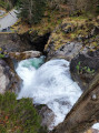
An accessible hike where you will walk around Cauterets on the heights with, for those who wish, a detour to the Waterfall Trail to the Ceriset Waterfall.
Turon de Hailla from Vizos
 6.29 mi
+3,304 ft
-3,330 ft
5h 45
Difficult
Departure from Vizos (Hautes-Pyrénées)
6.29 mi
+3,304 ft
-3,330 ft
5h 45
Difficult
Departure from Vizos (Hautes-Pyrénées)
A beautiful, little-known hike offering superb 360° views from Léviste to Pibeste via Luz, Bergons, Gavarnie and Viscos. The climb is steep but not difficult, and your thighs will feel the burn on the descent. There is a loop variant starting lower down (Saligos) and returning via Coueylas.
Three villages at the start of Sazos
 5.43 mi
+1,434 ft
-1,430 ft
3h 45
Moderate
Departure from Sazos (Hautes-Pyrénées)
5.43 mi
+1,434 ft
-1,430 ft
3h 45
Moderate
Departure from Sazos (Hautes-Pyrénées)
Follow old paths hidden under beech and hazel trees to discover three villages with a rich traditional architectural heritage.
The Ardiden lakes
 6.51 mi
+3,484 ft
-3,484 ft
6h 00
Difficult
Departure from Sazos (Hautes-Pyrénées)
6.51 mi
+3,484 ft
-3,484 ft
6h 00
Difficult
Departure from Sazos (Hautes-Pyrénées)
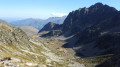
This is a fairly uncrowded hike leading to magnificent lakes below the Pic d'Ardiden, crossing small mountain pastures and ending in a fairly rocky area.
Ascent of Hautacam from Geu
9.15 mi
+4,321 ft
-4,321 ft
8h 00
Very difficult
Departure from Geu (Hautes-Pyrénées)
This is a physically demanding hike, reserved for experienced hikers or trail runners. The elevation gain is very significant over a relatively short distance. It is advisable to bring plenty of water and protection from the sun, as a significant part of the route is exposed. Protection from wind and rain is also strongly recommended.
The springs of Gazost
 1.50 mi
+427 ft
-427 ft
1h 05
Easy
Departure from Gazost (Hautes-Pyrénées)
1.50 mi
+427 ft
-427 ft
1h 05
Easy
Departure from Gazost (Hautes-Pyrénées)
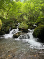
A family walk at the bottom of the green Gazost valley. Discover the history of the sulphurous springs that flow in a damp valley and now feed the thermal baths in the neighbouring valley.
The Raillère waterfall trail to the Pont d'Espagne hotel
 5.89 mi
+1,749 ft
-1,732 ft
4h 15
Moderate
Departure from Cauterets (Hautes-Pyrénées)
5.89 mi
+1,749 ft
-1,732 ft
4h 15
Moderate
Departure from Cauterets (Hautes-Pyrénées)
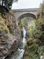
The path begins in the undergrowth of the Pyrenees National Park. From waterfall to waterfall, we reach Pont d'Espagne and its hotel. The path passes through the forest, which is very pleasant in summer. We walk along the Gave du Marcadau or Cauterets. This hike is a classic in the region.
3 days in the Central Pyrenees Park from Cauterets
 30.88 mi
+10,197 ft
-10,226 ft
3 days
Difficult
Departure from Cauterets (Hautes-Pyrénées)
30.88 mi
+10,197 ft
-10,226 ft
3 days
Difficult
Departure from Cauterets (Hautes-Pyrénées)
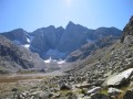
Explore the Pyrenees National Park (central section) with a trip to Spain, lakes and mountain passes at an altitude of 2,600 metres.
With an average elevation gain of ± 1,230 m and a distance of 17 km per day, this trip is, all in all, quite strenuous.
Please take into account the cumulative elevation gain and the distance to be covered.
The trip takes place between 1000 m and 2655 m altitude.
The start of this route is accessible by public transport (coaches and shuttle bus from Cauterets in summer).
From Cauterets to Ilhéou
 9.24 mi
+4,295 ft
-1,217 ft
8h 00
Moderate
Departure from Cauterets (Hautes-Pyrénées)
9.24 mi
+4,295 ft
-1,217 ft
8h 00
Moderate
Departure from Cauterets (Hautes-Pyrénées)
First day of a three-day route in the Central Pyrenees National Park.
This circular is best done from mid-June until the first cold spells.
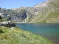
Ascent to Lac Noir, Col d'Ilhéou, Ilhéou Refuge and Lac d'Ilhéou.
Lac de Gaube from La Raillère
 9.54 mi
+2,405 ft
-2,395 ft
6h 30
Moderate
Departure from Cauterets (Hautes-Pyrénées)
9.54 mi
+2,405 ft
-2,395 ft
6h 30
Moderate
Departure from Cauterets (Hautes-Pyrénées)
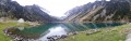
Discover Lac de Gaube from La Raillère, south of Cauterets, via theGR®10.
Ilhéou refuge
 6.27 mi
+2,054 ft
-2,054 ft
4h 40
Moderate
Departure from Cauterets (Hautes-Pyrénées)
6.27 mi
+2,054 ft
-2,054 ft
4h 40
Moderate
Departure from Cauterets (Hautes-Pyrénées)
Short 2-hour hike to the Ilhéou refuge (not forgetting the return trip).
Lac du Hourat from Cambasque
 7.89 mi
+3,340 ft
-3,346 ft
6h 30
Difficult
Departure from Cauterets (Hautes-Pyrénées)
7.89 mi
+3,340 ft
-3,346 ft
6h 30
Difficult
Departure from Cauterets (Hautes-Pyrénées)
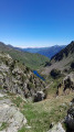
A beautiful lake with an island, difficult to access from Lake Ilhéou.
This hike is classified as difficult because the path is steep from Lac d'Ilhéou and a good sense of direction is necessary at the end of the route. This summer hike can be undertaken from the end of June until the first snowfall (for the Ilhéou - Hourat section).
Beware of Patou, the sheepdog. Do not cross through a flock, but go around it.
Tuc Arrouy via the waterfalls, the lake and the Ilhéou refuge.
 9.00 mi
+3,471 ft
-3,471 ft
7h 10
Difficult
Departure from Cauterets (Hautes-Pyrénées)
9.00 mi
+3,471 ft
-3,471 ft
7h 10
Difficult
Departure from Cauterets (Hautes-Pyrénées)
Lac d'Ilhéou, nestled in the hollow of a majestic cirque, reveals emerald blue-green waters that invite contemplation. Tuc Arrouy offers a bird's eye view of the lake and a myriad of Pyrenean peaks.These are the ingredients for a hike rich in magnificent landscapes and emotions.
Route of the Five Churches from Esquièze-Sère
5.22 mi
+1,365 ft
-1,335 ft
3h 35
Moderate
Departure from Esquièze-Sère (Hautes-Pyrénées)
On this route, there are five 11th- and 12th-century churches to see:- The 12th-century Church of Saint-Julien in Sazos.- The churches of Saint John the Baptist and Saint Nicholas in Esquièze-Sère: listed historic monuments from the 11th century. One is in the basilica style, whilst the other houses ancient chapels. Visits in July/August, 4pm–6pm.- The 12th-century Saint-Michel Church in Vizos.- The Church of Saints Peter and Paul in Saligos, dating from the 12th century.
The villages of Labatsus from Esquièze-Sère
7.30 mi
+2,198 ft
-2,182 ft
5h 15
Moderate
Departure from Esquièze-Sère (Hautes-Pyrénées)
An unmissable hike, visiting five villages that look like something out of a mountain ecology textbook. The men and women have tamed the slopes, working tenaciously to make a year-round living from livestock farming, which now boasts an appellation d'origine contrôlée (AOC) designation. It is thanks to this activity that we have these charming landscapes of high-altitude gardens, flower-filled meadows meticulously bordered by ash hedges, balcony paths and terraces on retaining walls.
Château Sainte-Marie and a panoramic view of Luz-Saint-Sauveur
 1.90 mi
+764 ft
-764 ft
1h 30
Moderate
Departure from Esquièze-Sère (Hautes-Pyrénées)
1.90 mi
+764 ft
-764 ft
1h 30
Moderate
Departure from Esquièze-Sère (Hautes-Pyrénées)
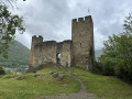
Panoramic view of Luz-Saint-Sauveur, situated at the confluence of three valleys. From the site, which has been developed as a viewing point, you can see the whole of the Central Pyrenees.
The Napoleon - Eugénie route in Luz-Saint-Sauveur
3.81 mi
+627 ft
-627 ft
2h 20
Easy
Departure from Luz-Saint-Sauveur (Hautes-Pyrénées)
It was following Napoleon III's visit that this small town in the Pyrenees began to flourish. This route highlights the buildings that the Emperor was directly or indirectly responsible for. Firstly, there is the spa district of Saint-Sauveur, then the bridge that bears his name and spans the Gavarnie river, and finally the small Solférino chapel, a reminder of his victory over the Prussians.
Soum de Trézères from Ousté
 8.69 mi
+3,323 ft
-3,320 ft
6h 55
Difficult
Departure from Ousté (Hautes-Pyrénées)
8.69 mi
+3,323 ft
-3,320 ft
6h 55
Difficult
Departure from Ousté (Hautes-Pyrénées)
This ridge hike offers views over a large part of the central Pyrenees. It should only be attempted when there is no thick, unstable snow. The return via the village of Ourdon requires a good sense of direction.
The Soum d'Andorre and the Soum de Conques via the ridges
 5.64 mi
+2,339 ft
-2,316 ft
4h 40
Difficult
Departure from Salles (Hautes-Pyrénées) (Hautes-Pyrénées)
5.64 mi
+2,339 ft
-2,316 ft
4h 40
Difficult
Departure from Salles (Hautes-Pyrénées) (Hautes-Pyrénées)
A very pretty circular reserved for very good walkers who are not afraid of heights. The hike is classified as difficult because of the passage over a ridge, but there are no particular dangers anda good sense of direction is essential. (¹)
Part of the return route is quite steep, after the Col de Las Escures.
This hike should only be attempted in the absence of snow and rain.
The GPX track is essential for this route.
A route taking in two of the Toy region’s gems, Viey and Sers
2.43 mi
+879 ft
-879 ft
1h 55
Moderate
Departure from Viey (Hautes-Pyrénées)
A short, very easy walk which, by following the paths once used by the area’s former inhabitants, allows you to discover two magnificent little villages in the Toy region near Luz-Saint-Sauveur.
Ilhéou Lake via the Crête du Lys from the Grand Barbat chairlift
 3.65 mi
+1,073 ft
-1,047 ft
2h 35
Moderate
Departure from Cauterets (Hautes-Pyrénées)
3.65 mi
+1,073 ft
-1,047 ft
2h 35
Moderate
Departure from Cauterets (Hautes-Pyrénées)
A lovely half-day hike through green summer pastures to Lac d'Ilhéou and its rocky landscape. Enjoy a 360° panorama of the surrounding peaks from the start of the hike.
Exploring Castelloubon around the Tuquet de Lhési
 11.49 mi
+3,022 ft
-3,025 ft
7h 55
Difficult
Departure from Juncalas (Hautes-Pyrénées)
11.49 mi
+3,022 ft
-3,025 ft
7h 55
Difficult
Departure from Juncalas (Hautes-Pyrénées)
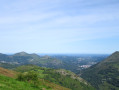
Near Lourdes, and dominated by the Pic du Montaigu (2,339 m), the Castelloubon offers a variety of landscapes that can be explored via nine hiking routes of varying lengths.
This circular route, starting from Juncalas, follows sections of these trails to explore the eastern part of this High Pyrenees region, featuring forests, pastures and ridges. You can thus admire the high mountain range, the foothills and the plain. It takes you up the Soum de Trées and the Tuquet de Lhési, and also allows you to visit the villages of Gazost, Ourdon, Lias and Ousté.
In search of the old Bolou stopover lodge
6.35 mi
+1,558 ft
-1,542 ft
4h 15
Moderate
Departure from Betpouey (Hautes-Pyrénées)
A long time ago, a group of young people spent a memorable week at the Bolou stopover lodge, between Luz-St-Sauveur and Barèges. Although the accommodation no longer exists, the building is still as it was when we found it during a beautiful walk under, in, and almost above the clouds. I invite you to follow us into one of the valleys that leads to the Néouvielle Massif.
From the Ilhéou Refuge to the Wallon Refuge via the Opale Lakes
 8.41 mi
+3,114 ft
-3,507 ft
6h 35
Difficult
Departure from Estaing (Hautes-Pyrénées) (Hautes-Pyrénées)
8.41 mi
+3,114 ft
-3,507 ft
6h 35
Difficult
Departure from Estaing (Hautes-Pyrénées) (Hautes-Pyrénées)
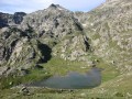
Second day of a three-day route in the Central Pyrenees National Park.The day will begin with a fairly steep climb, but will allow you to see a multitude of high-altitude lakes before arriving at the Wallon refuge.If there is not enough time, the visit to the Opale lakes can be omitted.
Circular Grand Barbat starting from Ilhéou
 5.85 mi
+3,215 ft
-3,215 ft
8 hrs
Very difficult
Departure from Estaing (Hautes-Pyrénées) (Hautes-Pyrénées)
5.85 mi
+3,215 ft
-3,215 ft
8 hrs
Very difficult
Departure from Estaing (Hautes-Pyrénées) (Hautes-Pyrénées)
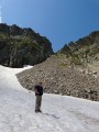
A circular loop starting from the small Ilhéou refuge, for experienced mountaineers seeking solitude.
Please note: the route is mostly off-track and poorly marked, over very rugged terrain (scree, rocky slopes, snowfields, steep slopes).
Should only be attempted in clear weather.
Extensive panoramic views due to its position set back from the border ridge: Néouvielle, Marboré, Vignemale, Balaïtous...