Circular walk above Lac d’Isaby

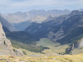
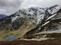
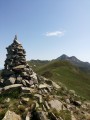
A majestic landscape, an unmarked path that sometimes requires you to improvise. If you enjoy walking and finding your own way, this is for you.
Difficult sections; not recommended for families with children.
Do not attempt this hike if there is frequent fog in the area.
GPX track recommended.

Details

25212510
Creation:
Last update:
Last review:
  • Walking
    Activity: Walking
  • ↔
    Distance: 7.26 mi
  • ◔
    Average duration: 4h 45 
  • ▲
    Difficulty: Difficult

  • ⚐
    Back to start: Yes
  • ↗
    Ascent: + 1,621 ft
  • ↘
    Descent: - 1,627 ft

  • ▲
    Highest point: 6,293 ft
  • ▼
    Lowest point: 5,223 ft

Description of the walk

Park at the top car park at Hautacam. Observatory and inn.

(S/E) From the large car park, head due south and, after 50 m, turn left, heading due east, onto the track to quickly reach the Col de Tramassel or Col de Buraou.

(1) Leave the track and continue to the right, heading due east, uphill to reach a car park near the Col de Moulata.

(2) Turn onto the path on the left, passing beneath the Naouit ski lifts. Follow a hairpin bend to the right to reach the top of the ski lifts.

(3) Cross the ridge and keep to the hillside to reach the junction with the Discovery Trail.

(4) Turn left onto this path and head for the Hourquette d’Ouscouaou.

(5) Caution here: this is where the difficult section begins, as the path is not marked; this section is strongly advised against for children. Note: the path shown on the IGN map very quickly turns out to be a network of sheep tracks. Navigate using the map; the GPS track is very useful here. Then rejoin the path.

(6) Follow it as it climbs gently to reach the highest point.

(7) Continue on and, via a wide bend to the right, reach the stream feeding into Lac des Plagnous. Follow it along until you emerge at the lake.

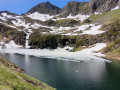
(8) Carry on along a good path to reach the area above Lac d’Isaby.

(10) Pass by the Cabane de Picourlet.

(9) Carry on straight ahead and, a few hundred metres further on, rejoin the Discovery Trail.

(11) Turn right onto it, following a gentle climb, and reach the junction you passed on the way out.

(2) Turn left and follow the outbound route in the opposite direction to return to the car park at the top of Hautacam (S/E).


Waypoints

  1. S/E : mi 0 - alt. 5,295 ft - Top Hautacam car park
  2. 1 : mi 0.15 - alt. 5,240 ft - Leave the track - Parking du col de Tramassel (ou de Buraü) (1615m)
  3. 2 : mi 0.65 - alt. 5,486 ft - Crossroads at the end of the circular loop
  4. 3 : mi 1.22 - alt. 5,705 ft - Naouit ski lifts
  5. 4 : mi 1.62 - alt. 5,623 ft - Nature trail
  6. 5 : mi 2.91 - alt. 6,079 ft - Near the - Hourquette d'Ouscouaou (1870 m)
  7. 6 : mi 3.1 - alt. 6,020 ft - Tricky section
  8. 7 : mi 3.72 - alt. 6,207 ft - High point
  9. 8 : mi 4.25 - alt. 5,679 ft - Lac dets Plagnous
  10. 9 : mi 4.98 - alt. 5,315 ft - Overlooking the - Lac d'Isaby
  11. 10 : mi 5.1 - alt. 5,322 ft - Cabane de Picourlet
  12. 11 : mi 5.4 - alt. 5,279 ft - Nature trail
  13. S/E : mi 7.26 - alt. 5,295 ft - Top Hautacam car park

Notes

Hourquette d’Ouscouaou mountain hut (5), Picourlet mountain hut (9).
Water from the stream must be filtered or treated.

Worth a visit

Take in the scenery.

Reviews and comments

4.4 / 5
Based on 4 reviews

Reliability of the description
4.5 / 5
Ease of following the route
4 / 5
Route interest
4.8 / 5
greg 19
greg 19

I'm really glad you enjoyed this brilliant route 😁

Machine-translated

matrat nelly
matrat nelly

Overall rating : 5 / 5

Date of your route : Aug 04, 2026
Reliability of the description : ★★★★★ Very good
Ease of following the route : ★★★★★ Very good
Route interest : ★★★★★ Very good
Very busy route : No

At high point no. 7, it’s not easy to find the right route (a cluster of rocks) to rejoin the path leading to Lac des Plagnous.
A very beautiful hike for those used to the mountains; there are a few sections where you need to be sure-footed.
Thank you – we didn’t come across a single person on this section.
Nelly

Machine-translated

Nous en rando
Nous en rando

Overall rating : 5 / 5

Date of your route : Oct 07, 2025
Reliability of the description : ★★★★★ Very good
Ease of following the route : ★★★★★ Very good
Route interest : ★★★★★ Very good
Very busy route : No

Easy hike but a few tricky sections, including crossing rock avalanches, which must be done with caution...

Machine-translated

jibe64
jibe64

Route taken on 18/09/2025. We set off from the Col de la Moulata, accessible by car via a track. We followed the path towards the Hourquette d'Ouscouaou, taking the right-hand branch which quickly leads down to the Lac d'Isaby path.
Beyond the Hourquette, the trail becomes increasingly narrow, going up and down and crossing two areas of scree, the last of which consists of boulders rather than gravel. There are a few cairns at this point, while you can make out a path that descends steeply down a small corridor that you will have to climb back up anyway. Therefore, avoid this loss of altitude.
You come out of the couloir on the right, which ends the cirque at the foot of Pène Lounque on the Grande Estibère (hut).
The return trip via Lake Dets Plagnous is straightforward.
We thought we would find a shortcut there that would not lose too much altitude to reach the Grande Estibère and then go towards the Mail de la Sède or the Soum Arrouy, but the difficulty of progressing on this small path does not offer the advantage we had hoped for, in our opinion.
However, the route offers spectacular views of the Isaby valley.

Machine-translated

greg 19
greg 19

Overall rating : 5 / 5

Date of your route : Oct 31, 2024
Reliability of the description : ★★★★★ Very good
Ease of following the route : ★★★★★ Very good
Route interest : ★★★★★ Very good
Very busy route : Yes

Thank you for this wonderful spot – there weren’t many people around at this time of year starting from Hautacam.
Once we left the nature trail, we were completely on our own all the way to Lake Isaby. There were some fairly technical sections, but what a blast!!!
Thanks again for this lovely route

Machine-translated

zaztrail
zaztrail

Overall rating : 2.7 / 5

Date of your route : Aug 07, 2023
Reliability of the description : ★★★☆☆ Average
Ease of following the route : ★☆☆☆☆ Very disappointing
Route interest : ★★★★☆ Good
Very busy route : No

The route was very difficult and technical, in that there were no markings on the winding section of the return leg and, above all, we had to cross a section of slippery rocks – a dangerous part. It was very tricky.
I wouldn’t recommend this route.

Machine-translated

Other walks in the area

For more walks, use our search engine .

The GPS track and description are the property of this route's author. Please do not copy them without permission.