Circular route starting from Pierrefitte-Nestalas

A circular route from Pierrefitte-Nestalas to visit the Abbey Church of Saint-Savin and its museum (if open). The Abbey Church is renowned for its furnishings; visit it with the description provided on the website to appreciate them fully. After a steep climb of about an hour up the mountain, the route follows the road, which in practice has very little traffic.
The starting point can be adjusted to a car park in Pierrefitte-Nestalas.

Details

96167564
Creation:
Last update:
Last review:
  • Walking
    Activity: Walking
  • ↔
    Distance: 5.60 mi
  • ◔
    Average duration: 3h 35 
  • ▲
    Difficulty: Moderate

  • ⚐
    Back to start: Yes
  • ↗
    Ascent: + 1,135 ft
  • ↘
    Descent: - 1,132 ft

  • ▲
    Highest point: 2,602 ft
  • ▼
    Lowest point: 1,440 ft

Description of the walk

Park on Rue Ledormeur in Pierrefite-Nestalas.

(S/E) Take a path running parallel to the road to reach the Route de Cauterets (the D920).

(1) Cross it with great care, then take the small path leading up the mountain opposite. At the top of the climb, join the Chemin d’Igau.

(2) Start the descent opposite and you will soon reach the hamlet of Uz.

(3) Continue along the Route d'Uz D101. 150 m before it joins the D13, turn right to reach the Abbey Church of Saint-Savin.

(4) Continue to the right until you reach the junction with a dirt track leading to Adast.

(5) Turn left onto it, enter the woods, and continue down the slope to reach a wash house located at the entrance to Adast.

(6) Turn left to cross Adast, then carefully cross the D921 and you will immediately come to the Greenway.

(7) Follow this path through the tunnel and then turn right. Continue straight on until you reach the roundabout at the entrance to Pierrefitte-Nestalas.

(8) Turn left here onto Avenue Jean Moulin, then right onto Rue Pierre Brossolette and then Rue Ledormeur to reach the car park (S/E).

Waypoints

  1. S/E : mi 0 - alt. 1,627 ft - Car park, Rue Ledormeur - Gave de Cauterets (rivière)
  2. 1 : mi 0.35 - alt. 1,890 ft - D920
  3. 2 : mi 1.3 - alt. 2,602 ft - Igau Path
  4. 3 : mi 1.75 - alt. 2,457 ft - Uz
  5. 4 : mi 3.07 - alt. 1,788 ft - Abbatiale de Saint-Savin
  6. 5 : mi 3.26 - alt. 1,749 ft - Dirt track towards the woods
  7. 6 : mi 3.93 - alt. 1,470 ft - Avast wash house
  8. 7 : mi 4.2 - alt. 1,453 ft - Greenway
  9. 8 : mi 4.85 - alt. 1,512 ft - Roundabout
  10. S/E : mi 5.6 - alt. 1,634 ft - Car park, Rue Ledormeur

Notes

(4) A drinking fountain is available in front of the Abbey Church of Saint-Savin, marked ‘drinking water’.

Worth a visit

(2) Here, you can turn left for a 40-minute round trip to see the Chapel of Pouyaspe, the birthplace of Saint Savin, on your left.
(4) Take the time to visitthe Abbey Church of Saint-Savin. You can also visit the museum (if open).
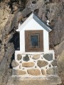
(5) You can turn right to take a short detour and see the Chapel of Piétat up close.

Other walks in the area

For more walks, use our search engine .

The GPS track and description are the property of this route's author. Please do not copy them without permission.