


Refine your search for walks in Le Vivier
Le Vivier walks


 The Fajas d'en Baillette
 Visorando Member
 6.95 mi
 +1,772 ft
 -1,772 ft
 4h 45
4h 45
 Moderate
 Departure from Le Vivier (Pyrénées-Orientales)
This splendid hike invites you to discover a magnificent forest with its springs, its view of the Canigou massif... and of course this truly remarkable beech tree: the 500-year-old Fajas d'en Baillette!
The Col Benta Fride from Le Vivier via Prats-de-Sournia
 9.50 mi
+2,274 ft
-2,274 ft
6h 20
Moderate
Departure from Le Vivier (Pyrénées-Orientales)
9.50 mi
+2,274 ft
-2,274 ft
6h 20
Moderate
Departure from Le Vivier (Pyrénées-Orientales)
A hike for autumn and winter. From the church at Le Vivier, head to Prats-de-Sournia via the Col de Guza.Then, after passing Al Carmeill and its orientation points, head for the Col de Benta Fride.After a stretch of open terrain, there follows a long descent through the beech forest of the Forêt Communale du Vivier, following theGR®®36. The total elevation gain is around 750 m.This walk is unmarked at the start. The GPX track may therefore prove useful (S/E) at (6).
The heights of Taïchac in Saint-Martin-de-Fenouillet
 4.01 mi
+741 ft
-758 ft
2h 30
4.01 mi
+741 ft
-758 ft
2h 30
 Easy
Departure from Saint-Martin (Pyrénées-Orientales) (Pyrénées-Orientales)
Easy
Departure from Saint-Martin (Pyrénées-Orientales) (Pyrénées-Orientales)
At the meeting point of the African-Iberian and European tectonic plates, this interpretive trail offers many geological, natural and scenic attractions through vineyards, fir trees and heathland.
The Col de Quitou, Trilla and the Col de Saint-Jean from Pézilla-de-Conflent
 7.35 mi
+1,946 ft
-1,926 ft
5h 05
Moderate
Departure from Pézilla-de-Conflent (Pyrénées-Orientales)
7.35 mi
+1,946 ft
-1,926 ft
5h 05
Moderate
Departure from Pézilla-de-Conflent (Pyrénées-Orientales)
A walk with no particular difficulties, which can be shortened.
Hike named: “Village Memories”, properly signposted by the Agly-Fenouilledes inter-communal committee.
Beautiful scenery and paths on this mid-mountain circular route.
Circular walk from Sournia to Campoussy via Font and the Dolmen de l'Arca
 9.55 mi
+1,391 ft
-1,394 ft
5h 35
Moderate
Departure from Sournia (Pyrénées-Orientales)
9.55 mi
+1,391 ft
-1,394 ft
5h 35
Moderate
Departure from Sournia (Pyrénées-Orientales)
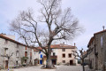
Starting from the village of Sournia, this circular route takes you to the beautiful village of Campoussy. It also allows you to discover lovely paths, stone huts, springs, wayside shrines, a memorial stone, and vast landscapes covered in low vegetation. The GR®36 and the GRP® Tour des Fenouillèdes are among the paths taken.Although almost the entire circular route is signposted, you must be extra vigilant as it features three different types of signposting!
Please note: on several occasions the IGN base map is inaccurate; the OSM base map may be helpful. There are many changes in direction and signposting. Total elevation gain closer to 550 m.The GPX track is strongly recommended.
Walk around the Desix
 7.50 mi
+1,322 ft
-1,322 ft
4h 35
Moderate
Departure from Sournia (Pyrénées-Orientales)
7.50 mi
+1,322 ft
-1,322 ft
4h 35
Moderate
Departure from Sournia (Pyrénées-Orientales)
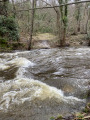
The ancient Gallo-Celtic oppidum of Sournia and Campoussy enjoy a remarkable mid-mountain setting. In this contrasting landscape of the Desix Valley, the land preserves Roman (bridge), Roman-Mozarabic and Templar remains. The route alternates between footpaths (GR®36,PR®) and forest tracks.
Pic Vergès and Saint-Arnac
 9.10 mi
+1,768 ft
-1,768 ft
5h 45
Moderate
Departure from Ansignan (Pyrénées-Orientales)
9.10 mi
+1,768 ft
-1,768 ft
5h 45
Moderate
Departure from Ansignan (Pyrénées-Orientales)
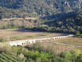
An exceptional route starting from Ansignan and its famous Roman aqueduct, where you will discover the beautiful village of Saint-Arnac and a sumptuous panorama at Pic Vergès.
 The Agly Valley and the Wine Route via Maury
14.22 mi
+1,060 ft
-1,086 ft
2 hrs
Moderate
Departure from Saint-Paul-de-Fenouillet (Pyrénées-Orientales)
A pleasant cycle ride through part of the Fenouillèdes region, taking in the ancient thermal baths of Saint-Paul, its hot springs at 28°C and its Via Ferrata. The route follows part of the River Agly, then climbs to offer views of the Canigou mountain range and the village of Maury with its trompe-l’œil murals and its AOP wine.
The Galamus Gorges via Cucugnan
26.77 mi
+3,156 ft
-3,179 ft
2.5 hrs
Moderate
Departure from Saint-Paul-de-Fenouillet (Pyrénées-Orientales)
A walk between the Corbières and the Fenouillèdes in the Corbières-Fenouillèdes Regional Nature Park. The walk through the gorges is impressive *. A touch of history with the castles of Peyrepertuse and Quéribus, listed as UNESCO World Heritage Sites.
From Saint-Paul-de-Fenouillet to Lesquerde via Saint-Arnac
10.49 mi
+1,480 ft
-1,490 ft
1 hr
Moderate
Departure from Saint-Paul-de-Fenouillet (Pyrénées-Orientales)
A cycle ride through the Fenouille region. Initially, you follow the River Agly, then cycle through the vineyards, with the added bonus of a beautiful view of the Canigou massif. All the villages produce wine bearing the ‘Agly’ appellation followed by the village name.
Through vineyards and orchards via Caudiès-de-Fenouillèdes
15.61 mi
+587 ft
-614 ft
1h 15
Moderate
Departure from Saint-Paul-de-Fenouillet (Pyrénées-Orientales)
A short cycle ride through the vineyards and orchards. No particular difficulties apart from a steep descent before reaching Caudiès-de-Fenouillèdes, and the final section being along the D117,
From Saint-Paul-de-Fenouillet to Caudiès-de-Fenouillèdes via Ansignan
24.50 mi
+1,194 ft
-1,135 ft
2h 02
Moderate
Departure from Saint-Paul-de-Fenouillet (Pyrénées-Orientales)
A cycle ride through the Fenouillet region, along small roads offering varied landscapes ranging from vineyards to forests. The villages are small and seem frozen in a bygone era. This route features some steep climbs and fairly fast descents.
Ansignan–Le Vivier circular route, starting from Saint-Paul-de-Fenouillet
19.39 mi
+1,017 ft
-1,253 ft
1h 34
Moderate
Departure from Saint-Paul-de-Fenouillet (Pyrénées-Orientales)
A cycle ride through the Fenouillet region along small roads offering varied landscapes ranging from vineyards to forests. The villages are small and seem frozen in a bygone era. This route features some steep climbs and fairly fast descents.
Lake Caramany, via the Agly Valley and the Wine Route
20.47 mi
+1,345 ft
-1,371 ft
1h 36
Moderate
Departure from Saint-Paul-de-Fenouillet (Pyrénées-Orientales)
A pleasant 33 km route through the Fenouillèdes, following the Agly as far as Ansignan and Lake Caramany, then climbing towards the villages of Lansac and Lesquerde. This is part of the Wine Route. For enthusiasts, there are numerous dolmens to see.
The Roc Paradet circular from Prugnanes
 6.76 mi
+2,008 ft
-1,982 ft
4h 50
Moderate
Departure from Prugnanes (Pyrénées-Orientales)
6.76 mi
+2,008 ft
-1,982 ft
4h 50
Moderate
Departure from Prugnanes (Pyrénées-Orientales)
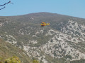
A beautiful, fairly challenging circular between Aude and Pyrénées Orientales with a magnificent 360° panorama at the summit of Paradet as a reward.
The Roc Paradet from Prugnanes
 9.29 mi
+2,349 ft
-2,323 ft
6h 20
Moderate
Departure from Prugnanes (Pyrénées-Orientales)
9.29 mi
+2,349 ft
-2,323 ft
6h 20
Moderate
Departure from Prugnanes (Pyrénées-Orientales)
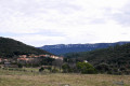
A hike from a pretty little village on the Sentier Cathare GR®367, the GR®36, and the GRP® Tour des Fenouillèdes.A sense of direction is required. The reward comes at the summit, with its 360° panorama.On the way back, a visit to a large and beautiful cave is very interesting.
Saint-Jaume Gorges and Fenouillet Fortresses
 5.51 mi
+1,047 ft
-1,056 ft
3h 25
Moderate
Departure from Caudiès-de-Fenouillèdes (Pyrénées-Orientales)
5.51 mi
+1,047 ft
-1,056 ft
3h 25
Moderate
Departure from Caudiès-de-Fenouillèdes (Pyrénées-Orientales)
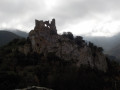
When the valley was unsafe, the men would retreat to the heights. The hills surrounding the Boulzane and Agly valleys are dotted with prestigious strongholds (Puylaurens, Fenouillet, Quéribus, etc.). And getting there was no easy task, as the Gorges de Saint-Jaume demonstrate.
The dolmens of Trilla
 4.56 mi
+912 ft
-922 ft
2h 55
Moderate
Departure from Ansignan (Pyrénées-Orientales)
4.56 mi
+912 ft
-922 ft
2h 55
Moderate
Departure from Ansignan (Pyrénées-Orientales)
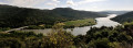
On the heights between Ansignan and Lac de Caramany, the village of Truilla clings to its granite mountain. The first inhabitants used the boulders scattered across the area to build their tombs. The trail winds through this landscape of ridges and granite chaos, connecting two of these dolmens lost in the heart of the vineyards.
Recent information: fences have been installed between points 6 and 7, preventing access.
Around the Galamus Gorges
7.44 mi
+2,907 ft
-2,927 ft
5h 55
 Difficult
Departure from Saint-Paul-de-Fenouillet (Pyrénées-Orientales)
Difficult
Departure from Saint-Paul-de-Fenouillet (Pyrénées-Orientales)
A beautiful, challenging hike around the Galamus Gorges, which you will follow from the start of the route.
The arrival at Pla de Brézou is also magnificent. A huge space at this location.
Tirounère Crag (climbing routes) – round trip
1.68 mi
+404 ft
-404 ft
1h 05
Easy
Departure from Saint-Paul-de-Fenouillet (Pyrénées-Orientales)
This route describes the access path to the cliff at the Tirounère climbing site from the Gorges de Galamus car park. It is not a hike in itself but is intended to facilitate climbers’ access to this cliff nestled in the forest.
From Caudiès-de-Fenouillèdes to Fenouillet
 6.40 mi
+1,014 ft
-1,001 ft
3h 50
Moderate
Departure from Caudiès-de-Fenouillèdes (Pyrénées-Orientales)
6.40 mi
+1,014 ft
-1,001 ft
3h 50
Moderate
Departure from Caudiès-de-Fenouillèdes (Pyrénées-Orientales)
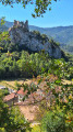
A peaceful, family-friendly itinerary featuring the Gorges de Saint-Jaume and the fortresses of Fenouillet on this heritage getaway.
The Pech de Bugarach circular route from Caudiès-de-Fenouillèdes
 11.85 mi
+3,514 ft
-3,510 ft
10 hrs
11.85 mi
+3,514 ft
-3,510 ft
10 hrs
 Extremely difficult
Departure from Caudiès-de-Fenouillèdes (Pyrénées-Orientales)
Extremely difficult
Departure from Caudiès-de-Fenouillèdes (Pyrénées-Orientales)
Ascent of the summit of the Aude starting from the Pyrénées-Orientales. The route follows sections of the GR®367A, the GR®36 and an unmarked section on the south-east ridge of the Pech de Bugarach.
⚠️ Please be aware of the difficulties encountered on the challenging route between (10) and (15).
The Château des Maures and Malabrac from Caudiès de Fenouillèdes
8.56 mi
+1,759 ft
-1,785 ft
5h 30
Difficult
Departure from Caudiès-de-Fenouillèdes (Pyrénées-Orientales)
From the village of Caudiès-de-Fenouillèdes through the forest, we will go to the spiral viaduct on the D9 and the ruins of the Château des Maures. We will pass the commemorative plaque marking the lunch stop of the Duke and Duchess of Orléans, sons of Louis-Philippe I, then head towards the abandoned hamlet of Malabrac.
The ruined sheepfolds of La Couillade and Campeaux
8.09 mi
+1,696 ft
-1,703 ft
5h 10
Moderate
Departure from Caudiès-de-Fenouillèdes (Pyrénées-Orientales)
In this remote corner, two hours from the nearest village, families dedicated to farming lived just a few decades ago.
Le Pla de Brézou and Pech d'Auroux
 6.63 mi
+2,277 ft
-2,283 ft
5h 00
Moderate
Departure from Saint-Paul-de-Fenouillet (Pyrénées-Orientales)
6.63 mi
+2,277 ft
-2,283 ft
5h 00
Moderate
Departure from Saint-Paul-de-Fenouillet (Pyrénées-Orientales)
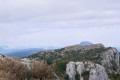
A very pretty route that takes you through areas still used for grazing and to Pech Auroux, offering a 360° view of the Corbières to the north, the Fenouillèdes to the south and Bugarach to the west. The last part of the route overlooks the Gorges de Galamus.
Hike closer to 750 m elevation gain.
A less challenging version is available: Le Pla de Brézou
Caudiès-de-Fenouillèdes - Cubières-sur-Cinoble
 15.07 mi
+3,287 ft
-3,009 ft
9h 45
Difficult
Departure from Caudiès-de-Fenouillèdes (Pyrénées-Orientales)
15.07 mi
+3,287 ft
-3,009 ft
9h 45
Difficult
Departure from Caudiès-de-Fenouillèdes (Pyrénées-Orientales)
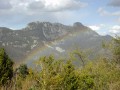
First stage of a 2-day circular route starting from Caudiès-de-Fenouillèdes, taking you to Cubières-sur-Cinoble on thefirst day.
This is a fairly long stage with a significant elevation gain. It is possible to adapt the route as you wish, as there are numerousPR®,GR® 36, Cathar TrailGR®367- 367A andGRP® Tour des Fenouillèdes paths.
The Agly and the Bugarach
 28.61 mi
+6,995 ft
-6,972 ft
2 days
Difficult
Departure from Caudiès-de-Fenouillèdes (Pyrénées-Orientales)
28.61 mi
+6,995 ft
-6,972 ft
2 days
Difficult
Departure from Caudiès-de-Fenouillèdes (Pyrénées-Orientales)
Here is a 45 km circular route that will allow you to explore the former natural border between France and Spain, between the Aude and the Pyrénées-Orientales, as well as the upper Agly valley and its magnificent Galamus Gorges, before climbing up to the Pic de Bugarach.The route starts from Caudiès-de-Fenouillèdes towards Duilhac-sous-Peyrepertuse, then descends towards Cubières-sur-Cinoble.On the second day, approach and climb up to the Pech de Bugarach, then descend and return to Caudiès.
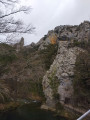
Around the Galamus Gorges
 7.20 mi
+2,388 ft
-2,398 ft
5h 25
Difficult
Departure from Saint-Paul-de-Fenouillet (Pyrénées-Orientales)
7.20 mi
+2,388 ft
-2,398 ft
5h 25
Difficult
Departure from Saint-Paul-de-Fenouillet (Pyrénées-Orientales)
Rocky landscapes, forest trails, views of the Canigou and Bugarach.A GPS is useful on certain sections.This hike is not recommended if you are prone to vertigo.
Le Pla de Brézou
 8.21 mi
+1,886 ft
-1,877 ft
5h 25
Moderate
Departure from Saint-Paul-de-Fenouillet (Pyrénées-Orientales)
8.21 mi
+1,886 ft
-1,877 ft
5h 25
Moderate
Departure from Saint-Paul-de-Fenouillet (Pyrénées-Orientales)
A very lovely route that takes you through areas that are still largely unspoilt.The final section of the route offers views overlooking the Galamus Gorges.Amendment made on 6 November 2019. Confirmed on 10 November following a recce.The hike is closer to 650 m of elevation gain.There is an alternative route via the Pech d’Auroux: Le Pla de Brézou and the Pech d’Auroux
Séquières plateau from the Col des Auzines
 Association / Club / Walk leader8.88 mi
+906 ft
-892 ft
4h 50
Moderate
Departure from Trévillach (Pyrénées-Orientales)
Association / Club / Walk leader8.88 mi
+906 ft
-892 ft
4h 50
Moderate
Departure from Trévillach (Pyrénées-Orientales)
A surprising and pleasant hike on the Séquières Plateau, a former mixed farming area. See the highest point of the plateau, the medieval village of Séquières (its name could be translated as "the high rock") with its restored and inhabited sheepfolds, its castle (12th century), or rather a fortified house, with two strange pillars over 12 metres high nicknamed "les demoiselles" (the young ladies). Visit the ruins of the Romanesque church of Saint-Vincent (12th century). An easy hike.
Roc de Lansac
3.47 mi
+659 ft
-673 ft
2h 10
Easy
Departure from Lansac (Pyrénées-Orientales) (Pyrénées-Orientales)
Nestled amongst the granite and limestone hills of the Fenouillèdes, Lansac is a peaceful little wine-growing village. The walk, starting from the winery, circles Roc de Lansac before returning to the village. A landscape of limestone and granite heath.
Cubières-sur-Cinoble – Caudiès-de-Fenouillède
13.53 mi
+3,714 ft
-3,963 ft
9h 25
Difficult
Departure from Cubières-sur-Cinoble (Aude)
Day two: return to Caudiès-de-Fenouillède via the Pic or Pech de Bugarach.
Pic Arnau and Les Séquières from Tarerach
 8.68 mi
+1,355 ft
-1,332 ft
5h 10
Moderate
Departure from Tarerach (Pyrénées-Orientales)
8.68 mi
+1,355 ft
-1,332 ft
5h 10
Moderate
Departure from Tarerach (Pyrénées-Orientales)
After a fairly steep climb from the village of Tarerach, a hike through the hills to discover a few rocks, peaks and the ruins of a church, a sheepfold and a fortified house. Vast landscapes throughout this circular route.
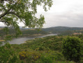
Around Lake Caramany
 6.13 mi
+745 ft
-761 ft
3h 30
Moderate
Departure from Caramany (Pyrénées-Orientales)
6.13 mi
+745 ft
-761 ft
3h 30
Moderate
Departure from Caramany (Pyrénées-Orientales)
A beautiful approach to Lake Caramany with views along the route.
The Source of the Agly and the Salt Spring
 8.76 mi
+1,978 ft
-1,939 ft
5h 45
Difficult
Departure from Camps-sur-l'Agly (Aude)
8.76 mi
+1,978 ft
-1,939 ft
5h 45
Difficult
Departure from Camps-sur-l'Agly (Aude)
A very pleasant hike, but best avoided in summer.
Beautiful views of Bugarach and the Corbières. Along the route, you can see the site of the old glass furnaces and taste the saltwater spring.
The hike is classified as difficult because you need to know how to find your way, read a map and/or follow the GPS track.
The GPS track and map are almost essential as there are many paths and the trails are not always well marked.
Summit of Pech de Bugarach from La Bastide
7.11 mi
+3,261 ft
-3,238 ft
6h 05
Difficult
Departure from Camps-sur-l'Agly (Aude)
Ascent of Pech Bugarach starting from La Bastide, a hamlet with a few inhabitants in the commune of Camps-sur-l'Agly. Climb to the summit of Pech de Bugarach and return via theCol de Péchine. A short hike but with a significant elevation gain.
⚠️ Please note the difficulty of reaching the summit from (2) and the tricky descent from (4). See the section: practical information.
Puig Pedrous from Montalba-le-Château
 5.15 mi
+801 ft
-804 ft
3h 05
Moderate
Departure from Montalba-le-Château (Pyrénées-Orientales)
5.15 mi
+801 ft
-804 ft
3h 05
Moderate
Departure from Montalba-le-Château (Pyrénées-Orientales)
A lovely circular of two hours starting from Montalba-le-Château and passing through Puig Pedrous.
Around Montalba-le-Château
 3.37 mi
+164 ft
-151 ft
1h 40
Easy
Departure from Montalba-le-Château (Pyrénées-Orientales)
3.37 mi
+164 ft
-151 ft
1h 40
Easy
Departure from Montalba-le-Château (Pyrénées-Orientales)
A short walk around Montalba-le-Château to enjoy the diversity of the landscapes.
Loop via Peyrepertuse, Rouffiac and the Moulin de Ribaute
9.03 mi
+1,913 ft
-1,913 ft
5h 50
Difficult
Departure from Duilhac-sous-Peyrepertuse (Aude)
A 16 km loop that passes under the walls of Peyrepertuse Castle, with views of Quéribus Castle and the Quille Massif. Most of the hike is in the woods. Finally, the Verdouble Gorges with their pools and waterfalls offer a refreshing and relaxing break.